Russian version
Photos by Nikolay and Peter Matusov, comments by Peter Matusov.
Day One - San Diego to Moab (via Coal Mine and Monument Valley)
If there was anything to brag about, this time it was timely take off - we cast off only half an hour after planned 4 a.m. departure. For that, we were rewarded with a gorgeous sunrise in Yuma, Arizona:
 |
 |
Beyond the sunrise, there was absolutely nothing worth mentioning in Yuma, Gila Bend, Phoenix, or always-ugly I-17 between Phoenix and Flagstaff. No, there was - after arguing for about fifty miles whether we should pull over to the gas station, we ran out of gas. It was just a minor inconvenience of pulling over and using the reserve from a 5-gallon jerry can. It had a side benefit of breaking up the monotony of sitting in a bumper-to-bumper traffic near Camp Verde, Arizona.
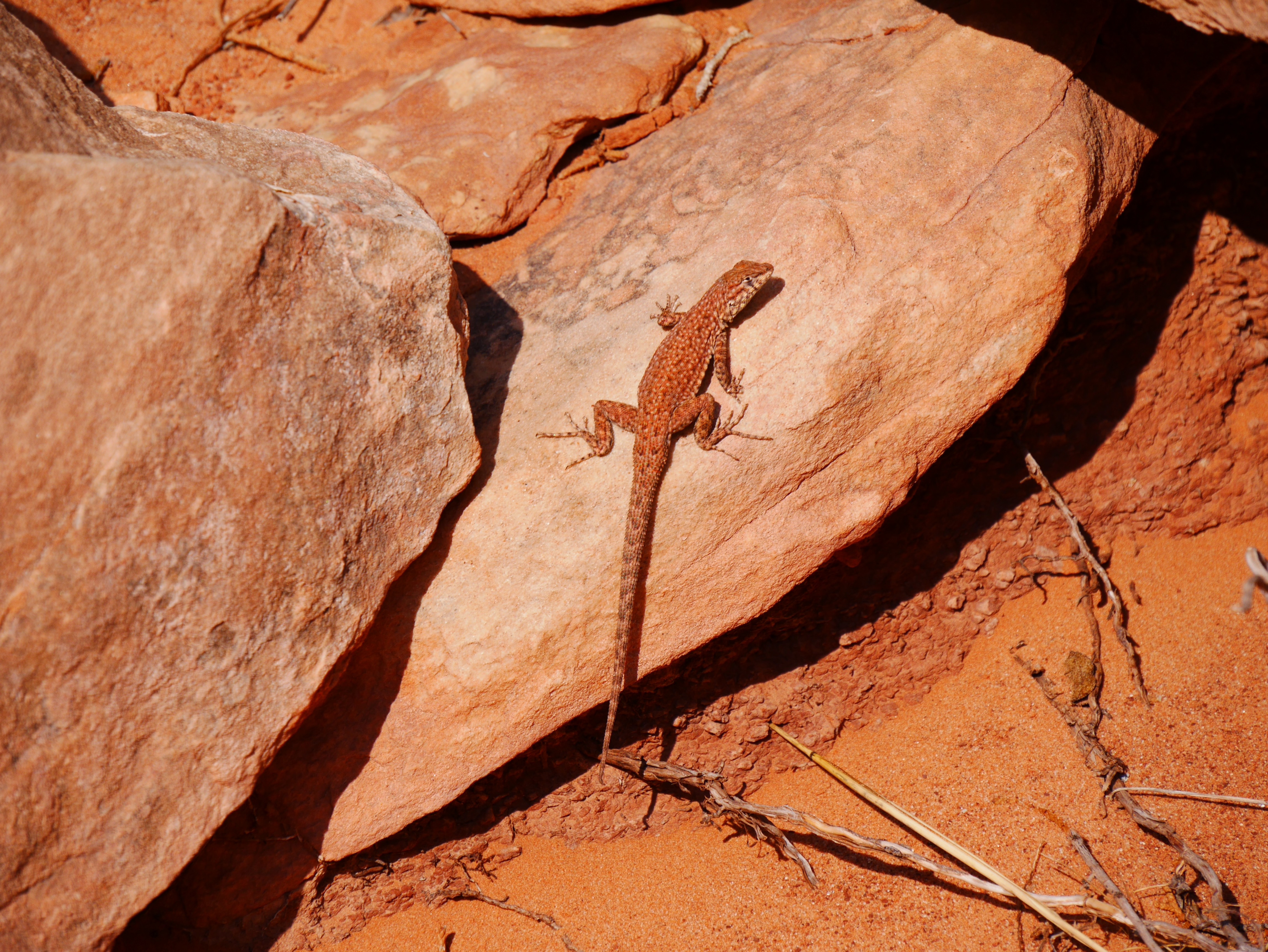
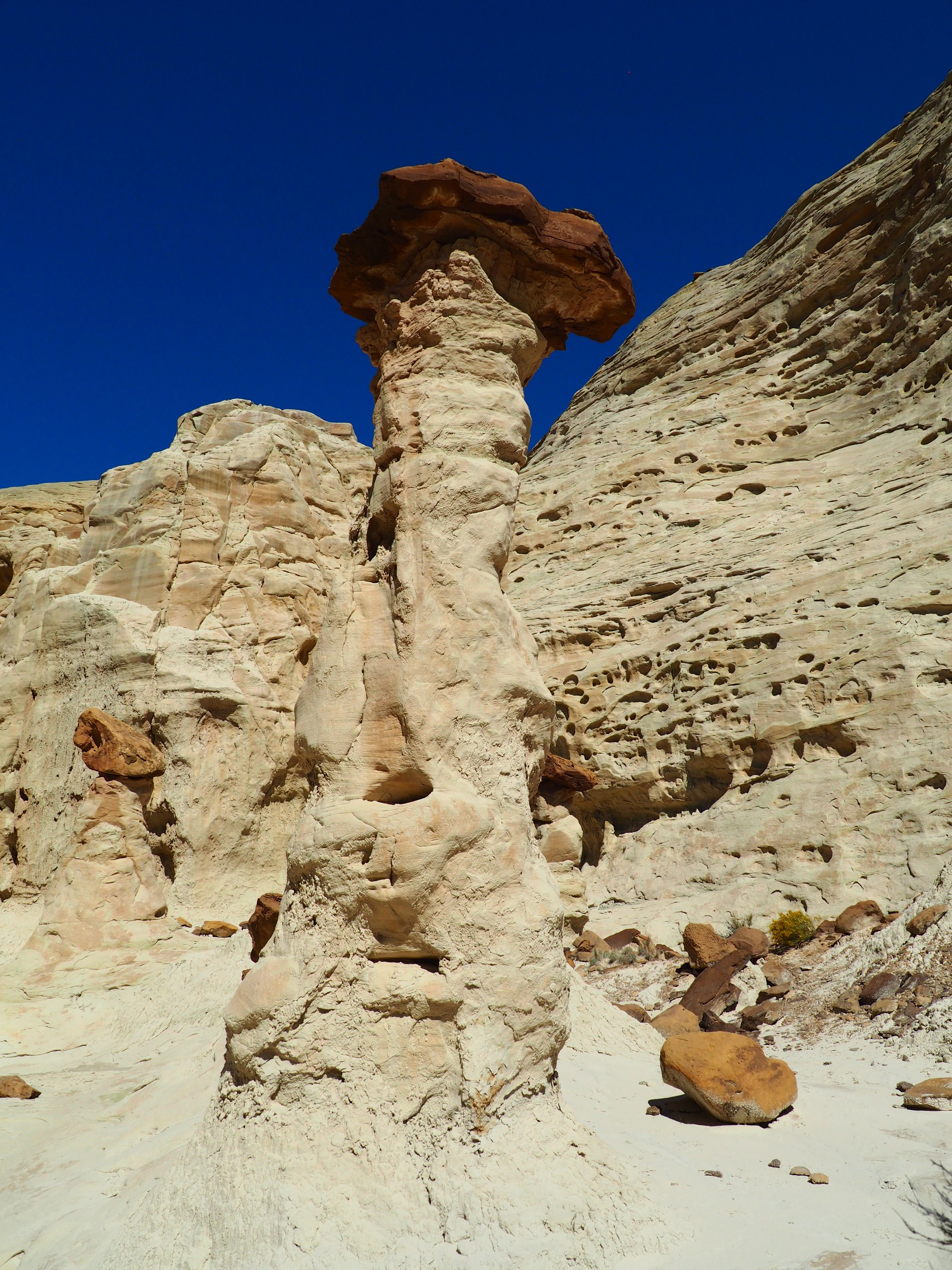
Our next stop - Coal Mine, a.k.a. White Canyon, near Tuba City.
Our next stop - Coal Mine, a.k.a. White Canyon, near Tuba City.
White Canyon

|
||
 |
 |
 |

|
||
Nearly at the sunset, we reached Monument Valley, Utah:
 |
 |
We drove around the Mexican Hat Rock for a while, but ... nothing to write home about. Met with Matt and Thao Bauer late at night in Moab, and a bottle of 12-year-old Buchanan fell victim to our first round of evening festivities.
Day Two - Arches National Park
After a kind of late start, we had breakfast at the Eclectic Cafe in Moab, and headed North on U.S.191 towards the entrance to Arches National Park.
It never disappoints.
It never disappoints.
 |
 |

|
|
 |
 |
 |
 |
It took us a while to hike up to The Arch:

 |
 |
 |
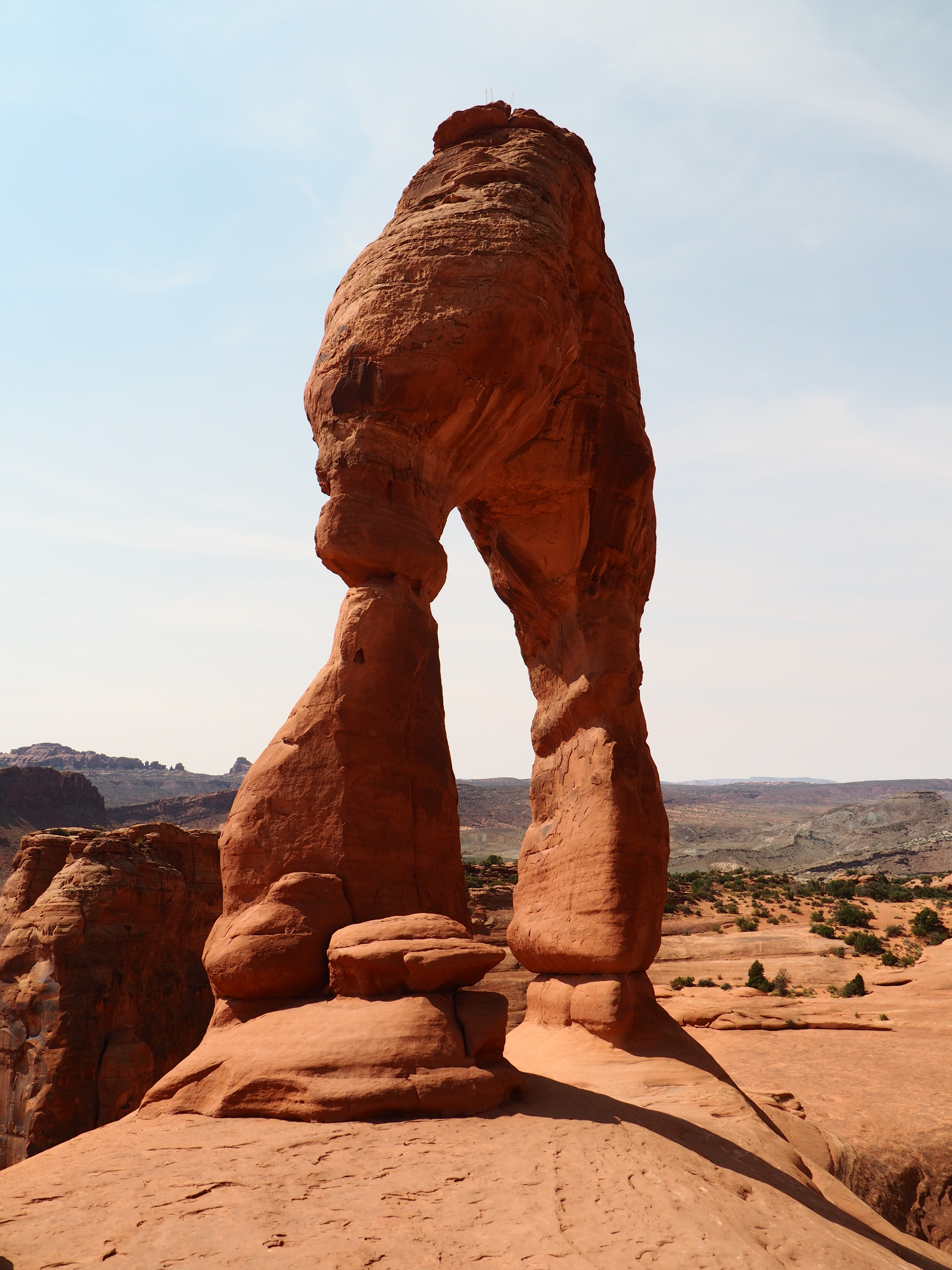 |
We had a nice company at the Delicate Arch:
 |
 |
Here, Matt and Thao are enjoying their first time at the Arches:
 |
 |
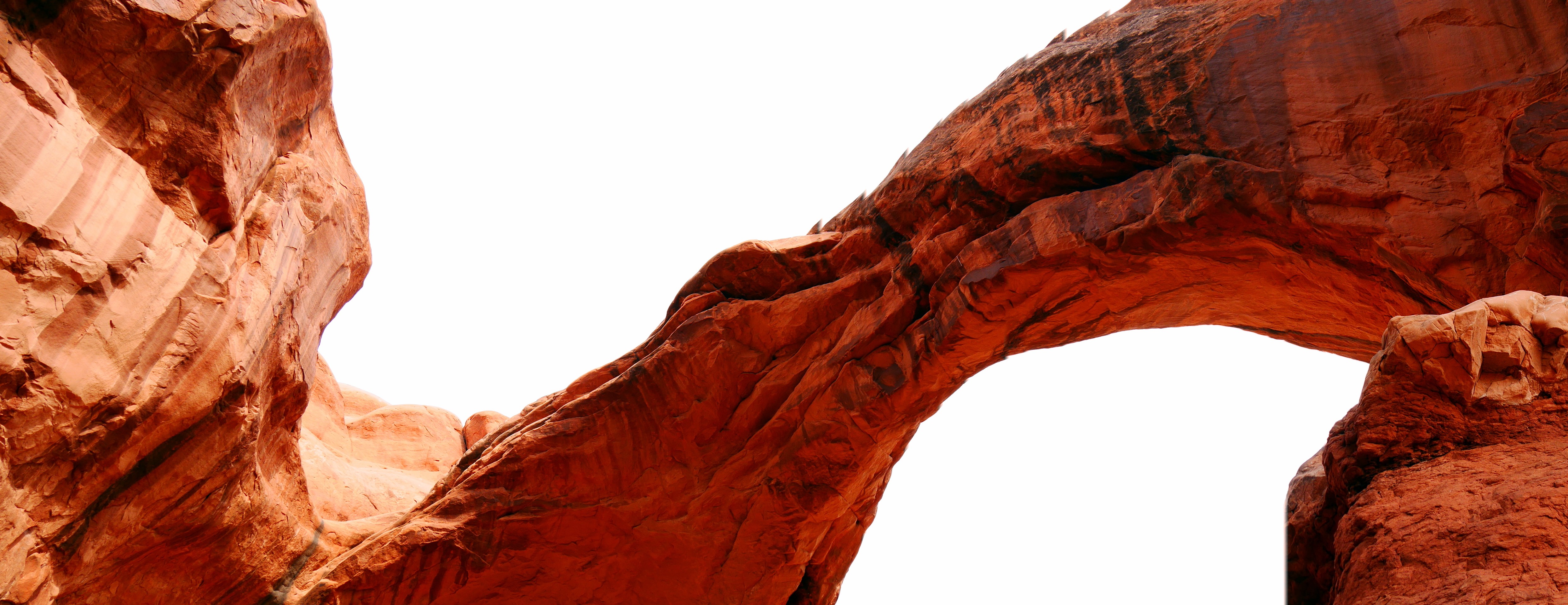
Devil's Garden and The Windows:

|
|

|
|
 |
 |
The Double Arch:
 |
 |
 |
 |
|
|
Thao looks like she's had plenty of the Arches:

We had, too - stop for one last panoramic view:

It's been a long day; by the time we got out of the Arches, it was late afternoon - so we packed up and drove to Carbondale, Colorado. The day's labors were celebrated at the picnic table at the motel's lawn.
Day Three
We met with Carol and Larry Samons (and their big JK) and Connie and Frank Gorcsan (and their big JK) near the Aspen Chapel. Introductions were made, and soon we were off to the dirt.
Aspen, Colorado - Taylor Pass trailhead
 |
 |
The aspens were out to blind us with their colors:
 |
 |
 |
 |
Matt is getting ready for the fun stuff:
 |
 |
Frank and Connie are enjoying a brief stop, as we are climbing towards Taylor Pass:

|
|
 |
 |
Soon, we are greeted with the view of Taylor Lake; the first pass merits an obligatory group shot.
 |
 |
Four wheel drive only? You can't be serious.
The descent from Taylor Pass proved to be more engaging then ascent to it:
 |
 |
 |
 |
 |
 |
In case you're wondering, our way is right down that creek:

We had a quick lunch at the junction of Taylor Pass and Italian Creek trails:

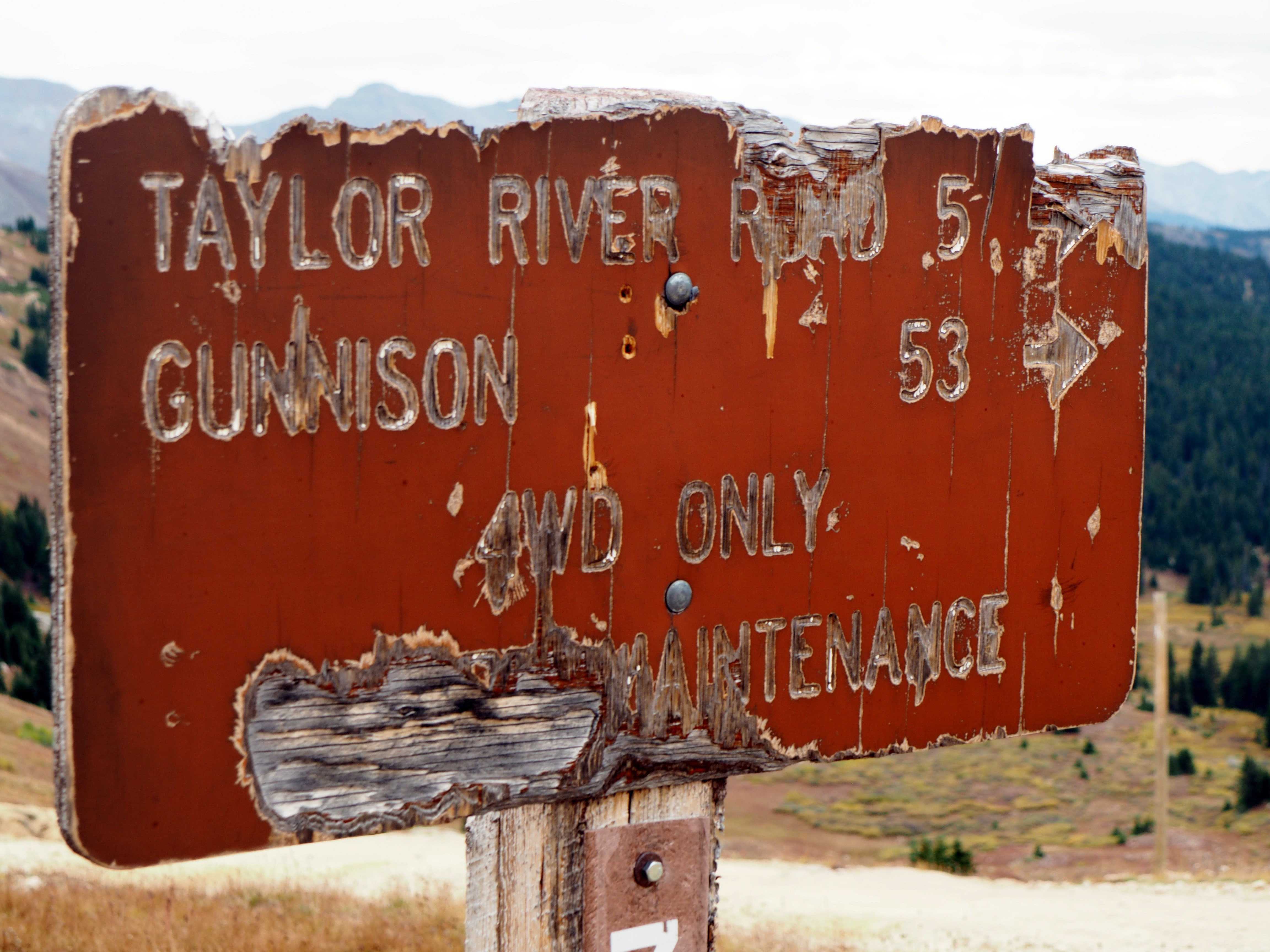
Having driven through Reno Divide before, we opted to see the town of Tin Cup instead:
 |
 |
 |
 |
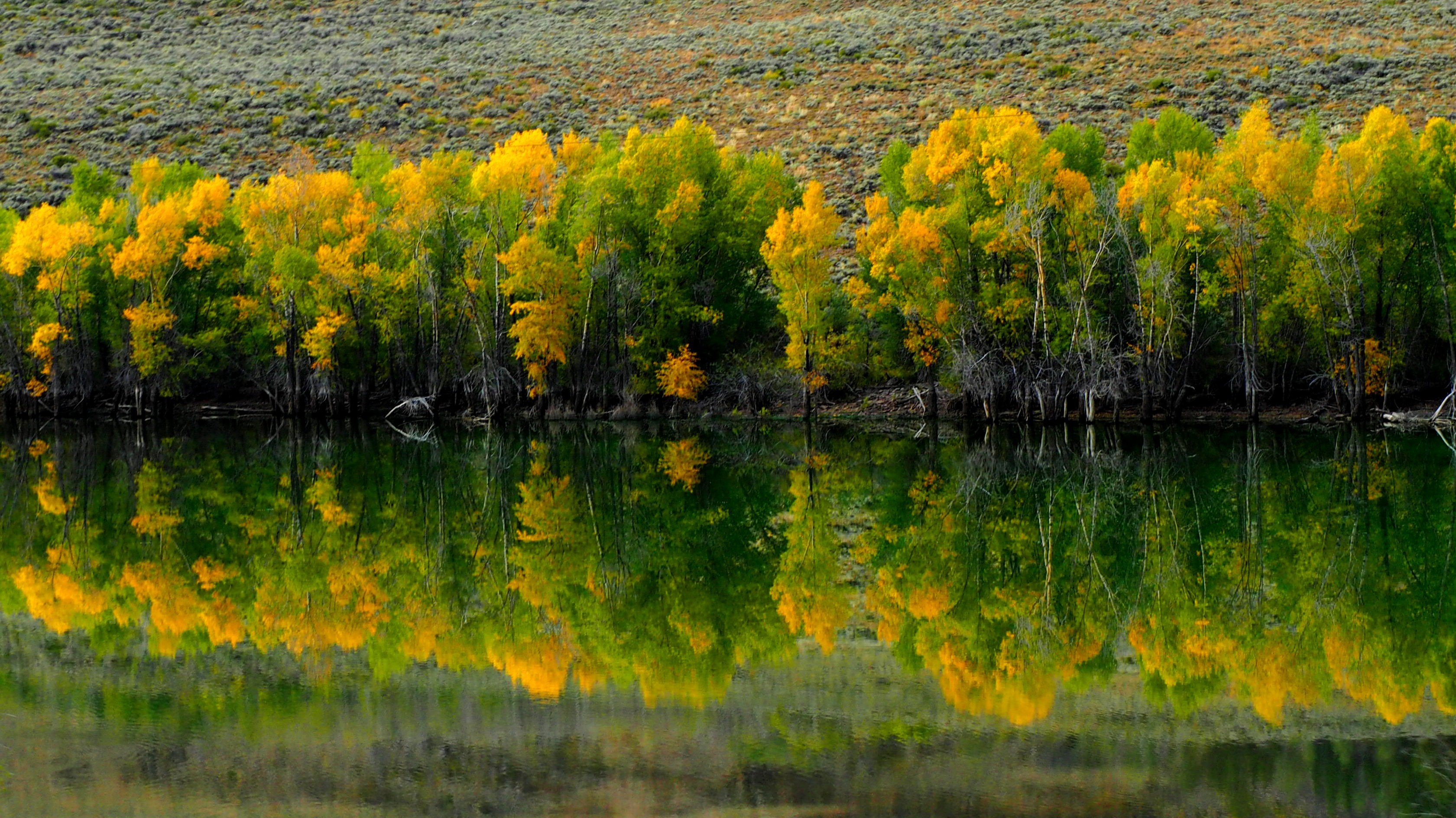
On the way to Gunnison, we're treated with display of fall colors and a double rainbow (which we would have seen had we stayed with Frank and Larry):
|
||
 |
 |
 |
The evening was rainy and not very exciting. We spread the tarp over the picnic table and stove, and had dinner with Matt and Thao.
Day Four
We met by the grocery store in Gunnison, and headed out of town towards Lake City, Colorado.
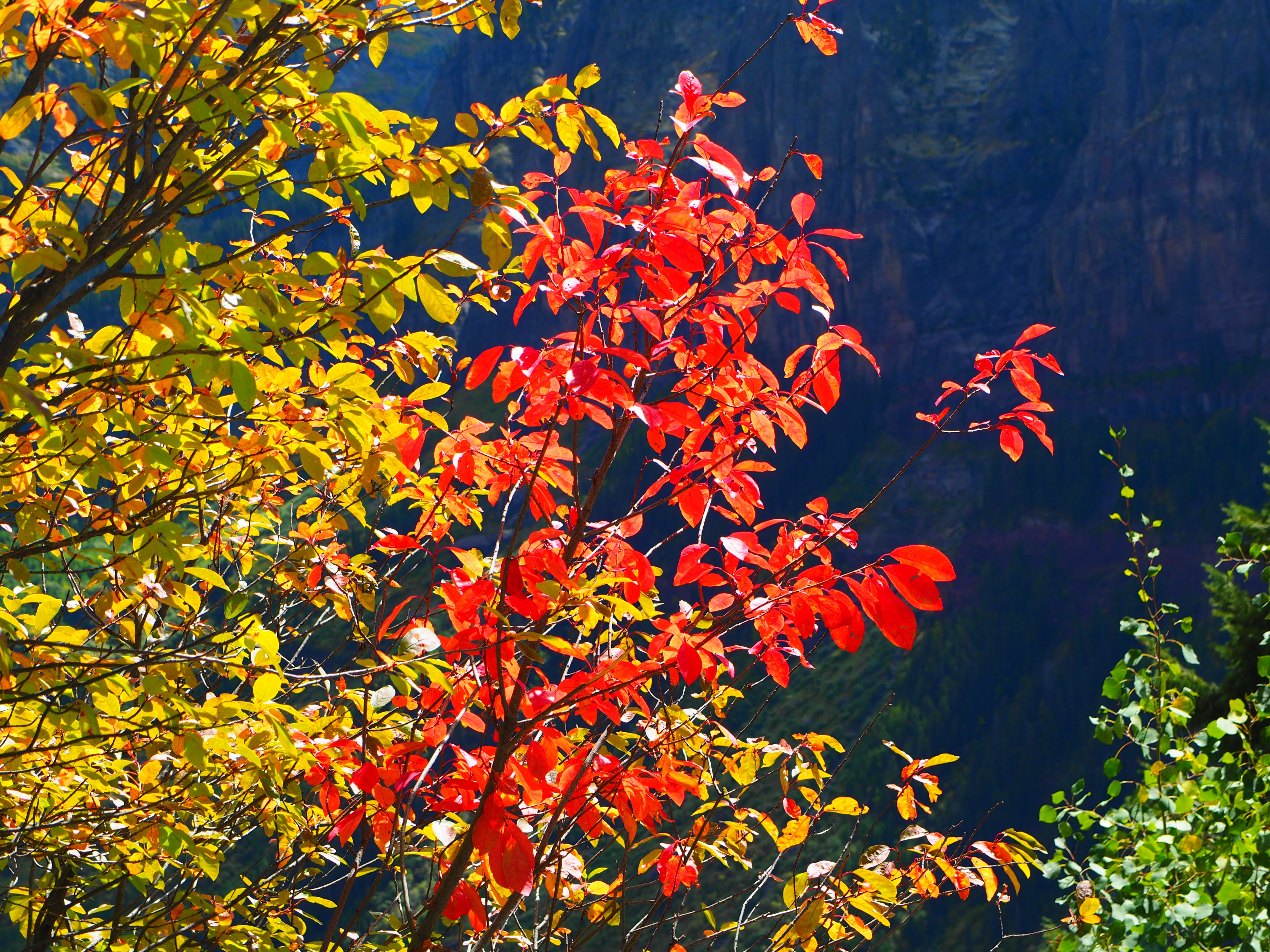
In Lake City, we split off to County Road 20 towards Capitol City and Engineer Pass. The aspen's assault on our vision continued with the vengeance:
In Lake City, we split off to County Road 20 towards Capitol City and Engineer Pass. The aspen's assault on our vision continued with the vengeance:
 |
 |
 |
 |
 |
 |
Soon, we reached Capitol City, and could not leave for at least an hour:
 |
 |
 |
 |
 |
The brief period of sunlight ended, and we continued our climb towards Engineer Pass in intermittent rain and mist. Saw some sheep (not the bighorn variety, though); stopped, of course, for a group shot at Engineer Pass.
 |
|
 |
 |
 |
|
 |
|
From there, it was a short run downhill to Animas Forks. An old house is not a bad place to have lunch when it is raining cats and dogs outside; Larry and Carol elected to have lunch "indoors:"
 |
 |
 |
 |
No matter how many times we visit Animas Forks, we can't keep our fingers off the camera shutter buttons:
 |
 |
California Gulch
Soon, it was time to press on towards California Pass; the jeeps find themselves at a relaxed pace in California Gulch.
The Gulch met us with its usual gloomy weather; we peeked into a closed and locked mineshaft - it must still hold some treasure:
The Gulch met us with its usual gloomy weather; we peeked into a closed and locked mineshaft - it must still hold some treasure:
 |
 |
 |
At California Pass, we faced a tough choice - to proceed to Cinnamon Pass, or descend to Lake Como, we argued that Corkscrew Gulch wouldn't much of a gas in rain and clouds, and headed down to the lake.
Not that we haven't been to the lake - I can remember at least five times. Nonetheless...
Not that we haven't been to the lake - I can remember at least five times. Nonetheless...
 |
 |
Since we've already sort of made up our mind about Cinnamon Pass and Corkscrew Gulch, Poughkeepsie Gulch was discussed as an obvious alternative.
The book said Poughkeepsie Gulch should not be driven when wet. We just had to try.
The book said Poughkeepsie Gulch should not be driven when wet. We just had to try.
 |
 |
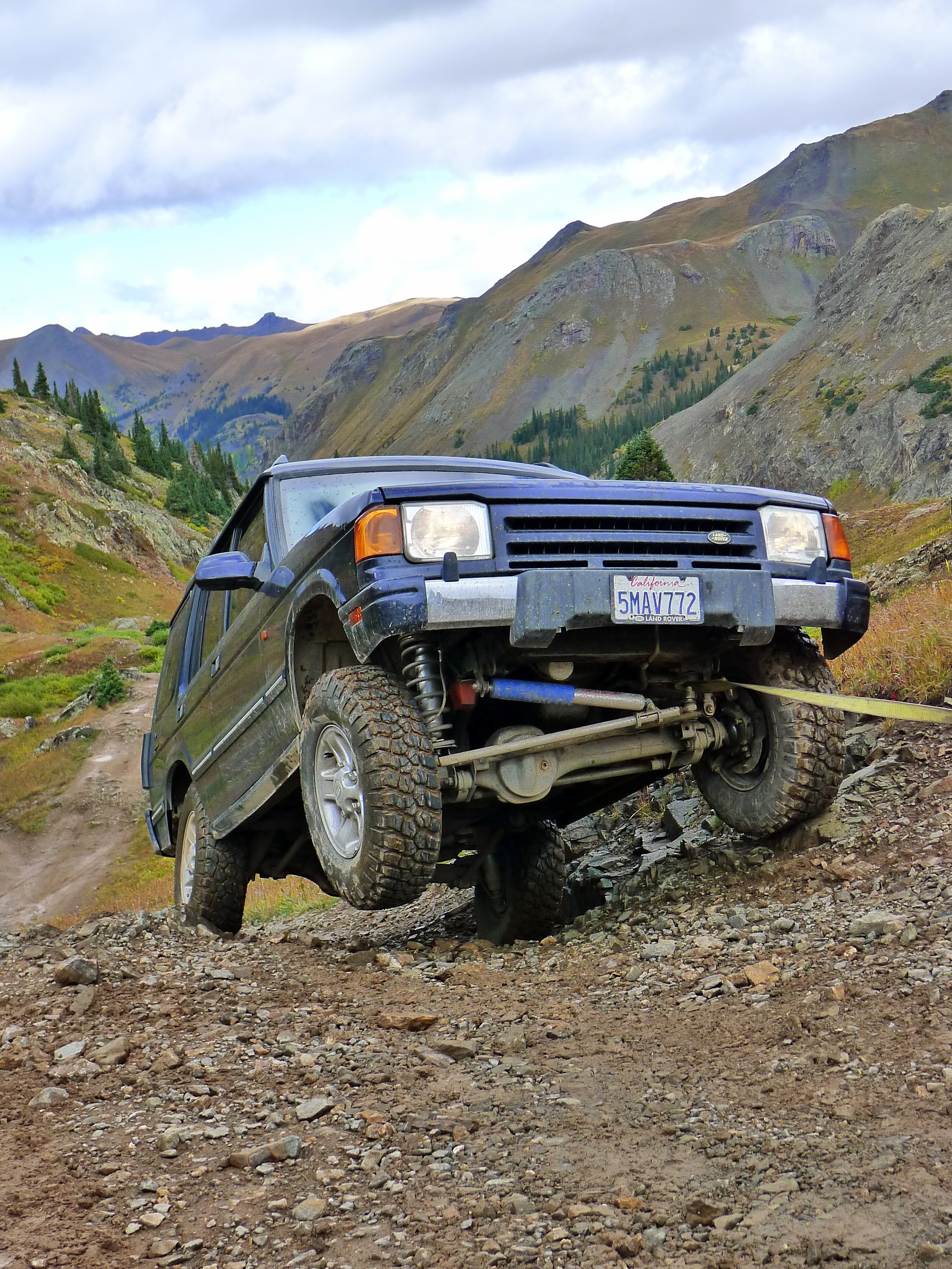
Regrettably, we chickened out of winching ourselves down the steps at Poughkeepsie, and elected to take the legal bypass. However, we had to climb back to where it split off the main trail - and that proved challenging!
Finally, time for the strap to come out and winch to get unspooled:
Finally, time for the strap to come out and winch to get unspooled:
 |
 |
We made it to Ouray already late. It took us a while to get to the KOA campground and then back to town for dinner; afterwards, we spent some quality quiet time at the campground around a fifth of Black Label.
Day Five - Imogene Pass, Telluride, Ophir Pass
The plan for the day - Imogene to Telluride, and return via Ophir Pass. Nothing difficult, but it's still a long day. We met at the turn-off from U.S.550 to the County Road 361, and headed uphill.
We had to take a photo under the overhang; then, a while later, from one of the tight switchbacks overlooking Camp Bird mine:
We had to take a photo under the overhang; then, a while later, from one of the tight switchbacks overlooking Camp Bird mine:
 |
 |
Every time we drove past a waterfall, I promised to stop by the best one. Finally, we reached it; it ran a little dry at the end of the Summer season. I dug into the back of my truck - it was in need of some housekeeping.
 |
 |
 |
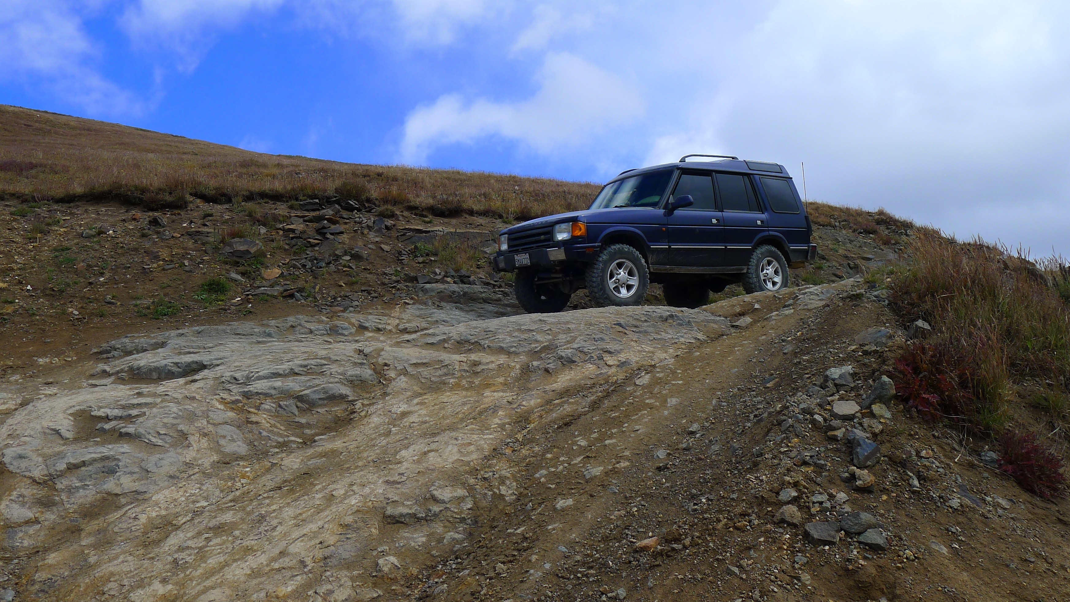
The road made a few distracting moves to make you think you're already going downhill, but not for long. The mountain slopes everywhere are dotted with old mineshafts; a curious baby deer watches our progress from the weeds.
 |
 |
 |
From the top of the world - an observation hut at the mountaintop overlooking Imogene Pass:
 |
 |
A panorama of Red Mountains opens up from Imogene Pass:

A group photo at Imogene Pass: left to right:
Matt and Thao Bauer, Frank and Connie Gorcsan, Larry and Carol Samons, Nikolay Matusov, Peter Matusov
Matt and Thao Bauer, Frank and Connie Gorcsan, Larry and Carol Samons, Nikolay Matusov, Peter Matusov

When we had our fill of photos from the observation hut and the Imogene Pass, it was time to head downhill towards Telluride. We passed by the ruins of one of stone buildings of the town of Tomboy.
 |
 |
Foundation pillars are all that remains of the Tomboy Mine power station; somehow, in the past, I missed the two-story restroom. It cracked me up, reminding of the caricature I saw earlier.
 |
 |
 |
Finally, the trail descends below 11,000 ft and enters the mixed forest. The switchbacks of Black Bear pass can be seen across Ingram Basin:
 |
 |
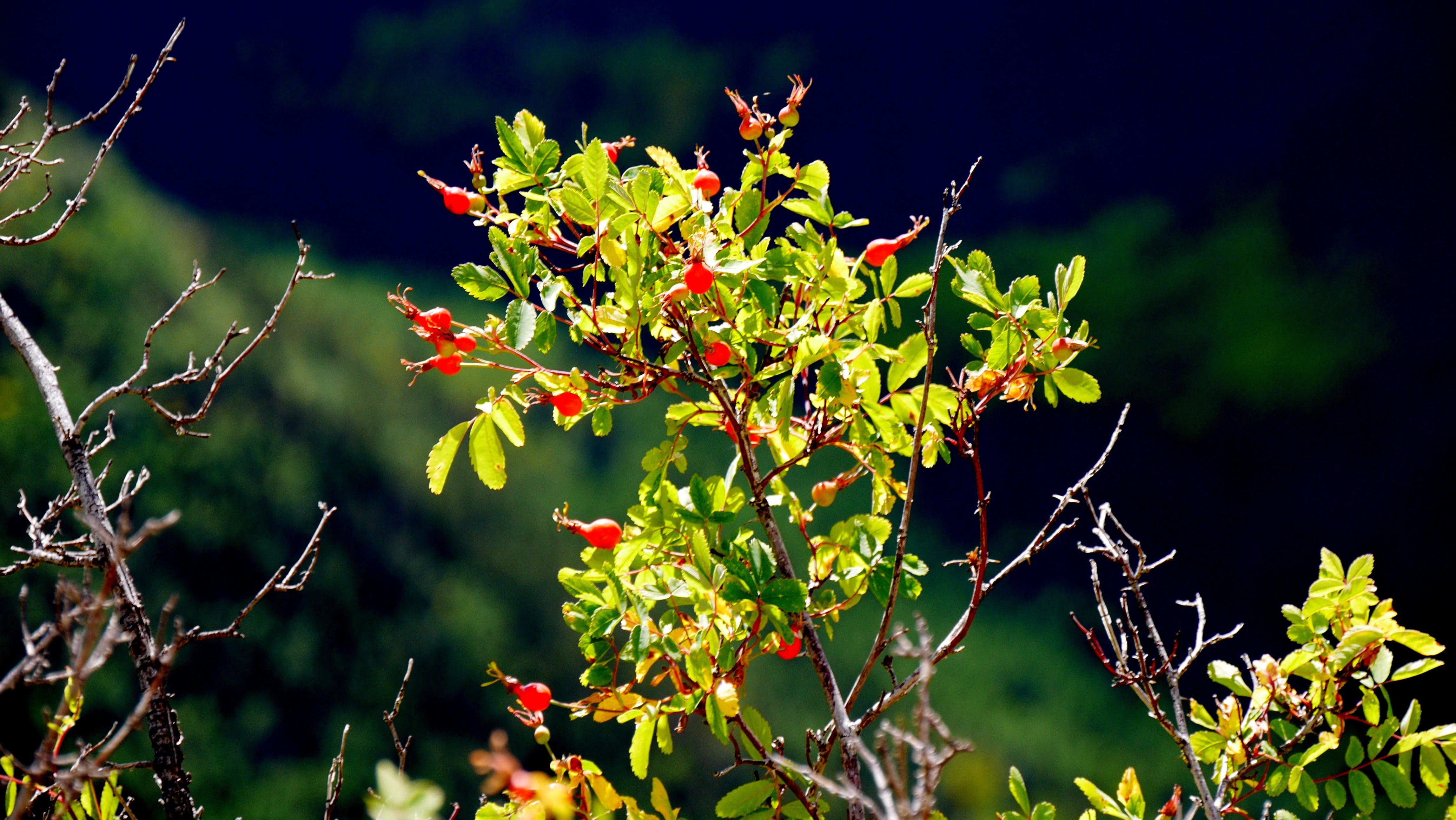
There's no end of edible stuff in San Juan Mountains. Here's wild Rose near the ghost town of Tomboy - the picture moment afforded by the wait for the rental Wrangler traffic jam to clear up:
 |
 |
Here we embark in wordsmithing and coin the term "Aspenglow:"
 |
 |
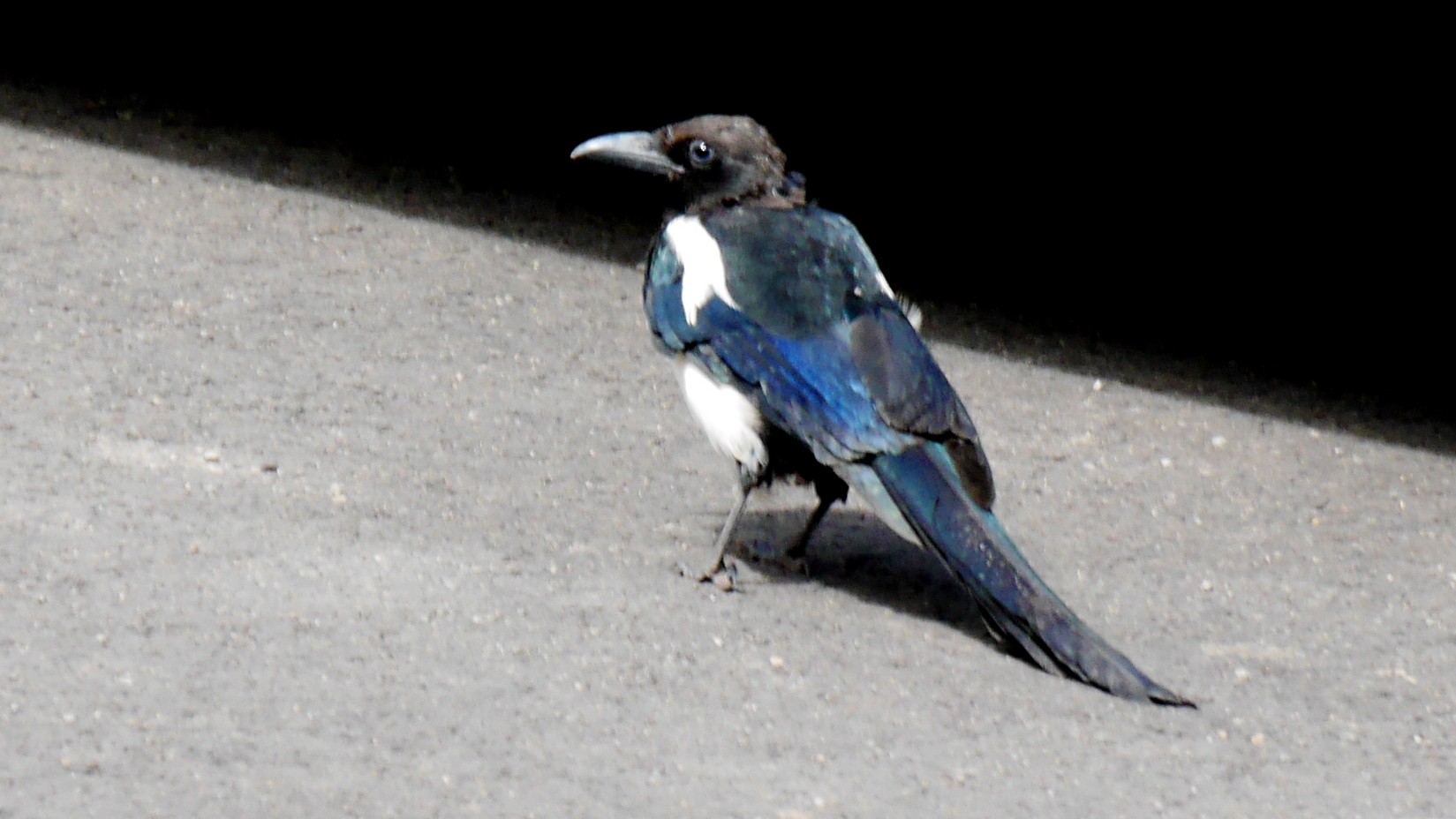
Finally, we're in Telluride, Colorado, land of a lunch of three appetizers and four drinks for $169. By the way, if you're headed to Colorado and are considering a purchase of, say, a hundred-dollar jacket at REI - do it, the same exact jacket with a Telluride logo will go for twice as much. Don't get me wrong, however, it is a beautiful town to visit - and likely to live in as well.
 |
 |
Don't try to talk the owner of this FC150 out of it - he knows what it's worth. The gorgeous magpie close by is not impressed.
 |
 |
We gave ourselves an hour and a half to enjoy Telluride, and headed out South on Colorado 145 towards the town of Ophir. The town's far from dead, and seem to be flourishing - every year new buildings show up. It does have its share of mining past - retention ponds, mine tailings, abandoned mines, etc. A beautiful aspen forest lies between the town site and the pass.
 |
 |
Ophir Pass is generally considered a pretty tame trail; but, just like on Upper Reno Divide, things can go from peachy to very much not so with a single vehicle going in the opposite direction. Last time on Ophir Pass we encountered a stalled CJ5 halfway through the the narrow section - it wasn't pretty. I asked the group to stay back until I could drive to the nearest spot wide enough for two vehicles to safely pass each other, and shouted on the radio that the road was clear for them.
 |
|
 |
 |
We crested the pass, and descended to U.S.550 near the ghost town of Ironton. The remnants of National Belle Mine and the panorama of Red Mountains were our last scenic views for the day.
 |
 |
Someplace along the way, Matt discovered that his truck drives kind of ... differently. Yes, the longer shock absorbers in the rear will allow the unrestrained spring(s) to come out of their perches - and it is a relative bitch to reseat in absence of very tall jackstands. Reseating an unretained rear spring in a Discovery by holding the entire rear of the truck on a maxed-out Hi-Lift Jack is a dicey proposition, but it works.

We spent the evening with Nikolay checking out the [clothing optional] Orvis Hot Springs near Ridgway, Colorado. The place is fantastic; the mostly-heterosexual crowd in the pool instantly made a wrong conclusion about us, so our family lives did not endure an ounce of risk.
Later this evening, the rest of Johnny Walker fell victim of whisky abuse. I think it was then... was it?
Later this evening, the rest of Johnny Walker fell victim of whisky abuse. I think it was then... was it?
Day Six - Last Dollar Road, Fall Creek Trail, and Bolam Pass
We went completely out of our way and left the campground early enough to have breakfast in Ridgway. Here's Thao waiting for her stuff:

The plan for the day was derailed by the road repairs on the U.S.550 - which was closed in both directions until the lunchtime. So we met at the gas station in Ridgway, and decided to forgo the plans to hike around Ironton and drive the Bolam Pass East to West to spend a whole day on dirt - driving the Last Dollar Road, Fall Creek Trail, and only then traverse the Bolam Pass Road West to East. It dashed the hopes for the visit to Mesa Verde National Park for some of us.
The Last Dollar Road is surrounded by the aspen forest, and it was predictable scenic along its entire length. The wild berries were abundant:
The Last Dollar Road is surrounded by the aspen forest, and it was predictable scenic along its entire length. The wild berries were abundant:
 |
 |
Has there ever been a gas station at the Last Dollar Road? In any case, landing at Telluride airstrip must be terrifying:
 |
 |
The Fall Creek Trail seemed to be a perfect extension of the Last Dollar Road. It was, however, longer than the Last Dollar Road. A lot longer - about fifty miles. We stopped at what we hoped to be a halfway point (it was more like a quarter-way point), and met Dave The Moose Hunter.
Here, Dave The Moose Hunter very eloquently explains the tricks of the job, and Peter and Matt are ogling his 50-caliber muzzle-loader:
Here, Dave The Moose Hunter very eloquently explains the tricks of the job, and Peter and Matt are ogling his 50-caliber muzzle-loader:
 |
 |
As the day progressed, I could feel that everybody was getting tired - or, worse yet, bored. The scenic quality of the road only takes you so far; when I felt that we were within half a mile from Colorado 145, I shouted on the radio - "Bolam Pass next?" I don't remember - was it Larry or Frank who reluctanly asked how far the trailhead was. To which I was more than happy to respond - right there, across the valley:

The trail climbs up pretty quickly from the valley floor, and it must have only taken us about half an hour to reach the Bolam Pass:
 |
 |
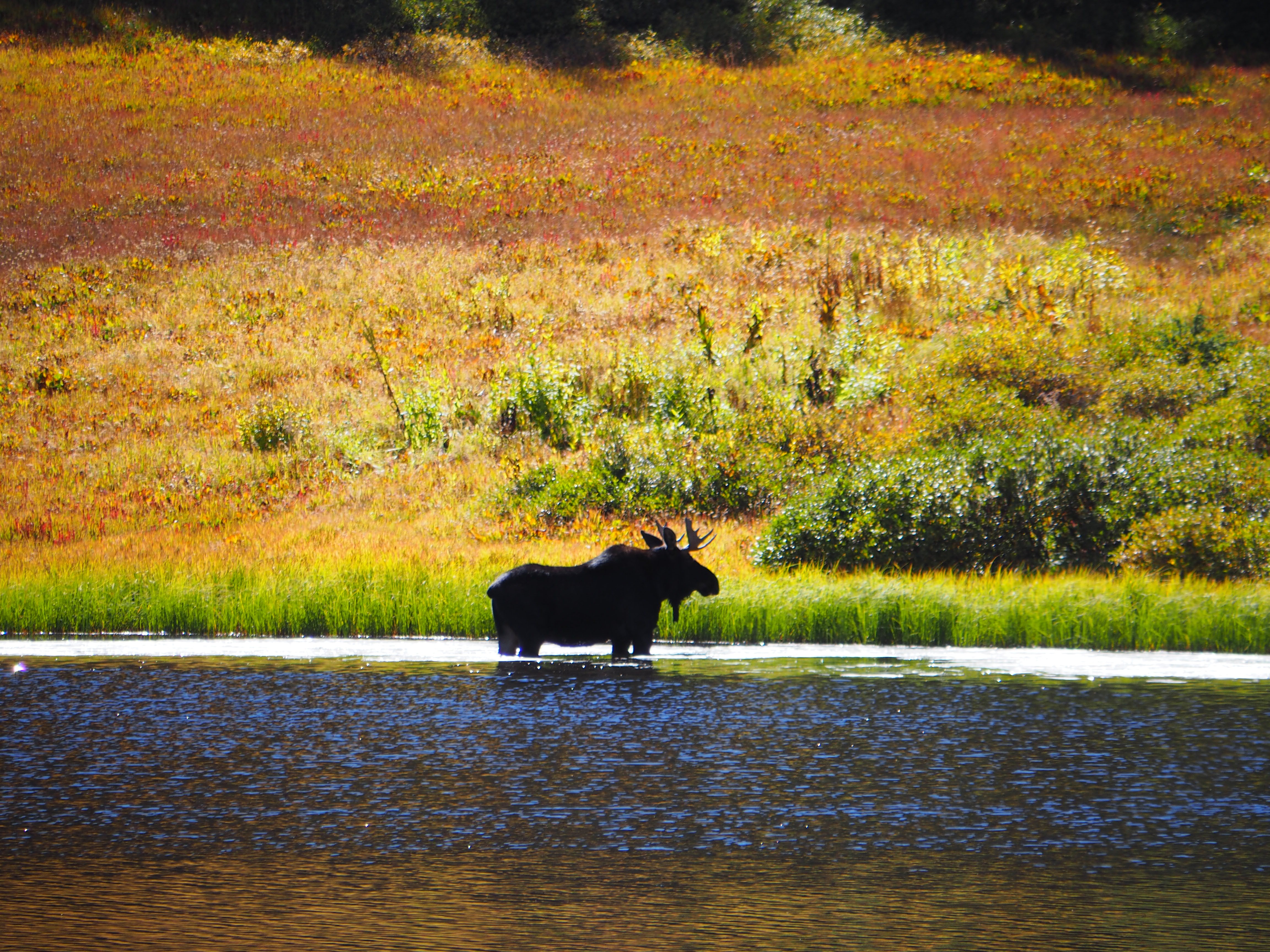
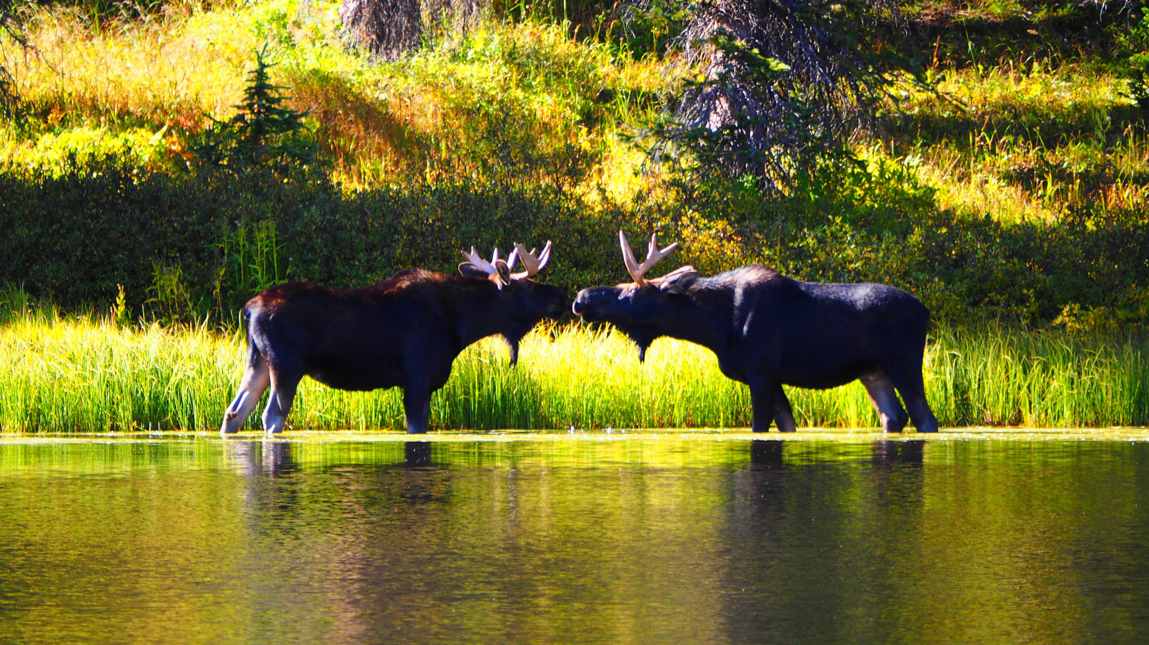
Some fellow four-wheelers told us of a group of moose feeding near the lake, about a mile from the pass. We only saw two of them, and they were just... majestic. Is it love, or what?
 |
 |
|
|
Near the lake, there were thickets of wild red currant:
 |
 |
A nice-looking girl playing cards with a friend, at eleven thousand feet, close to five in the afternoon in the end of September, with no vehicle, no horses, no bicycles, no hiking gear or even backpack in sight. What's up with that? At the very worst, they could spend a night in one of the buildings left standing from the Wold War II Uranium mine.
 |
 |
Day Seven - Navajo Land, Toadstool Hoodoos, and White Pocket
After a night in a sketchy motel in Cortez, we said out goodbyes to Colorful Colorado, and hit the U.S.160 west-bound towards Kayenta. The hills in the rearview mirror must be "The Sleeping Ute" mountain.
 |
 |
There's a lot to see around the U.S.160, when one isn't driving:
 |
 |
For the environmentally-concsious reader, here's the Black Mesa coal terminal, and the Navajo Power Station where this coal is headed:
 |
 |
The schedule of tours to Antelope Canyon was out of our reach - and in this "sellers' market," the tour operators felt at ease being rude. We limited our Page attractions to Lake Powell dam:

Fortunately, U.S.89 had the Toadstool Hoodoos in store for us:
 |
 |

|
|
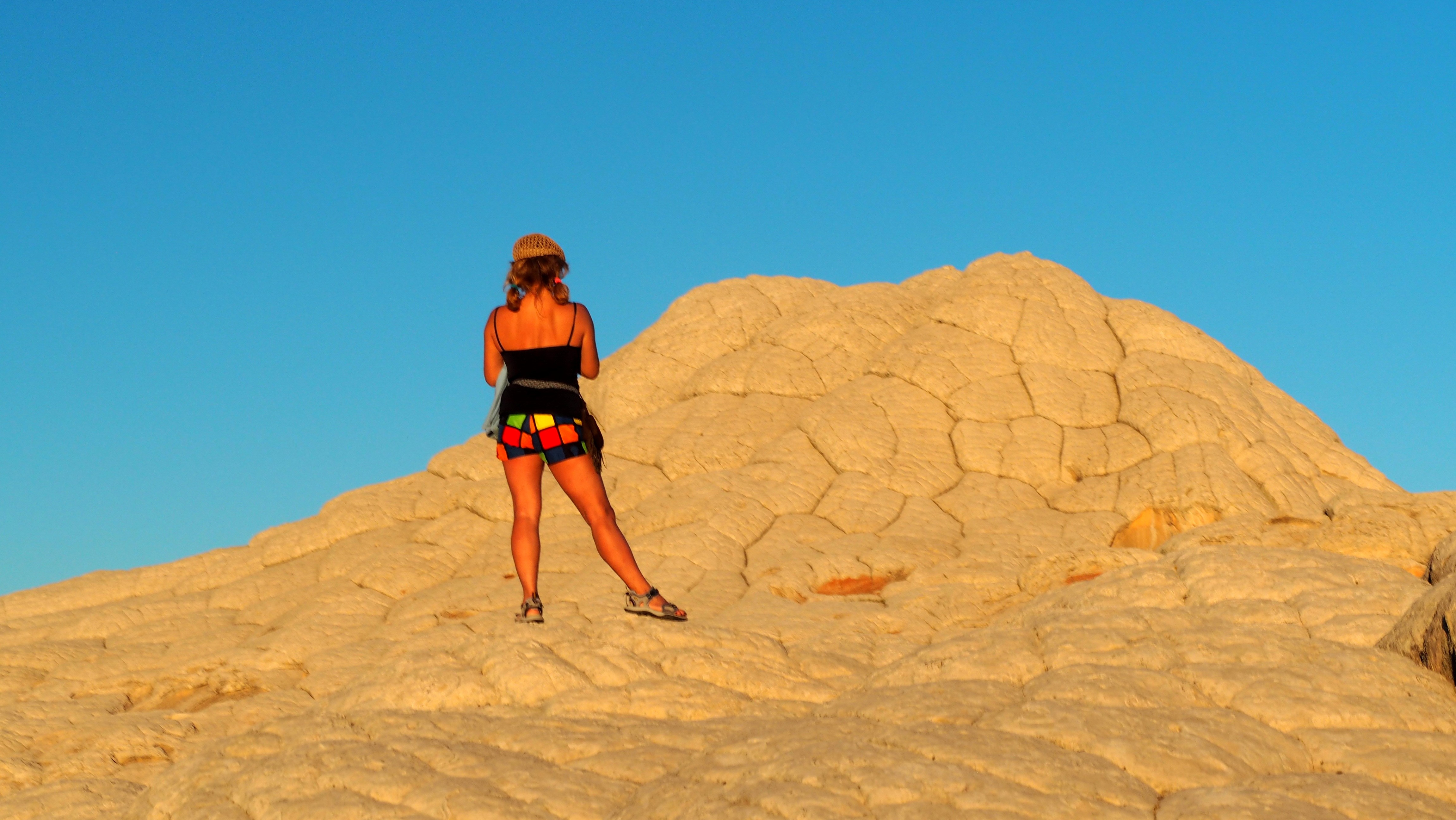
We left the Hoodoos, and headed out to the White Pocket.
As a result of our impeccable planning and communication, or plain incredible luck, we met our Russian friends at the House Rock Valley Road:
As a result of our impeccable planning and communication, or plain incredible luck, we met our Russian friends at the House Rock Valley Road:

It was great that they rented a Jeep, and not a smaller species of all-wheel-drives. It did not help that the Jeep came with the dinky donut street tires, and not a single spot to attach a rope.
Looking at the paper - the Jeep had as much ground clearance as the lifted Land Rover on tall mud tires. But what the Land Rover barely scraped with the differentials, the Jeep took under its entire belly - and had to be pushed downhill, to find an easier route.
The evening at the White Pocket was insanely gorgeous.

|
||
 |
 |
 |
 |
 |
 |
 |
I played a lot with the camera, enjoying reflections of the colored rock in the shallow water pools. Then something drew my attention: this is Olga, one of our Russian friends. How come she does not cast a shadow? (no, I did not use the flash.)
 |
 |
We made the camp about half a mile from the "main entrance" to White Pocket. The tents were pitched, the grille set aglow, and the skillets on the stove.
 |
 |
 |
Soon, most everybody drifted towards the "dinner table." Many pressing issues of international politics were discussed, while people representing the cutting edge of science on different sides of the pond carefully avoided asking and answering any work-related questions.
Day Eight - White Pocket, North Rim of Grand Canyon, and mad dash home.
During the festivities the night before, the international community of liquors was represented by Hornitos Reposado, Casadores Reposado, 16-year-old Lagavullin, 9-year-old Bulleit, and a fine old Cognac from the Republic of Georgia.
This, or before-dinner beer, made us to get up at the sunrise and head out to the rocks again.
This, or before-dinner beer, made us to get up at the sunrise and head out to the rocks again.
 |
 |
 |
 |

|
|||
 |
 |
The last look at the White pocket, and at our camp, half-way stricken, after a late breakfast:
 |
 |
Our Russian friends bailed out early to hike the Wave, and we used our opportunity to take the last complete group shot:

After that, we parted ways with Larry and Carol, and headed out to the North Rim of the Grand Canyon.
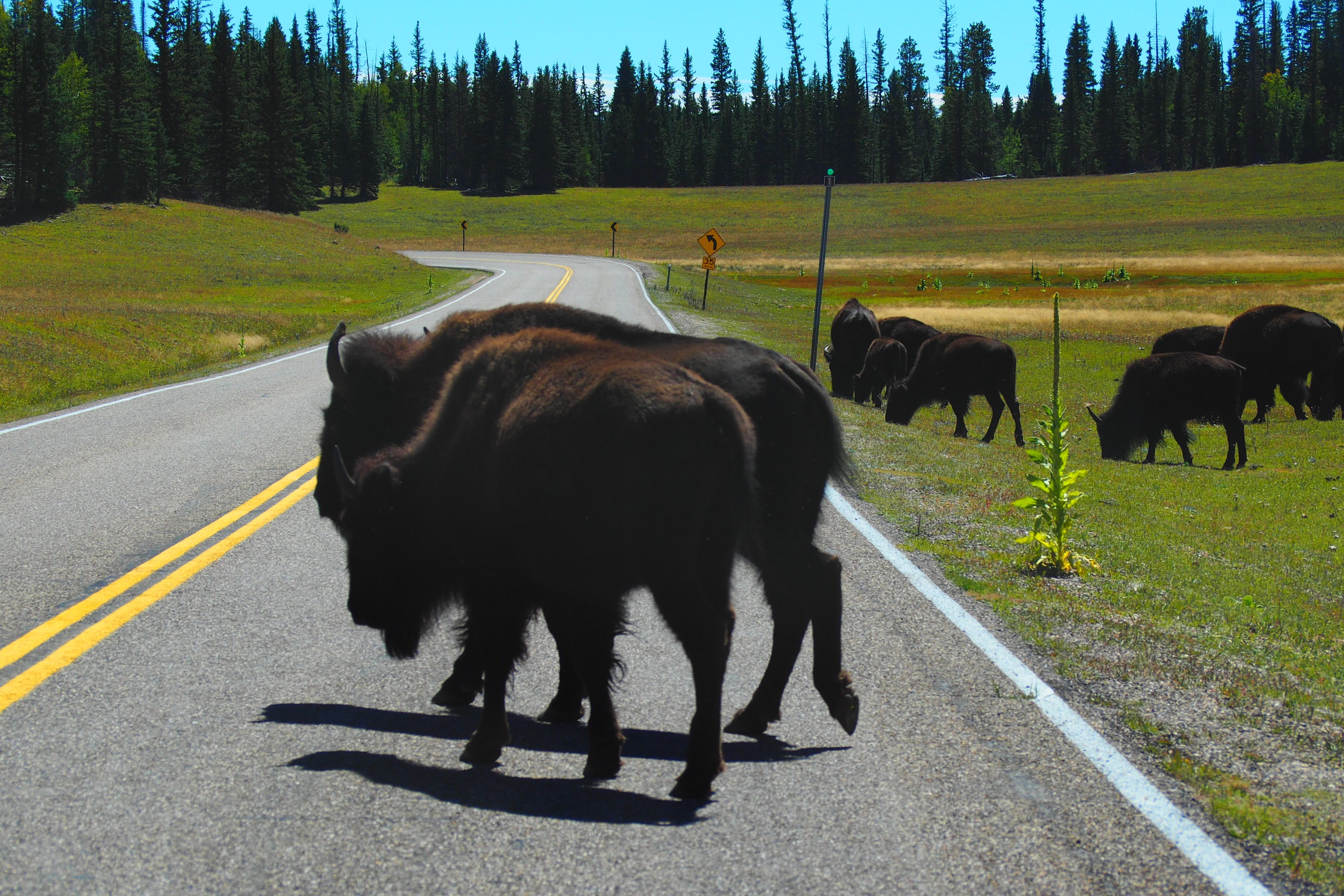
What we saw we did not expect - a large herd of buffalo having fun right near the road. The big guys couldn't be bothered with our presence
What we saw we did not expect - a large herd of buffalo having fun right near the road. The big guys couldn't be bothered with our presence
 |
 |
 |
 |
 |
 |
I didn't even care for any photos of the Large Hole In The Ground.
We hit the blacktop, had a halfway-miserable dinner in Mesquite, Nevada, and headed home after checking the vital fluids in our trucks:
We hit the blacktop, had a halfway-miserable dinner in Mesquite, Nevada, and headed home after checking the vital fluids in our trucks:

It was a long and boring ride from Mesquite all the way home to San Diego - fortified by coffee, Red Bull, chewing gum, and sheer resolve.