Here we come to a day in our lives when we can't stay home any longer, yet don't have time to embark on a long trip. What's a poor schmuck to do? Once our plans for a four-day trip to Arizona fell through, the ambitions got scaled down to a
"quick" hop to Sierra Nevada.
Plans: nothing in particular. We're going to drive up North on the U.S.395, maybe to Big Pine, maybe to Bishop, maybe to Mammoth Lakes.
We'll camp - maybe on White Mountain Road, maybe near Mammoth, maybe near June Lake. Next day, we're going to drive... and so on.
Lack of precision in planning is compensated by certainty of outcome: we WILL drive, and we WILL camp.
So one fine and very dark Saturday morning finds us converging on the exit to Deer Springs Road from I-15, North of Escondido.
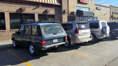
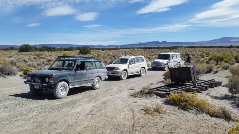
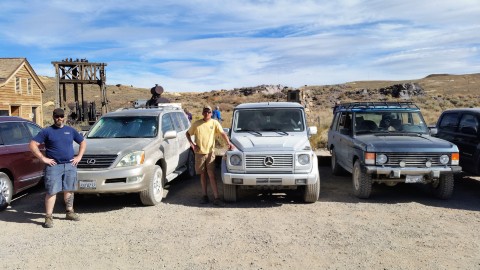
"Us" include Matt and Thao and little Frosty in their "new" Gelaendewagen, Jordan in his "new" GX470, and me and Jules The Airedale in my "new" Range Rover.
At Deer Springs Road, our brisk progress comes to a screeching halt.
We discover ourselves on Citizens' Band, spread out along about quarter-mile of I-15. The "thin blue line" crosses ALL four lanes of I-15,
and even at 6 in the morning on Saturday it creates one mondo traffic jam. It takes about an hour for the first person in our little convoy
to get off the freeway and onto the old U.S.395, and another half-hour - for the last person. All - while being practically within an eyesight
from each other.
Bummer.
Dogs are let loose before we set sail again, and are not in hurry to get back. We spend some quality time checking communications in CB and VHF,
and hit now-flowing I-15.
Pilot Truck Stop in Hesperia greets us with ferocious wind on the verge of a full-blown sandstorm.
The wind will follow us through the entire trip. Visibility improves around Inyokern, about 90 miles away. Today, it's a stiff tailwind -
the truck wanders around a bit, but feels generally pretty happy moving along.
We stop for a doggy break and top off the gas in Lone Pine, and arrive to Convict Lake in mid-afternoon.
A nice lady at the Convict Lake Resort tips us off to some unclaimed first-come, first-serve sites at the Forest Service campground,
and it takes us less than five minutes to claim one for our own. We all plan on camping in our vehicles, yet all entryways to the campsites
seem to only have enough of flat space for a single truck - so we simply sneak between the camping table, bear-proof food locker, and fire ring
to the tent spot, exactly the size of a Range Rover and Lexus GX side-by-side.
A groundskeeper walks by, and it takes him a couple of passes to understand what he's looking at. He chuckles but lets us stay as we are.
The family of deer are within thirty feet from the site, eyeing us and our dogs.
This campground has a distinction of restrooms with flush toilets, running water, and mirrors to make sure one's hat is on straight and lipstick
is applied properly.
On the trail around the lake, we meet our friends Andrey and Natasha, and make promises to meet at, during, or after dinner.
We do meet - at our campsite, follow the multiple beers with Glenlivet and beef stew made by Thao Bauer.
The night is chilly - in mid 30s, - but having a large furry dog as a bunkmate makes it perfectly good.
* * *
In the morning, the bunkmate is rewarded with a walk to the lake. No wildlife or neighbors are harmed during
the walk, but Jules the Airedale keeps the deer family annoyed and at a distance.
In process of making breakfast and carrying stuff from and to the Range Rover, I discover a dark spot on the
old railroad tie under the front bumper. A quick inspection proves it to be coolant, coming out from the seam
between the plastic tank and aluminum core of the radiator.
Someday, I hope, workmanship of our friends making auto parts across the big ocean exceeds the relative price of these parts...
But today the only remedy is a bottle of K-Seal poured into the expansion tank (which seems to be whole, despite having come from
the same neck of the woods).
Coffee and breakfast are consumed, stuff packed in the trucks, and we're off to today's adventures.
Not that we have any plans in particular, but some of our crew have not seen Mono Lake, and most - the ghost town of Bodie.
Twenty minutes on the U.S.395, and we're off to California SR120 towards South Tufa Beach.
On the way, Matt remembers that I once promised him a hike to the volcanic crater, so we make a detour.
The small parking lot near the trailhead is busy with 12- and 15-passenger vans - it is terrifying.
We learn that this group or multitude of groups is going to South Tufa Beach right after visiting the crater,
and it is even more terrifying.
In the meantime, the trail to the "Plug" (a blob of magma that got stuck in the volcano, cooled off, and prevented future eruption)
has some upslope and thus is nearly deserted.
We return to our vehicles, and take a dirt trail towards Mono Lake - hoping to sneak in to the South Tufa Beach
around the van parade.
Little do we know...
The gravel lot near the trailhead to the Tufas is a war zone. We find ourselves parking spots, retreat to the fridge
for cold beers, and watch with amazement angry outburst of a woman, who's probably a regular nice person in
a city life. She's berating an Asian students' couple who mistook the woman's husband miserable attempt to back into
the spot for something else and almost,
almost, took
their parking spot.
That does it for us, and we bail on South Tufa Beach. It's already almost noon, far from being the most-photogenic time
at Mono Lake. We turn off to a gravel two-track past the sign promising all sorts of bad things to the lesser souls who don't have
four-wheel-drive. We do, so we don't care.
The gravel makes way to sand, and sand gets deeper.
I hook up the phone to the Range Rover's engine computer to watch the coolant temperature closely, especially after the K-Seal application.
Fortunately, the temp stays between 79C and 89C (175F to 192F), no matter whether I am churning deep sand in low range or am stopped altogether.
The sand occasionally yields to "moon dust," so common for Great Basin and Northern Nevada desert. I lose sight of Jordan and Matt
following me in clouds of finest-ground particles, and hope for the wind not to turn into my tail.
We keep raising dust for about 20 torturous miles, passing sand dunes along the way, and decorating our trucks with
proper desert pinstriping. Sorry Matt and Jordan... That's what it is.
Finally, we're on pavement for a short time - going East on California SR 167 to Cottonwood Canyon Road, with
a goal to reach Bodie.
And here comes Bodie.
We pay the ranger, park our trucks, and walk into the past.
After a while, everyone seems to having had their fill of Bodie.
We get back to our trucks and have some beers, then we're off West-ward towards U.S.395. I have to admit to
thinking that the paved road to Mono Lake is faster - nowhere close.
We have a late-afternoon lunch at Lee Vining - absolutely nothing to write home about.
Mid-lunch, I call Keough Hot Springs and inquire about availability of campsites - it's Sunday night, so they definitely
have a few. We head South on 395, with a stop in Bishop.
We're at the door of Keough Hot Springs proper - barely half an hour before closing time.
Dogs are left behind, and we hit the hot pool with a vengeance.
That stop in Bishop brought us, among other things, charcoal and a bottle of Cognac.
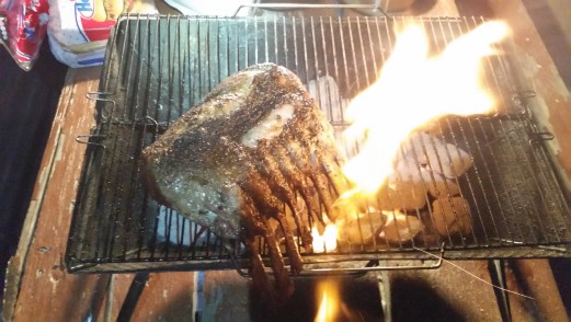
We pick the largest and flattest dirt campsite void of any vegetation, fire up the grill, and Jules is off to make love
to the neighbors' dog one-third his size. It gets busy, between flipping the rack of lamb and roping the dog back to our
site; after a while I convince him to jump in the Range Rover, where he's perfectly content to stay despite open tailgate.
Lamb ribs and sausage links are properly washed down, and we spend a couple of blissful hours doing exactly nothing, staring
at the stars, and talking about nothing in particular.
The night at 4500 ft is a lot warmer than the one at 9000 ft.
* * *
In the nice and fresh Monday morning, our new plans acquire shape.
We're going up Silver Canyon Road to see the Ancient Bristlecone Pines. And since Matt, Thao, and I have been to Shulman Grove,
we are going to see the Patriarch Grove.
Silver Canyon Road itself is one of must-see features of Eastern Sierra.
This road appears almost straight in most, even high-resolution, maps of the area. Yet one following this road will
climb 6 thousand feet in elevation in 6 miles - which translates into roughly 20-percent grade, on average.
In practice, it is a little different.
First, the road follows the mouth of the canyon, with six or seven creek crossings that can be axle-deep or deeper, depending on the season.
Last two times on this road we were greeted with a herd of bighorn sheep, sometimes within 20 feet from our trucks.
Eventually, the road comes to a point where one wonders - we're still far from the crest of the White Mountain range, yet the canyon walls close in.
That's where the fun begins.
It's all low range from here.
The switchbacks are so steep and short that they don't even register on the map. The turns are steep and tight, too, and you really don't want
to have to yield the way to oncoming traffic (which you almost never have a chance to see, should it appear).
All of it is a good reason to have few photos of the climb. Or any at all.
The Range Rover develops a tendency to flip open its upper tailgate whenever it pleases - meaning every hundred yards or so.
After a while, I take a short stop and ratchet-strap it shut.
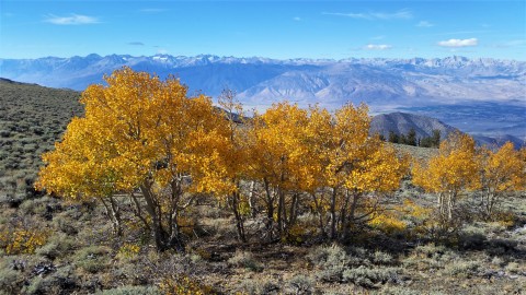
Near the top we ride into one of rare places to see the fall colors in California - a rather thin aspen grove.
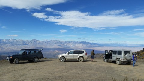
We park the trucks at the gravel patch at the top, look down at Bishop sprawling two vertical kilometers below us,
break out more beers, and I am off to take aspen photos.
It is a lot colder at ten thousand feet. We have our warm jackets and hats on, and the cold beer has noticeably
less allure.
We get back in our trucks, and, for the first time, take a left turn on White Mountain Road.
The road crosses a shallow saddle, and enters the switchbacks in the midst of Bristlecone Pine trees. I guess
these trees are nowhere as Ancient as the others in two "designated" groves, and are not given any kind of official
recognition. What's there to see, really - probably none of them is even 500 years old!
It takes about 8 miles of bone-rattling, tooth-filling-loosening road from the Silver Canyon Road to the turn-off towards
Patriarch grove. The road becomes steeper and narrower, and ends at a little loop. Compared to Shulman Grove, with paved parking lot,
a large Visitor Center (where one has to pay one's dues to National Parks Service), and generally crowded - this one is empty and peaceful.
Matt, Thao, and I notice immediately the huge difference between two groves.
The trees here are all alive.
We take our time walking a short and relatively flat loop trail - we are at 11,500 feet now, and steps count. We are mostly silent, Thao's getting a headache.
Jules doesn't give a shit, and runs around as if he were at the beach in Del Mar. This dog is turbocharged, I swear.
The trees are magnificent, huge, twisted, having seen all the winds and storms and fires of the last four thousand years.
We come back to the lot, fire up the butane stove and it takes its agonizingly long time to make us a kettle of tea.
We finish off our snacks, pack up, and head back towards Silver Canyon Road. We meet a couple of Subaru drivers who
somehow thing it is our moral duty to climb up the bank of the road so they could have a sweet flat spot to pass (despite having
just passed perfect wide spots to get by side by side). What's up with the Subie crowd?
A lone coyote runs across the road but stops to take a better look of us.
Matt makes up a reason to get to Bishop, so we go back to Silver Canyon Road, to lose that hard-earned elevation.
My poor Range Rover is terribly under-geared, so I have to ride the brakes a lot even in first-low on the way down.
Once back on blacktop of the U.S.395, we are met with the wind - the stiff tailwind of Saturday became a stiff headwind of Monday.
I feel my right toe almost about to touch the floor - just to keep near the speed limit of 65.
Matt volunteers to lead the convoy - so I could draft behind. I do, and stay buffeted side-to-side until Jordan takes the #2 spot.
I have to say that being #3 to draft is very beneficial. The difference between my dismal gas mileage and Matt's dismal gas mileage
was considerably less (so is the difference between Matt's and Jordan's).
Somewhere in Bishop I find an electrical curiosity - the engine stalls every time I hit the PTT button on the CB. First time I dismiss it as
a bizarre coincidence; the second time it appears definitely related. I stay off CB for a while, but decide to test my fate again
in Lone Pine. This time, the engine dies right proper - so I have to coast off to the shoulder in Lone Pine.
Disconnecting everything from the rear 12V battery feed seems to have done the trick - engine starts as if nothing happened at all.
We stop again at the park in Lone Pine. Jules surprises me by agreeing to jump back into the Range Rover and stay there, despite
the presence of a husky, good for sex or fight, less than 20 feet away. Did I finally wear him down?
The rest of the trip is, as usual, a blur.
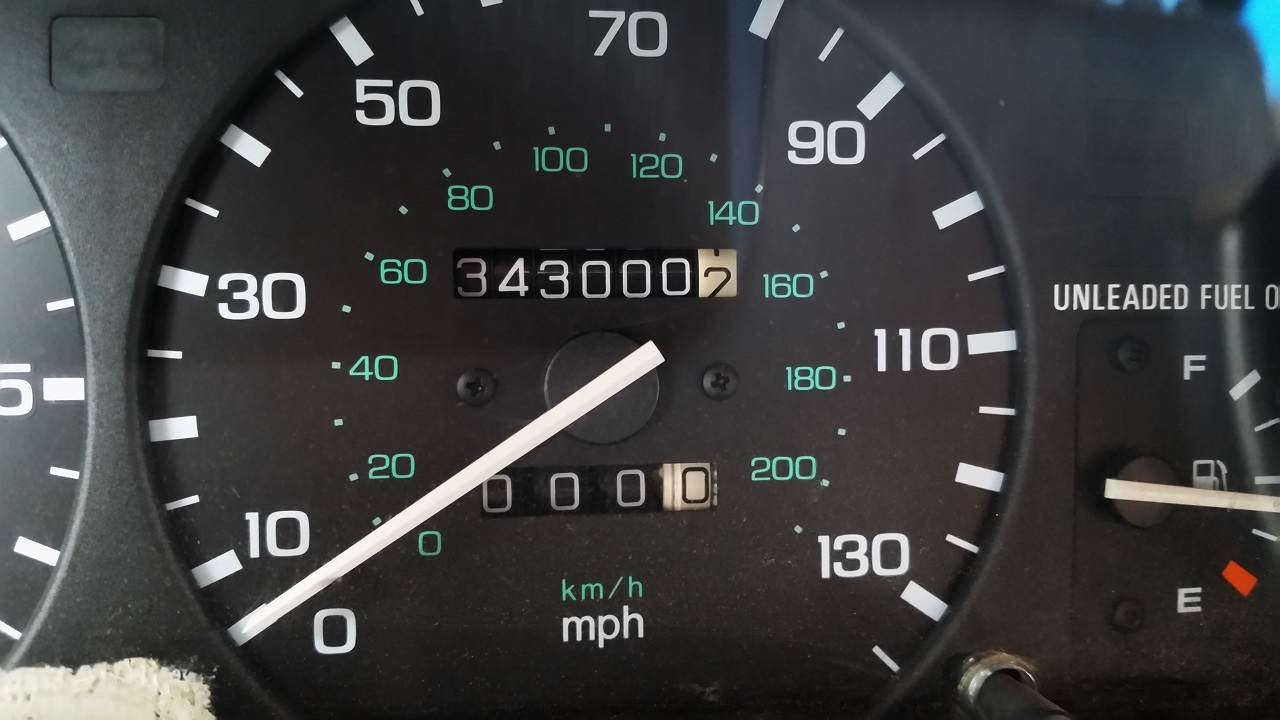
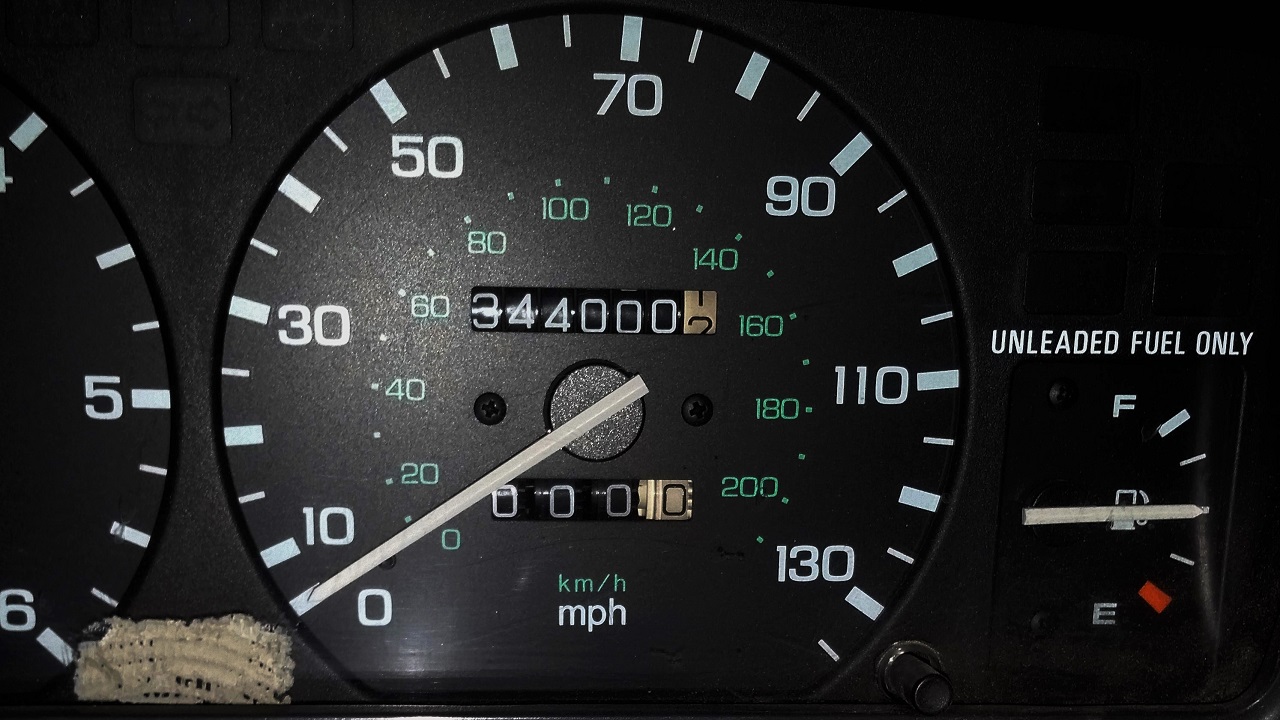
I just happened to take a "round-figure" odometer photos just before and immediately after the trip.
We covered one thousand miles in three days, about a hundred of them off pavement. That ought to take care of cabin fever.
* * *
