I am getting lazy.
Instead of leaving town at four in the morning, I leave at almost five - and waste another ten minutes trying to get the last-minute stuff from storage that's locked up for the night. It surely doesn't help that the hood (left open the night before) does not want to stay closed, requiring fiddling with such an odd tool as seven-millimeter nut driver.
My endpoint for the day is the town of Ely, Nevada. Google Maps are in solid agreement with Garmin in the choice of I-15 to Las Vegas and U.S.93 - on to Ely. I opt for a road along U.S.395, through Death Valley, U.S.95, and U.S.6 to the end. Not the longest route - but close; optimistic navigation tools suggest the travel time around 10 hours, but I know it won't happen.
Mojave Desert sees me way past the sunrise, after two hours on the Interstate and half an hour wasted at a Pilot truck stop in Adelanto.

|
My progress is punctuated by the hood popping open - twice, which is somewhat unnerving. The first stop involves a ratchet strap, the second - digging out the abovementioned seven-millimeter driver and pliers. Every time I stop, big rigs I just passed blow by, their drivers probably laughing at me.
Less than an hour later, I leave 395 for the "calm" of Trona Road. Not a single vehicle is encountered in 45 miles from the turn-off to the town of Trona. It is Sunday all right, but I expected to at least see some motorcycles on the hillsides.
Trona (please pardon me Trona hometown patriots) is terrifying. The town is dominated by Searles Valley Minerals - according to Wikipedia, a fairly large mining operation, started by John Searles in 1873. Now it is shipping out about 1.7 million tons of corrosive or causting minerals like borax, boric asid, soda ash and salt.
The abundance of said chemicals in local soil makes Trona a bit of a national celebrity, boasting the only dirt high school football field in the nation (go Tornadoes!). Real estate is golden here: where else in California can one buy a five-bedroom, two-bathroom, 2000-square foot house for $15K? Here are some memorable quotes from an old article in LA Times:
"The San Bernardino County Sheriff's Department has offered deputies willing to work in Trona free housing and less jail duty. Most prefer jail."
Chemical dominance in the area rubs off on its citizens, in the "Breaking Bad" way.
But it isn't that bad, really. It has two functioning gas stations (two more than 10 years ago), a supermarket, a few places to eat, and it boasts having been a stopover for the Manson family.
It is also close to famous Trona Pinnacles - bizarre mineral formations where a bunch of movies were filmed and where conspiracy theorists believe NASA faked the Moon landing. I drove by the turn-off to the Pinnacles too many times not to make a short trek.
The road to Pinnacles is a Death Valley-classic full-blown washboard. Fun starts after crossing the Trona railroad tracks.

|
 |
 |
The first vehicle I encounter is enormous EarthRoamer-type build on an F550 Super-Duty chassis. Things like this make me wonder - do we really need to bring all comfort features out to the desert, short of a grand piano? I saw people arguing the merits of these vehicles for far-out international travel, but it has all the subtlety of U.S.Government-issue black Suburban with bulletproof glass. Whatever floats their boat...
By then I can already see the Pinnacles.
By then I can already see the Pinnacles.
 |
 |
 |
Now's time to hand the mike off to Wikipedia again:
"The Trona Pinnacles are an unusual geological feature in the California Desert National Conservation Area. The unusual landscape consists of more than 500 tufa spires (porous rock formed as a deposit when springs interact with other bodies of water), some as high as 140 feet (43 m), rising from the bed of the Searles Lake (dry) basin. The pinnacles vary in size and shape from short and squat to tall and thin, and are composed primarily of calcium carbonate (tufa). They now sit isolated and slowly crumbling away near the south end of the valley, surrounded by many square miles of flat, dried mud and with stark mountain ranges at either side.
The Pinnacles are recognizable in more than a dozen hit movies. Over thirty film projects a year are shot among the tufa pinnacles, including backdrops for car commercials and sci-fi movies and television series such as Battlestar Galactica, Star Trek V: The Final Frontier, Disney's Dinosaur, The Gate II, Lost in Space, and Planet of the Apes."

|
 |
 |
 |
 |
 |
I may have stumbled into another moviemaking scene, although it did not appear terribly professional. Many nice faces and shiny suits, however. After I finish shooting the panorama of particularly-well-spaced tufa towers, I continue on to the film crew - and the girl in the "Defend New Orleans" t-shirt waves me to stop. Fine, be that way.
I get back in the Land Rover, drive out of the Pinnacles, by the borax works, and into Panamint Valley. Forty minutes later, I am in Death Valley.
I get back in the Land Rover, drive out of the Pinnacles, by the borax works, and into Panamint Valley. Forty minutes later, I am in Death Valley.
 |
 |
The climb over the Panamint range is torturous; in a few spots I have to drop down into the second gear, with no hopes to keep the speed above 60 miles an hour. All the crowded minivans I passed on the way from Trona to Panamint Springs exact their revenge. A ranger station near Stovepipe Wells hit me with $80 for an annual National Parks pass, and there's absolutely nothing I want to buy at the gift store.
 |
 |
 |
Drive by Mesquite Dunes - no, they aren't even close to Eureka Dunes in size or impression. A lot more crowded, too.
Garmin suggests me to veer left on North Death Valley Road - with signs that Scotty's Castle Road is still closed. My knowledge of Death Valley geography is rusty, so I ignore Garmin and press on the 190. Garmin is insistent, and in the last act of desperation sends me to the Beatty Cutoff. I stop and zoom out the map - sure enough, I don't need to count miles to Furnace Creek. Off to the North we go, taking photos of the unusually-bright-blue and yellow flowers along the way.
Garmin suggests me to veer left on North Death Valley Road - with signs that Scotty's Castle Road is still closed. My knowledge of Death Valley geography is rusty, so I ignore Garmin and press on the 190. Garmin is insistent, and in the last act of desperation sends me to the Beatty Cutoff. I stop and zoom out the map - sure enough, I don't need to count miles to Furnace Creek. Off to the North we go, taking photos of the unusually-bright-blue and yellow flowers along the way.
 |
 |
 |
 |
 |
 |
Soon, I cross the border of The Silver State. The first stop is in the ghost town of Rhyolite. Started in 1906 as a mining town, a year later it had electric lights, running water, telephones, newspapers, a hospital, a school, an opera house, a stock exchange, and a train station (with connections to Las Vegas and Tonopah).
It has been a fairly large town, housing between 3000 and 5000 people, in its very short glory days that only lasted for about 13 years between 1907 and 1920. Interesingly enough, the demise of the town was prompted by the independent audit of the mine, primarily invested in by one Charles M. Schwab. I wonder if Charles R. Schwab, the founder of a well-known corporation, is a relative - Wikipedia is silent on this matter; wonder where whatever little 401(k) money I have is held...
A ghost of its own past Rhyolite may be, but a few artists took their time to erect all sorts of bizarre sculptures. The most famous of them are The Last Supper and The Ghost Rider by Charles Albert Szukalski, but there are several others as well as a collection of Goldwell Open Air Museum. Read up on Wiki if you wish.
 |
 |
 |
 |
 |
 |

|
 |
 |
 |
 |
 |
 |
 |
 |
 |
 |
 |
 |
 |
 |
I get my fill of photos, and discover that the clock's already in the mid-afternoon, with some 260 miles to go to Ely.
I pack up and continue to Beatty - to take a few photos of the infamous Angel's Ladies airplane crash site. The story has it that in 1978 the owners of the brothel were looking for creative ways to spice up the attendance, and organized an airdrop of courtesan ladies on parachutes off a twin-engine plane. The pilot was understandably distracted by the passengers, and somehow managed to belly-land the plane right near the entrance to the establishment. Miraculously nobody was seriously hurt, and the management decided to keep the plane on premises as a side attraction.
I pack up and continue to Beatty - to take a few photos of the infamous Angel's Ladies airplane crash site. The story has it that in 1978 the owners of the brothel were looking for creative ways to spice up the attendance, and organized an airdrop of courtesan ladies on parachutes off a twin-engine plane. The pilot was understandably distracted by the passengers, and somehow managed to belly-land the plane right near the entrance to the establishment. Miraculously nobody was seriously hurt, and the management decided to keep the plane on premises as a side attraction.
 |
 |
My pre-trip road survey included yet another attraction about 5 miles down the road - Bailey's Hot Springs. I could not make anything reasonable out of Google Earth imagery, so I had to check it out.
Bailey's Hot Springs (rated 4.3 out of 5 by Google reviewers) is a collection of dilapidated shacks and permanently moored trailers, but with a reasonably clean and equipped RV parking/camping area, and two hot spring shacks. A peacock guards the premises.
For a princely sum of $8, you get to use one of these; judging by multiple clothes hooks on the walls, these are not expected to be private - but the nice folks I distracted from their grilling duties aim me towards one not occupied by the rowdy bunch of kids. It is nice, clean, and hot - about 104F, about knee-deep, with a nice sandy bottom. There are two cinder blocks in the water in case you want to sit - that's where comfort features peter out. Still, it is kind of establishment more like Keough's Hot Springs near Bishop, California, than to the concrete-lined holes in the ground. It is very refreshing albeit short; I go outside and made myself a lunch of a pretzel bun, some cheese, and a Stone IPA. Life is great.
For a princely sum of $8, you get to use one of these; judging by multiple clothes hooks on the walls, these are not expected to be private - but the nice folks I distracted from their grilling duties aim me towards one not occupied by the rowdy bunch of kids. It is nice, clean, and hot - about 104F, about knee-deep, with a nice sandy bottom. There are two cinder blocks in the water in case you want to sit - that's where comfort features peter out. Still, it is kind of establishment more like Keough's Hot Springs near Bishop, California, than to the concrete-lined holes in the ground. It is very refreshing albeit short; I go outside and made myself a lunch of a pretzel bun, some cheese, and a Stone IPA. Life is great.
 |
 |
 |
On my way to Tonopah, I get to see some wildlife - a little herd of Pronghorn antelopes and wild burros.
 |
 |
In my absent-minded drive North, I have to admit to driving through a town of Goldfield and only doing some drive-by-shooting of roadside artifacts.
 |
 |
 |
A year and a half later, I [will have] revisited the town and found it to be very entertaining. I missed a lot; for the sake of geographic continuity of this story, I am going to do add a few photos and comments here.
One of the famous attractions in Goldfield is about quarter-mile to the East from U.S.95, just as you drive into town.
Its full name is quite lengthy: "International Car Forest of The Last Church."
Here's a short quote from Atlas Obscura:
 |
 |
 |
 |
The original artists and likely generations of their followers are liberal with life-defining advice, from "Never reveal your identity" to "Surve no one." I need a few takes to decipher the latter one.
 |
 |
 |
 |
 |
 |
Out of the Park, the attractions are not over. In the middle of town, U.S. 95 makes a 90-degree bend, and at the right the County offices show up.
On the official side of the building, police Explorers are lined up. The backyard, however, offers a different story - almost from the "Cars" animation.
 |
 |
Unfortunately, Goldfield Hotel is closed and can only be admired from outside.
 |
 |
Going back to the trip at hand...
In Tonopah, I leave the U.S.95 and hop on the U.S.6. The road itself deserves some mention. Started in 1928, "diagonally" across the United States and out of order with existing highway nomenclature, it was the U.S. longest highway from 1936 and until 1964. Currently it is "chopped off" on the Western side in Bishop, and only measures about 3200 miles in length. The Western part of it rivals "The loneliest highway in the U.S.," the 50; Jack Kerouac in his wandering times has been absolutely discouraged to hitchhike along the U.S.6 for the complete lack of traffic.
To which I can attest. I do not pass a single vehicle, nor am I passed by another vehicle, in all of 142 miles from Tonopah to junction with Nevada SR 318 (which carries whatever little Las Vegas traffic there is to the North of the state). I count less than 10 vehicles in the opposite direction, in more than two hours on that road. I watch the wild burros and magnificent vistas of insane volcanic activity of recent geological past around.
My day ends at the Historic Hotel Nevada and Gambling Hall in Ely.
 |
 |
 |
 |
 |
 |
 |
 |
 |
The hotel, built in 1929, is in a reasonably good condition, even without the smell of stale cigarette smoke in the room. Downstairs gambling is in full swing, with one-armed bandits steadily emptying the pockets of somewhat-downbeat crowd with a median age of 65. As in most other places in Nevada, smoke fills the air; the complimentary bar drink tickets only cover the brand of whiskey I have never heard it - Cluny (subsequent googling of this brand reveals the cause of the awful taste - it retails for about 10 bucks a liter). The only dinner option is Denny's on premises; it is already late, but I try Cellblock Restaurant at the Jailhouse Motel across the street with a great success.
The morning brings me to the shower with a warning that the water temperature may swing between ice cold and scalding hot as it pleases. I am lucky to use it entirely between any other instances of shower use by hotel guests and escape without blisters.
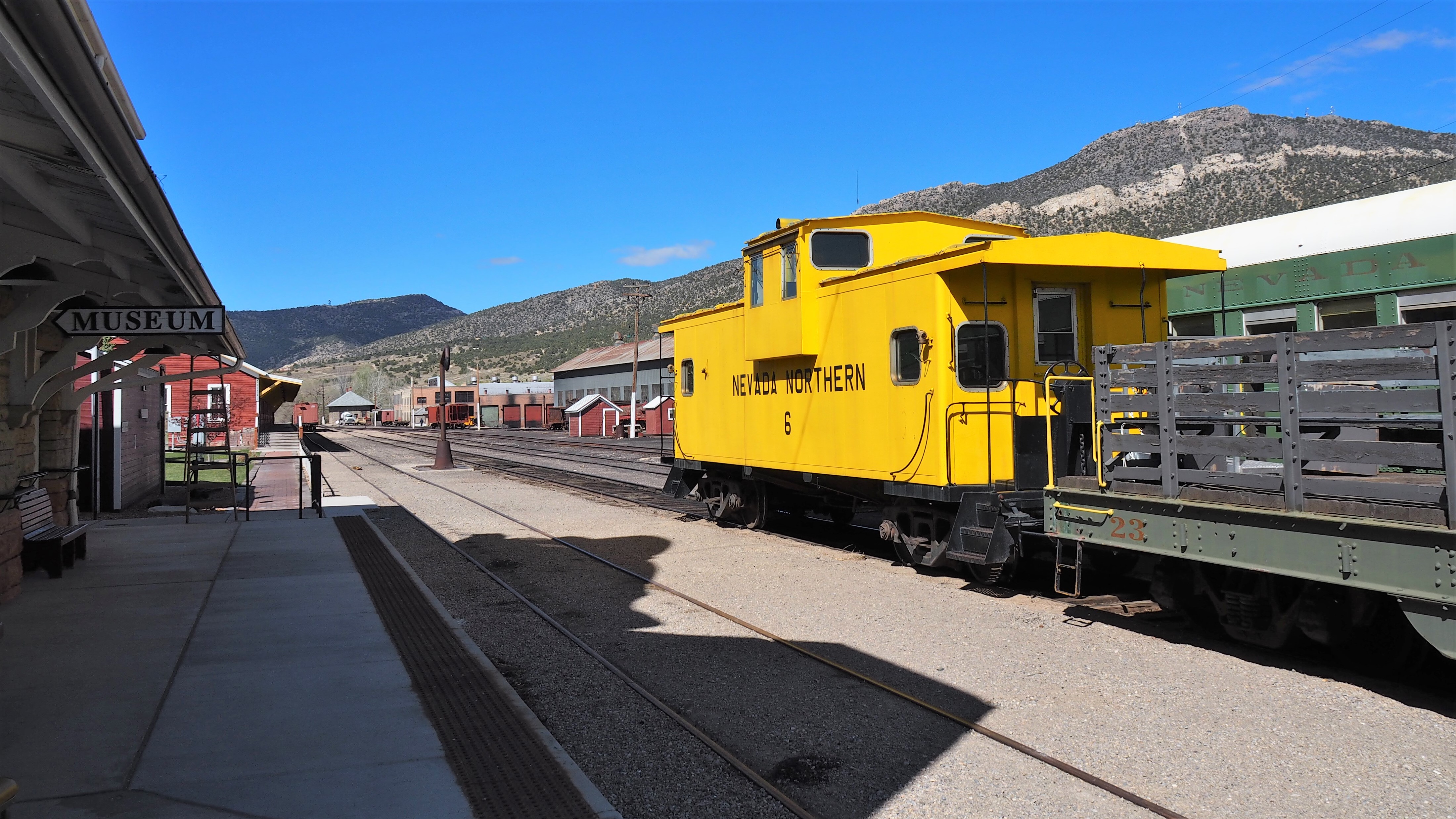
After a coffee and eggs at Denny's, it's time to see the Ely Railroad Museum.
The morning brings me to the shower with a warning that the water temperature may swing between ice cold and scalding hot as it pleases. I am lucky to use it entirely between any other instances of shower use by hotel guests and escape without blisters.
After a coffee and eggs at Denny's, it's time to see the Ely Railroad Museum.
 |
 |
The first thing I see on the block near the museum is a fine collection of old-timers, including an old Volvo hatchback and a Jeepster Commando.
 |
 |
 |
 |
Time for trains!
Since I was a kid, I was thrilled with everything railroad-related. The smell of creosote from the ties, the smell of coal briquets burned by the car's attendant on a frisky cold day, a glass of tea brought into the compartment, jerk of a car and clanking of the wheels on the switches, bizarre red, green, and blue lights appearing from the dark and disappearing again, muted conversations. The entire railroad romantics, you name it.
So the museum in Ely was not to be skipped.
Having had enough of old car photos, I walk into the museum cashier's office (which also doubles as a gift shop), pay my dues, receive the map and whatnot, and am on my way out. I snap a couple of photos of old cars in front of the station before heading into the old Railroad office complete with the steel desks, Underwood typewriters, and all sorts of mechanical calculating machinery.
 |
 |
 |
 |
 |
A museum staffer raises an eyebrow at seeing an adult without kids in tow visiting the office and the rest of the stuff, and allows me to wander anywhere on the large museum property and take photos. I oblige.
Soon, I am at the maintenance depot, meet a mechanic there, and ask and say every wrong thing to be asked or said.
Soon, I am at the maintenance depot, meet a mechanic there, and ask and say every wrong thing to be asked or said.
 |
 |

|
 |
 |
The torn-apart steam engine turns out not to be one under restoration, but under mandatory pressure testing. It is the engine #93, in most use on the weekend train rides. I marvel at all enormous machinery - from a lathe with something like a 2-foot chuck to a lathe that accomodates the entire axle and wheels. The picture of the steam engine's headlight doesn't do justice to its size; a cat's taking it easy by the engine's wheels; wrenches dangle from a workbench. Fun stuff, all of it.
 |
 |
 |
 |
 |
 |
 |
 |
 |
 |
 |
 |
 |
 |
I am trying not to annoy the mechanic with my picture-snapping, and go on. Next door there's a building with some broken-down car parts and axles; an owl is startled by my presence, flops around, and flies outside.
 |
 |
 |
 |
 |
 |
 |
 |
 |
 |
 |
 |
 |
 |
 |
 |
 |
I keep taking photos of whatever's there - bunker tower, rail testing car, yard engine, snowplow, coal tender, Pullman and a cabooze in the depot. I watch in fascination how a little yard engine moves another cabooze from one track to another, whistles and all, with another museum staffer working the manual track switches. Then I run out of things to look at and take pictures of, and leave the place.
A gorgeous bright-yellow Studebaker Hawk Grand Turismo is parked outside. Even the NRA affiliation of its owner does not stop me from ogling it from every which side.
A gorgeous bright-yellow Studebaker Hawk Grand Turismo is parked outside. Even the NRA affiliation of its owner does not stop me from ogling it from every which side.

|
 |
 |
 |
 |
 |
A young man manning the museum's cash register advises me to visit the Robinson mine a few miles West of town, and names Garnet Peak as the best viewing spot. I take off on U.S. 50; soon, I pass the mine (indeed can't see much from the road), take the first turn-off to a dirt road, and climb up to the top of the peak (as it turned out, not Garnet Peak but its smaller brother). I still have about a couple of hours before the rest of our crew arrives, so I set up a folding chair, grab a beer, and set about sewing together torn Ecco boots with a fishing line. Not a bad way to kill time, if you do your diligence with the sunblock. Cool wind with ferocious sun do a number on me, which I learn about a day or so later.
Sometime around 1 pm, Jason chimes in electronically and lets us know that his truck practically pole-vaulted on the front driveshaft while he was on his way... So he is back to Boise and scrambling to get it replaced (along with everything else that may have been damaged along the way). That's one giant bummer that is hard to swallow.
Around 2 in the afternoon, I head out to the city park. The attempts to communicate with Dan (heading in his 97 NAS D90 from the West on U.S.50) and Chris and Ben (heading in their MOD D110s from the East on dirt roads) are sketchy - Chris says they are rolling into town, but... he's said it half an hour ago already. I sit down and try to read a book, when the radio comes alive and they guys appear as they are really close. We establish good radio contact pretty much at the same time as we see each other... quite some ham experience.
Soon, Dan joins us at the backslapping party, and we buy some useless crap at a local hardware store (like a roll of 3-inch-wide Gorilla tape and firewood) and decide to have a late lunch.
Most restaurants are closed including Jailhouse's, so it has to be McDonalds. What a downer.
 |
 |
 |
Soon, we're gassed up and are on our way. Chris' knowledge of local topography and road network is way beyond mine (and probably others as well); he hatches a plan to get to some elusive valley surrounded by the mountains not far away from Robinson mine, bypassing the land belonging to the mining company.
When we're on dirt, it's already late afternoon. We take our sweet time taking group photos, and meander up and down on a bizarre berm that we speculate protect the mine leaching ponds from rainwater runoff from the mountains. The road on the berm winds up at the faded two-track that once was The Lincoln Highway (the U.S.50). Here I take my first taste of Nevada "moon dust" - dust so fine that its particles make their way through the smalles openings in the truck body (and Land Rovers have never been known to "babysit" their occupants and protect them from the environment).
When we're on dirt, it's already late afternoon. We take our sweet time taking group photos, and meander up and down on a bizarre berm that we speculate protect the mine leaching ponds from rainwater runoff from the mountains. The road on the berm winds up at the faded two-track that once was The Lincoln Highway (the U.S.50). Here I take my first taste of Nevada "moon dust" - dust so fine that its particles make their way through the smalles openings in the truck body (and Land Rovers have never been known to "babysit" their occupants and protect them from the environment).

|
 |
 |
 |
 |
 |
 |
 |
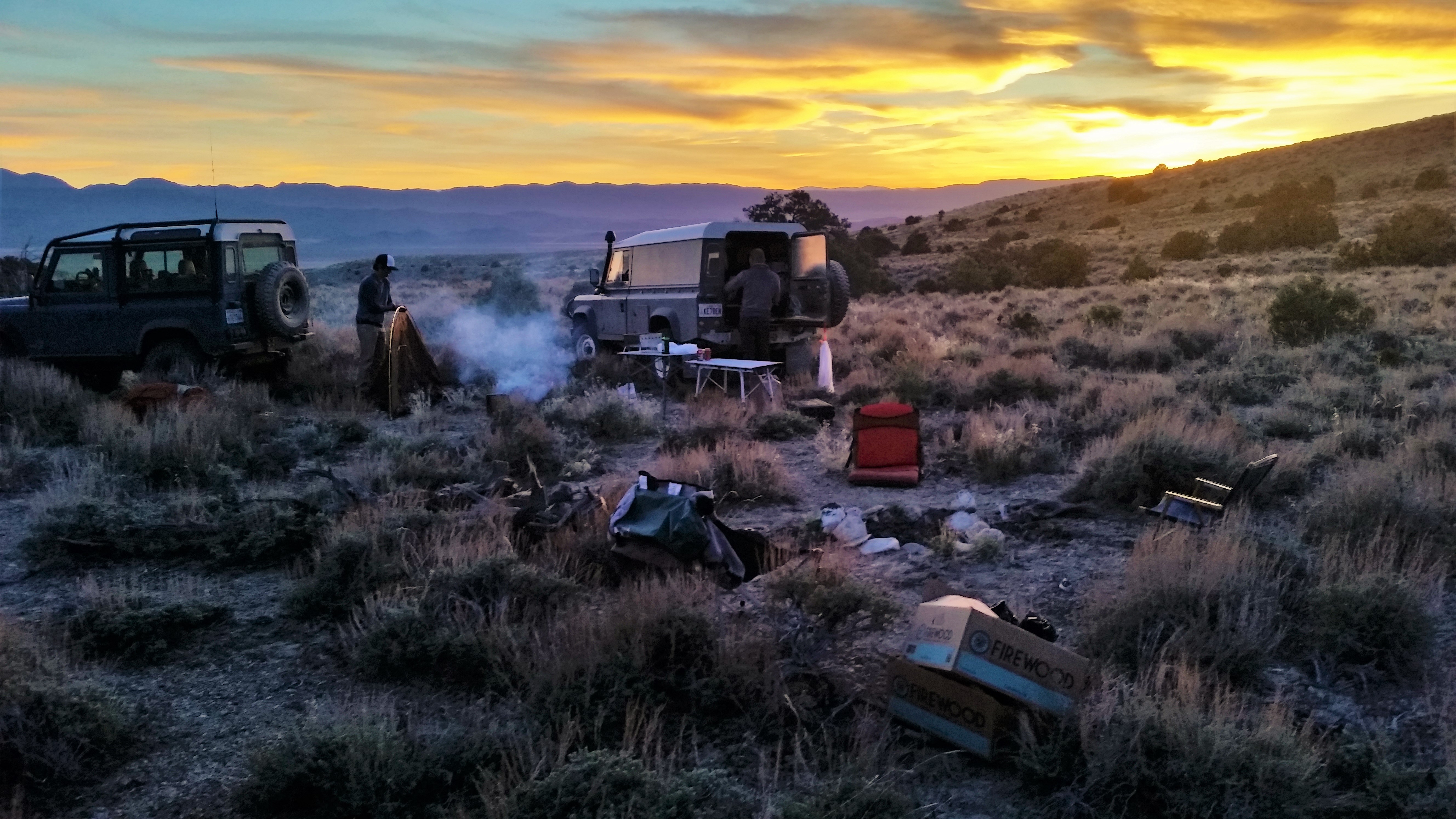
The elusive valley is found, and a beautiful, flat as a pancake, camping area near a cattle corral is found. Photos of the trucks at the sunset are taken, and we start setting up a camp for the night.
It does not take the wind long to drive us nuts. We stagger the trucks in an intricate matter to somewhat impede the airflow to our camp, and Dan proceeds to making a fantastic dinner centered around Korean barbecue (or was it Mongolian? I heard something about Korean).
It does not take the wind long to drive us nuts. We stagger the trucks in an intricate matter to somewhat impede the airflow to our camp, and Dan proceeds to making a fantastic dinner centered around Korean barbecue (or was it Mongolian? I heard something about Korean).

|
 |
 |
 |
Beer and whiskey are flowing - leisurely, and we enjoy our first group dinner. The mood is somewhat muted, because we all are badly missing Jason. The valley is apparently close enough to the mine, and cell phone coverage is absolutely exceptional - so we carpet-bomb Jason with unsolicited advices.
Reflecting on Jason's predicament, Dan mentions something about his front driveshaft that he wasn't happy about.
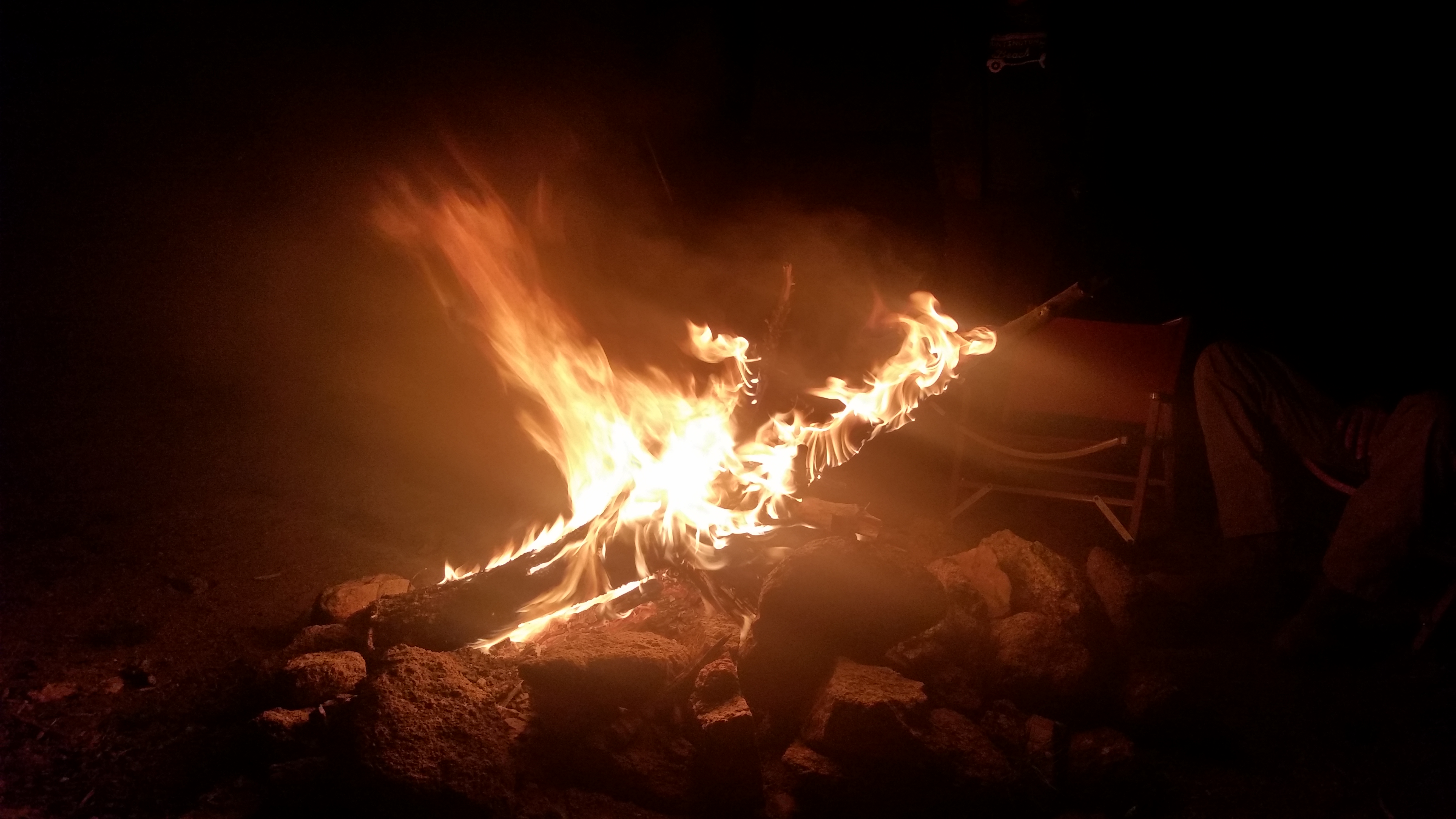
The air cools off so fast that we have a hard time keeping up with putting on layers of clothing. The temperature must have dropped off thirty degrees (F) since we arrived. We move closer and closer to the fire - which, fueled up by the grocery store firewood, doesn't feel all that hot.
Finally, everyone calms down and we turn in for the night. I am shivering, from both cold air and earlier sunburn, so I have to fire up the truck for a couple of minutes to take the edge off the chill.
Before I roll out a $15 WalMart sleeping bag, I peek in the bag I grabbed from the closet on my way out in San Diego. Guess what, it is a brand new, gorgeous Marmot sleeping bag - my wife's birthday gift. What a gas!
* * *
The night was chilly; weather report for Robinson mine listed frisky 33 degrees.
Dan is the first to rise and shine - his luster is lacking, however, for he contemplates removal and inspection of his D90's front driveshaft. We dig out a tarp and tools, trying not to make too much noise. Between us, we have enough U-joints, both Land Rover and Spicer, to replace whatever may be on its way out.
By the time the driveshaft is out, everybody is up, stoves are going, and kettles are steaming. We make breakfast and take turns bending the driveshaft yokes every which way. Dan, a trauma surgeon, knows right away what's wrong - the centering ball in the double-cardan joint. This is something we are more reluctant to rebuild in the dirt; the decision is made to leave it out and continue in two-wheel-drive.
Something lurks under Ben's truck - looks like a nice horned toad lizard. We take our photos.
Reflecting on Jason's predicament, Dan mentions something about his front driveshaft that he wasn't happy about.
The air cools off so fast that we have a hard time keeping up with putting on layers of clothing. The temperature must have dropped off thirty degrees (F) since we arrived. We move closer and closer to the fire - which, fueled up by the grocery store firewood, doesn't feel all that hot.
Finally, everyone calms down and we turn in for the night. I am shivering, from both cold air and earlier sunburn, so I have to fire up the truck for a couple of minutes to take the edge off the chill.
Before I roll out a $15 WalMart sleeping bag, I peek in the bag I grabbed from the closet on my way out in San Diego. Guess what, it is a brand new, gorgeous Marmot sleeping bag - my wife's birthday gift. What a gas!
The night was chilly; weather report for Robinson mine listed frisky 33 degrees.
Dan is the first to rise and shine - his luster is lacking, however, for he contemplates removal and inspection of his D90's front driveshaft. We dig out a tarp and tools, trying not to make too much noise. Between us, we have enough U-joints, both Land Rover and Spicer, to replace whatever may be on its way out.
By the time the driveshaft is out, everybody is up, stoves are going, and kettles are steaming. We make breakfast and take turns bending the driveshaft yokes every which way. Dan, a trauma surgeon, knows right away what's wrong - the centering ball in the double-cardan joint. This is something we are more reluctant to rebuild in the dirt; the decision is made to leave it out and continue in two-wheel-drive.
Something lurks under Ben's truck - looks like a nice horned toad lizard. We take our photos.
 |
 |
Time passes quickly between Dan's driveshaft ordeal, lazy breakfast, and calisthenics with Chris' collection of Pelican cases. By the time we hit the road, it is dangerously close to noon.
We hit the road with a vigor, and zigzag through the valley, generally moving Southeast. Pronghorns are always near, and move way faster than us.
We hit the road with a vigor, and zigzag through the valley, generally moving Southeast. Pronghorns are always near, and move way faster than us.
 |
 |
Soon, we are at the foothills of a mountain range, one of many we encounter on this trip, and climbing. A faded sign announces a presence of a Forest Service ranger station, which we are happy to check out. As we turn off towards it, we come across a herd of wild horses - we stop and quietly approach on foot. The horses, remarkably, reciprocate - and we really don't know what to make of two complete horse families with young colts moving towards us. A creek separates us from the horses, and we decide to keep it this way - and move on to the ranger station. Nice digs, it is, with a couple of picnic tables in the shade, and a barbecue trailer.
 |
 |
 |
 |
 |
After this side trip, it was time for the higher pastures. The road meanders up and down a few valleys, but generally climbs up. We drive through a few pockets of thick brush and close trees - reminding us of one canyon near Owyhee River two years ago - and eventually clear the treeline.
 |
 |
 |
 |
 |
 |
We encounter our first snow around 8200 ft; the old snowdrift stretches across most of the road and thus merits some recon on-foot. Chris thinks nothing of it, and cuts us a nice path with a deep rut for the right-side wheels. Shoveling is not required, and none of us run into any problems.
 |
 |
 |
 |
 |
 |
The road from there is all downhill. We continue along the valley, keeping the snow-capped Duckwater range to our right, and along a swiftly-running creek. The trees appear, then cede ground to junipers, then we're out on the desert floor again.
 |
 |
 |
Forest Road 407 takes us South to the U.S.6, which we take for a few miles to Nevada SR 379 into Duckwater Valley. The sun is already pretty low and we should be looking for a campsite - but there's nothing around but sage-covered plain, and we're entirely out of firewood. We take a random two-track towards the treeline, in hopes of finding a decent spot.
The distance feel in the desert is deceptive; the tree-lined hillsides that look so close are actually about six or seven miles from the road. We meander up the shallow slope of the alluvial fan, and finally start seeing occasional cedar or two. The entire ground is covered with knee-deep sage plants; not an issue for us sleeping in our trucks, but posing a challenge for wheelbase-deprived, tent-camping Dan. Having a campfire or putting up tent inside an empty and bone dry water tank is discussed more seriously than it should. Ben volunteers to take a faint two-track off to the side, and shouts on the radio that a good candidate for a campsite is around, complete with a fire ring.
The distance feel in the desert is deceptive; the tree-lined hillsides that look so close are actually about six or seven miles from the road. We meander up the shallow slope of the alluvial fan, and finally start seeing occasional cedar or two. The entire ground is covered with knee-deep sage plants; not an issue for us sleeping in our trucks, but posing a challenge for wheelbase-deprived, tent-camping Dan. Having a campfire or putting up tent inside an empty and bone dry water tank is discussed more seriously than it should. Ben volunteers to take a faint two-track off to the side, and shouts on the radio that a good candidate for a campsite is around, complete with a fire ring.
 |
 |
 |
 |
Soon, we're all business setting up camp. There is no shortage of dead and very dry cedar branches around to make a fire - and we discover that cedar burns very hot and for a pretty long time.
The dinner for the night - New York steak. Ben makes a marvel out of it, supplemented by veggies, and washed down by beers and Bourbon.
The dinner for the night - New York steak. Ben makes a marvel out of it, supplemented by veggies, and washed down by beers and Bourbon.
 |
 |
 |
Getting up in the morning was punctuated by stepping on some thorny bushes all around our trucks. The night before Chris has noticed that the lower bushing on the left rear shock absorber "vacated premises," so now it is his time for a perfunctory survey of underside of his truck, with wrenches in hand. Fortunately, we have plenty of this kind of spares; hundreds of miles in the desert do take their toll on vehicles. I think that's when we all decide to air down somewhat (me from 45 to 30 psi) - more from vehicle integrity than from confort standpoint.
Both me and Dan are already low on gas. Dan uses both of his spare jerry cans, I use one (another is empty); Chris laments on his dislike for fuel-necessitated detours (of course, with a TDI and two spare cans he has a range approaching 700 miles). We depart considerably earlier than yesterday, for we need to reach Eureka on the U.S.50 for gas and supplies.
 |
 |
 |
It takes us close to half an hour to reach pavement and head North on NV SR 379. Pavement expires soon, so we continue on gravel in a cloud of dust for about forty miles. Turn West on U.S.50, and we're in Eureka ("The Friendliest Town on the Loneliest Highway In America") in another half an hour.
 |
 |
 |
We have lunch at Pony Express Cafe, and take multiple trips across town in search of hardware and grocery stores. Restock on sunblock and water (I guess, fully-laden, we carry about 15 gallons of water between four of us), top off the fuel, and hit the road again.
Eureka is also a mining town, and Chris makes several attempts to find a path to our destination around the mine property. After a few attempts we hit the 50 Westbound, and many miles later -South into Monitor valley, separating two of several Toiyabe mountain ranges. The next hour or so we are busy raising the dust plume, moving fast along the desert two-tracks and mostly concerned of an itinerant cattle on the road.
Suddenly, Chris makes a sharp left turn, and drives towards a shallow knob on the valley floor. The knob is carefully fenced-over, with a gate that we have to open and close when we are through. Then the radio delivers a somewhat-ominous warning: "Drive very carefully alongside, and do not, repeat do not, drive any farther than me."
Wow.... wonder what is it? We find ourselves staring into a very round hole in the rock, about 50 feet in diameter, and about 30 feet deep. We learn from Chris that this place is called "Diana's Punchbowl," (also known as Diana's Cauldron) and the water gets close to 200 degrees and is also said to be fairly acidic.
Some time is rightfully spent taking photos.
 |
 |
 |

|
 |
 |
 |
 |
 |
Finally, we have our fill, and head out - and South along Monitor Valley, towards the ghost town of Belmont. It dates back to 1865 (full 40 years earlier than Rhyolite), and it lasted quite a few years longer. At its peak, it housed close to 15 thousand souls, and for 38 years it was the Nye County seat - yielding the title to Tonopah in 1905. Quite a few buildings remain - most-intact (or restored) is the stately two-story Courthouse.
Unlike many other ghost towns of the West, Belmont is gradually restored - and it looks like it is actually inhabited, including a tiny city park halfway between the Courthouse and Saloon.
We could have easily missed this town - but were told about it by a friendly local at a gas station in Eureka. He also advised us to pay tribute to Dirty Dick's Saloon - but it turned out to be closed. What a disappointment.
 |
 |
 |
 |
 |
 |
 |
 |
 |
 |
A little earlier, a couple of miles short of Belmont, Chris spotted a two-track going up to a shallow plateau, and guessed that this road could lead to a decent campsite. I went to check it out - and it turned out plain gorgeous. After our visit to Belmont, we return to the campsite and spread out.

|
 |
 |
On the dinner menu - carne asada tacos, skillfully executed by Ben. It was a beautiful, calm, warm, and otherwise fantastic evening.
 |
 |
Ben is the first one to be woken up by carne asada and bourbon, and immediately distracted by a flock of bighorn sheep. By the time we are up, he is flipping through many photos in his camera. We are envious - but get over it and make breakfast. As usually, I have no clue what Chris has in the store for us. We grudgingly leave the beautiful campsite in mid-morning, and cross Monitor Valley towards the East.
 |
 |
 |
On a shallow ridge to the East of Monitor Valley we come across remnants of an old stone cabin, and check out of we can find any rattlesnakes. None are found; only a black lizard lounged on cool cabin rocks. We're off to another valley, and that's where some fun begins.
Chris decides to spice things up and turns into what is billed a Jeep 4x4 trail. For a while it has nothing to impress us with, and then all of a sudden corkscrews downhill in a series of tight, off-camber, rock-lined, turns.
Soon, Dan is out dismantling his ham radio antenna, and we are wondering what would these really stiff, low, and frequent, cedar branches do to one's rooftop tent. Or how would an F550-based glamping truck fit between the walls. . One of these trees sees a saw to come out and lop off an offending branch.
 |
 |
 |
 |
 |
 |
 |
 |
 |
In a while, we cross another shallow range and find ourselves in a narrow canyon called Hot Creek Canyon. A game of opening and closing the cattle gates begins; we travel through private property and are grateful that the owners are allowing the people to pass.
The dark-green grass in an occasional meadow definitely indicates some heavily-mineralized, year-round, water source nearby.
The dark-green grass in an occasional meadow definitely indicates some heavily-mineralized, year-round, water source nearby.
 |
 |
 |
 |
 |
 |
 |
 |
 |
 |
 |
The fauna is represented by very well-fed, likely purebred, beautifully-looking horses, some cattle, and a huge flock of bighorn sheep.
 |
 |
 |
 |
 |
 |
 |
 |
We continue on, chatting about the benefits and downsides of living in such remote places, and eventually drop down into a large valley - and turn North. Half an hour after we're on the valley floor, we are at the Project Faultless Test site. There is some interesting read about the project, besides the usual dry Wikipedia stuff. In essence, one-megaton nuclear blast was carried out in January of 1968 at a depth close to one kilometer; as a result of the test, a round fault emerged around the test site and the ground subsided by several feet. I found the name of the test fairly ironic - it was supposed to be a test for ground faulting in preparations for a five-megaton underground blast. The consequences of the test were sufficiently convincing to abandon any further high-yield nuclear testing in this area, and in six months' time - in Nevada altogether.
 |
 |
In the panorama image below, one can easily trace out the part of the circular fault line.

|
 |
 |
 |
We have a quick snack and leave the valley - on to the other exciting sightseeing in Nevada. As we crossed the U.S.6 again, I had to take a better photo of a beautiful lava field.

|
We don't stay on U.S.6 for long - and continue East towards a National Landmark known as Lunar Crater. Now that I have read about it, I can share fairly entertaining quotes from Wikipedia:
"Lunar Crater National Natural Landmark is a volcanic field landmark located 70 miles (110 km) east-northeast of Tonopah in Nye County, in central Nevada. It was designated a National Natural Landmark in 1973. ... A 400-acre (1.6 km2) crater that is thought to have been formed by several volcanic explosions, and is one of two maars in the volcanic field of the Pancake Range."
Maars? Have to look it up - Wikipedia, conveniently, provides the link to the word.
"A maar is a broad, low-relief volcanic crater caused by a phreatomagmatic eruption (an explosion which occurs when groundwater comes into contact with hot lava or magma)."
At this point, Wiki is kind to the reader enough to skip reading up on phreatomagmatic eruptions.
The place we stopped was devoid of any plaques or other signs elaborating on maars and phreatomagmatic eruptions. Having just seen another clear former volcano, I could have guessed what it was, but ... my mental abilities somewhat decline after a hundred miles in the desert. To refine the feeling - I felt too lazy to even think of what have brought this hole in the ground to existence. It is a great fun and great sight nonetheless.

|
We are somewhat faded - so we don't hang around the crater too long, but head to the East. The plateau drops into the vast valley dominated by two kinds of wildlife - cattle on the ground, and fighter pilots doing donuts in the sky. It's already late afternoon, but we have to cross this valley and find ourselves a good campsite for our final night together.
 |
 |
 |
 |
In our quest for a perfect campsite, we cross yet another mountain range, and Cherry Creek Campground is our hope of last resort. We have no clue what does it have to offer - but it does not disappoint. The only civilized amenity at our campsite is a picnic table - which is not insignificant, but not too bad a concession for outdoorsy lifestyles.
 |
 |
 |
 |
 |
 |
 |
 |
Pine firewood is no match to cedar; yet we manage to get both grill and campfire going (aided with Chris' butane torch, not quite boy-scout style). Lamb ribs are liberated from my fridge and perched on the grill. It was a long day, so everybody seems a little antsy for the meat to be ready.
And then... it is. Retrieved from the grill, sliced up, and consumed with a lightning speed. Chewing is intense, and leaves little time to have a sip or two of Macallan.
We cap it off with a bottle of Glenmorangie, drink for the health and well-being of Jason (who we have not heard a word from in two days), and pass out.
Morning sees us well-rested and a little sad. The adventure is about to end - but... not until we get to the gas station. It is about seventy-five miles away, fifty-five of them on dirt; I have about 1/8 of the tank, and hope Dan has enough so two gas cans could see us to the pump.
I use up one of my jerry cans (made in Latvia); peek inside the other (made in Germanu), discover that it is incompatible with the spout I have, spend some torturous ten minutes emptying the German jerry can into the mouth of the Latvian without the aid of a funnel, and pack up my stuff.
We head downhill and South-East, towards the [what I think is a sprawling metropolis, full of gas stations, of] Hiko, Nevada.
Stop for the last group photo, and watch the fighter jets do all sorts of crazy stuff in the sky.
 |
 |
 |
 |
 |
 |
 |
Five or six miles before we reach pavement on Nevada SR 318, I stop to take a photo of my Discovery's odometer turning 280 thousand miles. It's been a long time; 18 years and 240 thousand miles is my personal toll on this truck.
 |
 |
Soon, we are on pavement, at a gas station, fueled up, and ready to part our ways. Dan is heading West to Reno, Chris and Ben - East to Utah, and me - South to Las Vegas and San Diego. In about five hundred miles of my way home, the most-memorable sights and events are a giant D-100 dozer at that gas station, $12 hot shower at a Pilot truck stop on I-15, insane traffic in Las Vegas, and a giant thermometer in Baker, California, reading balmy 102 degrees.
 |
 |
The entire way home I battle a ferocious headwind. The hood is flopping every which way, and I stop thinking of stopping and ratchet-strapping it to the brushguard only when it gets dark and I no longer can see it.
So long, folks.
* * *
So long, folks.