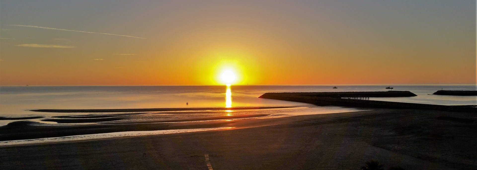
"A few feet wider, and it would be Highway Five," responds our friend after seeing a hastily-uploaded video clip of our slow progress towards Rancho Casa Verde. We know very little, and take it as an insult. We are yet to learn what Highway Five looks like.
Our plans for a nearly-annual Utah pilgrimage are falling apart. Most of our compadres seem to have urgent and unavoidable commitments, and the number of trip participants dwindle down to two. At which point the plans are changed on the spot - Chris Snell is flying to San Diego, and we're driving South to Mexico. Call it "Plan B" for Baja California.
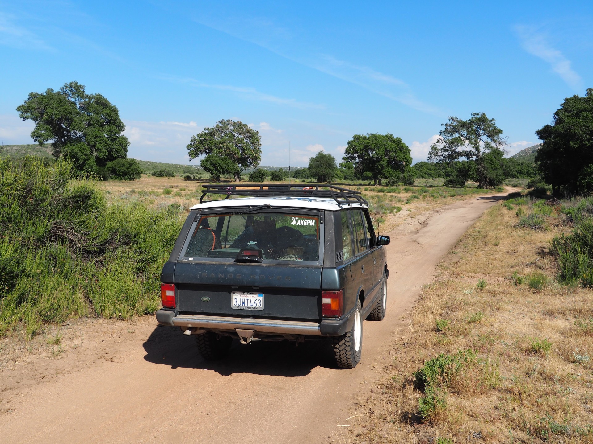
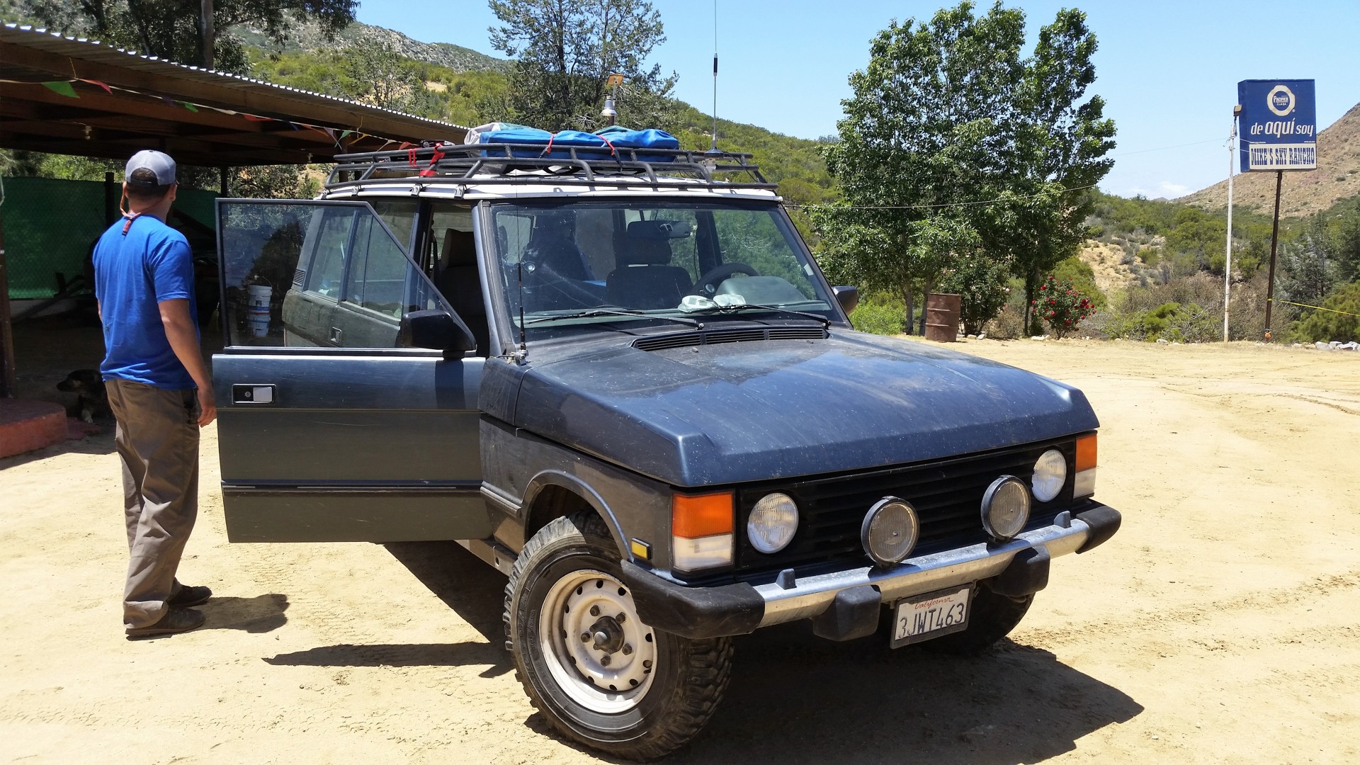
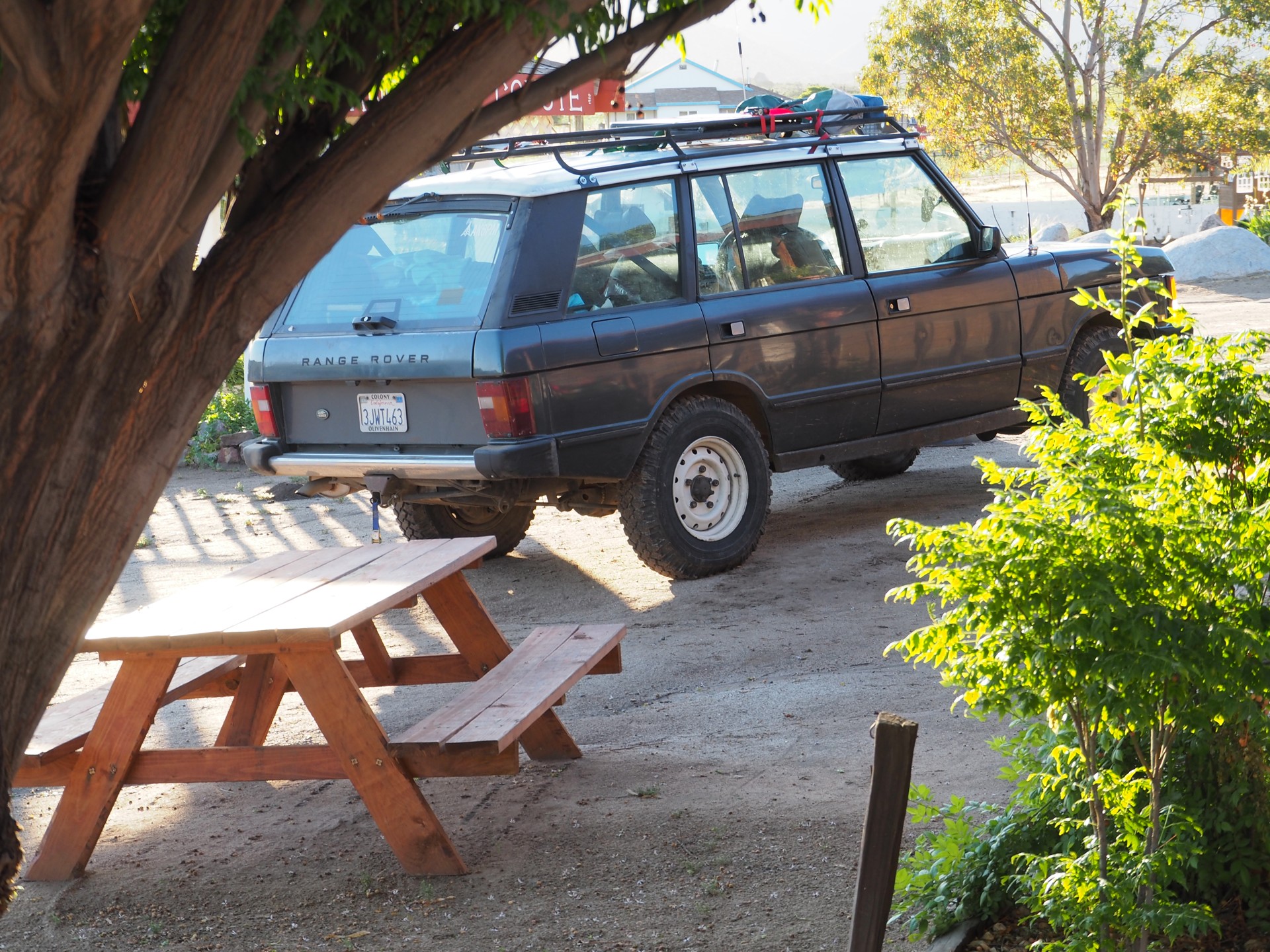
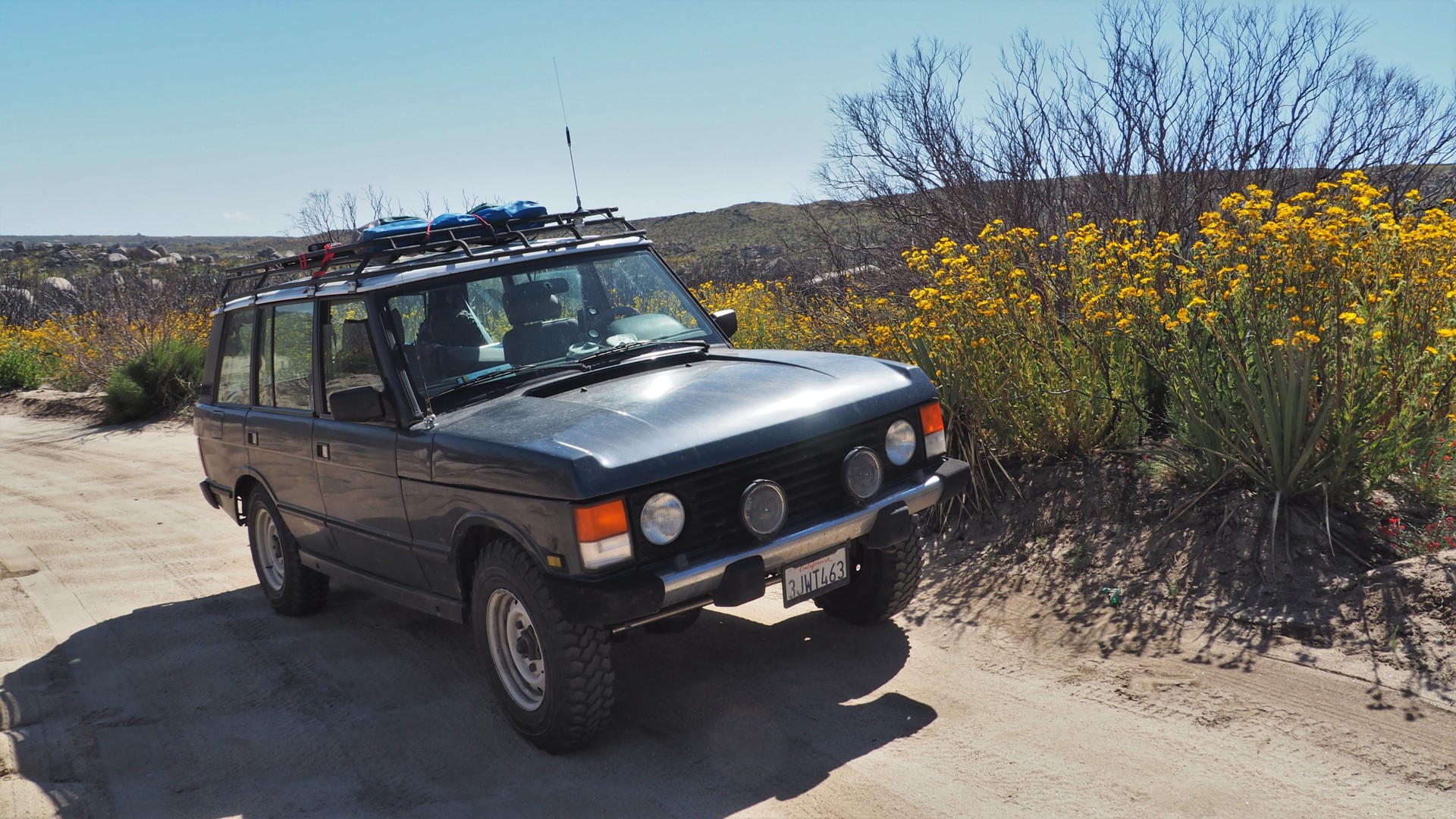
The Range Rover is loaded with spare parts, tools, camping gear, fridge full of beers, and the wheels softly rattle over the dots marking the Southern border of the United States.
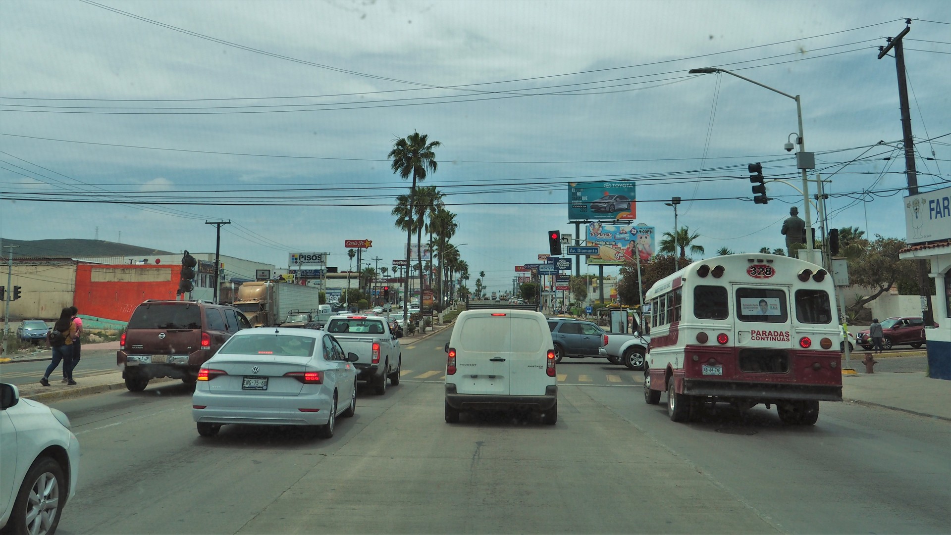
We're in Tecate.
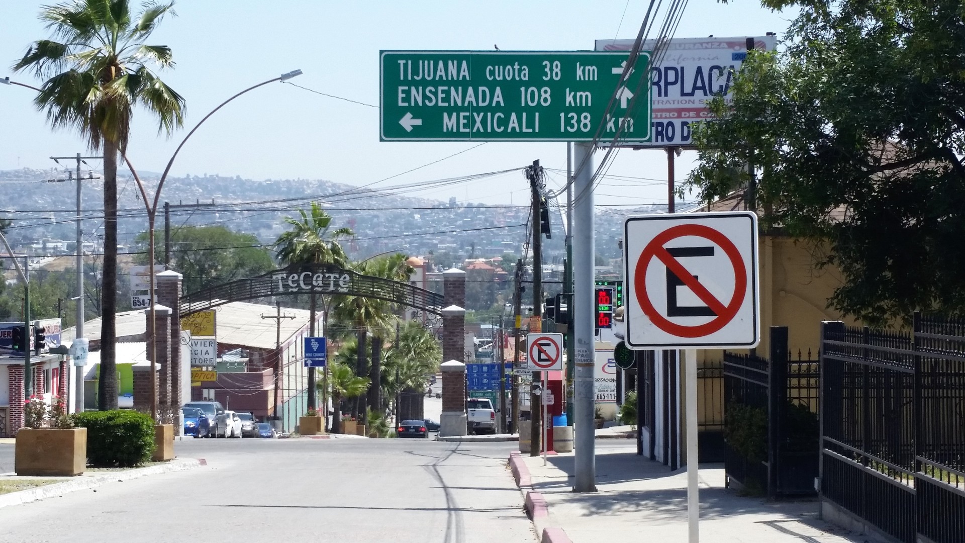 |
I embark on a trip to the Immigración - to get myself a tourist card. The comandante makes me pay thirty bucks and slams the entry stamp into my passport. Chris follows through without the stamp and any monetary damages. We write it off as a necessary dose of absurdity, without which a trip is not an adventure.
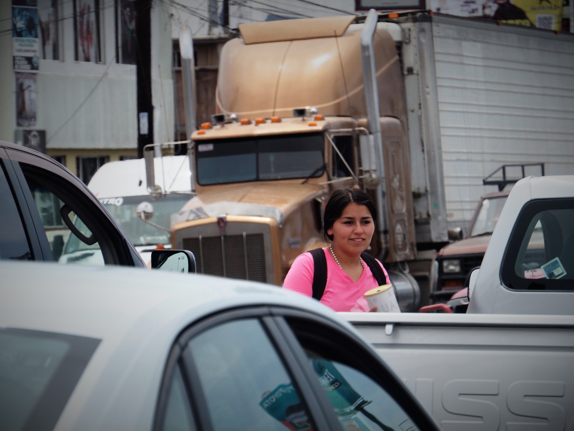
Next stop - un cajero automático. The pesos are procured, and some of them immediately spent at Taqueria Los Amigos on the main road. The burritos are smaller South of the border, but very good.
Well fed and with eyes slightly glazed, we depart South on Highway 3. Chris is juggling the Garmin, Google Maps on the phone, and a vast National Geographic map of Baja California Norte.
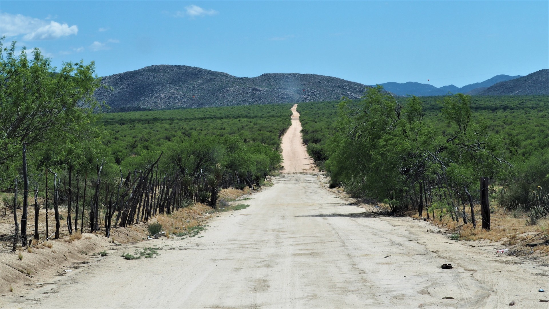
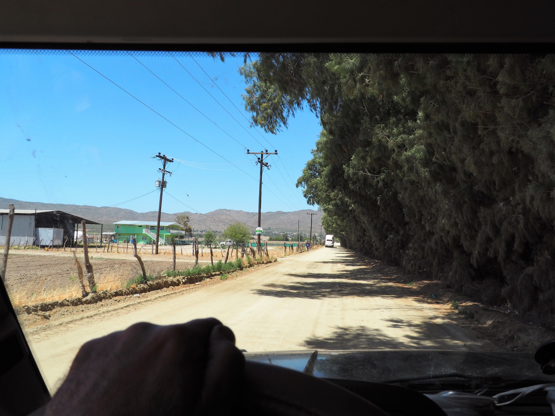
We take a few wrong turns, but finally find our way to dirt - less than 5 miles from the border. Time instantly slows down; houses by the roadside become smaller and then disappear altogether.
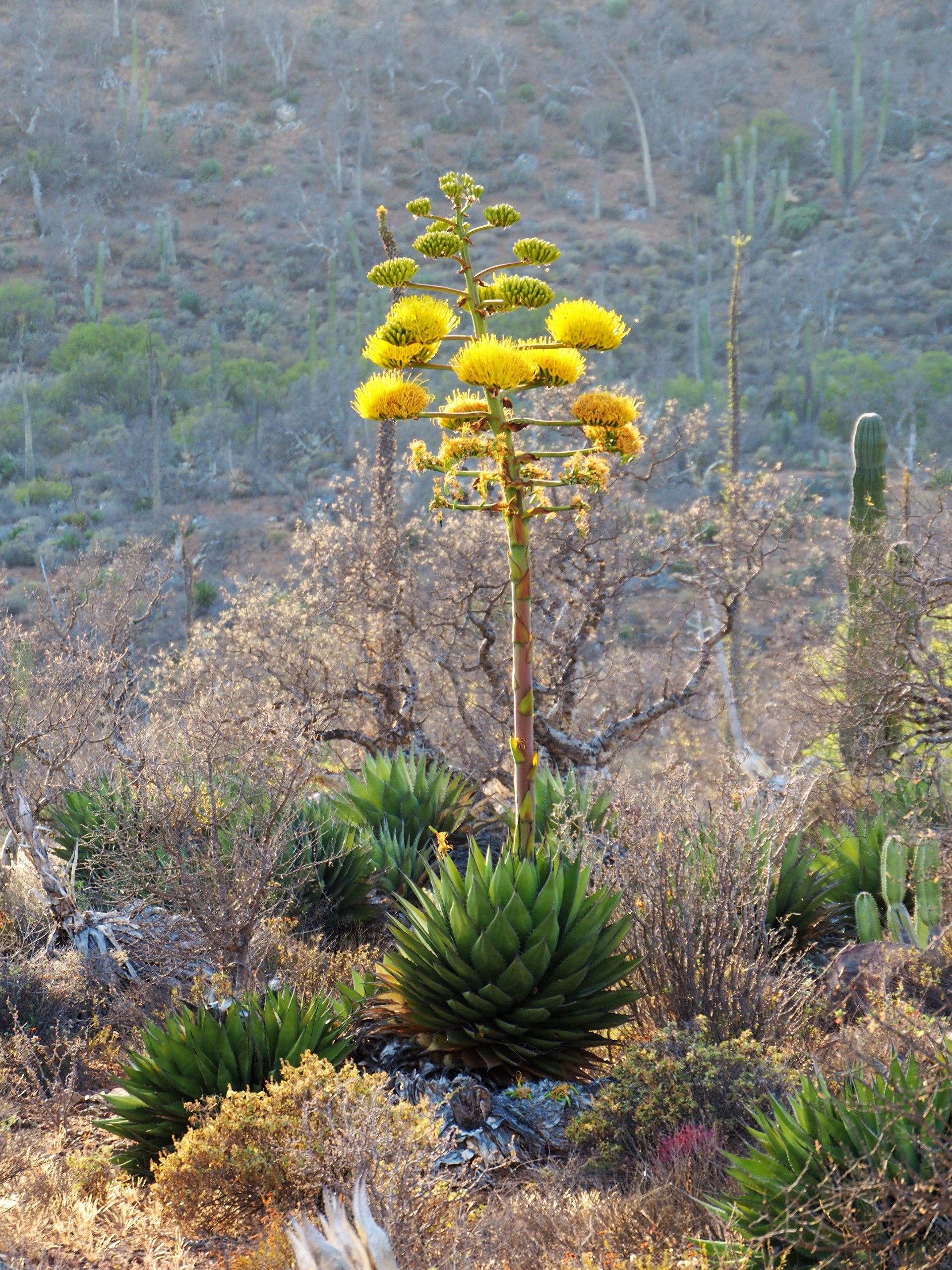
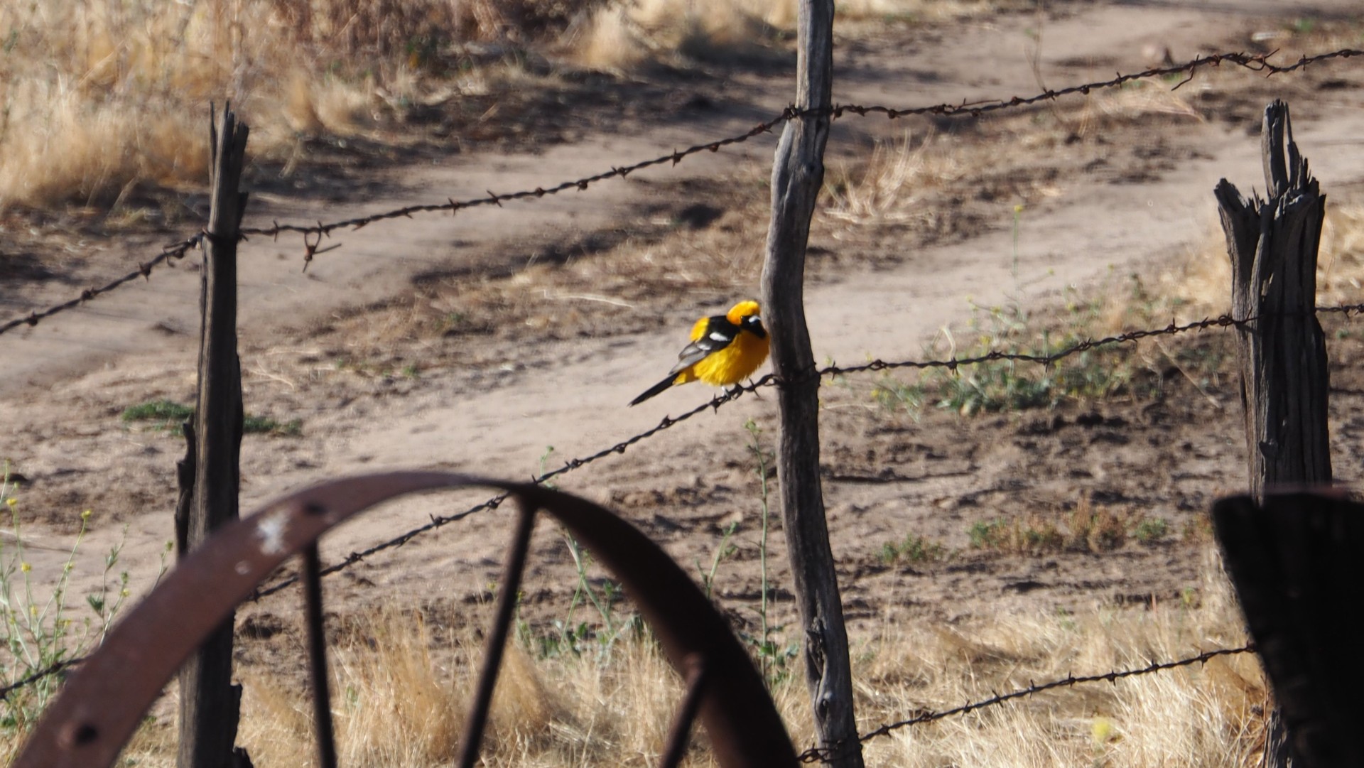
We're in Baja! The craziness of the weeks before - with both of us moving, me tearing a right Achilles, plane tickets, supplies, things not to be forgotten and forgotten nonetheless - fades away. Around us - rolling hills with brush, agave in bloom, and wildlife. A pack of vultures lazily takes off from the dirt, leaving an unfinished meal of a dead rodent on the road.
 |
 |
 |
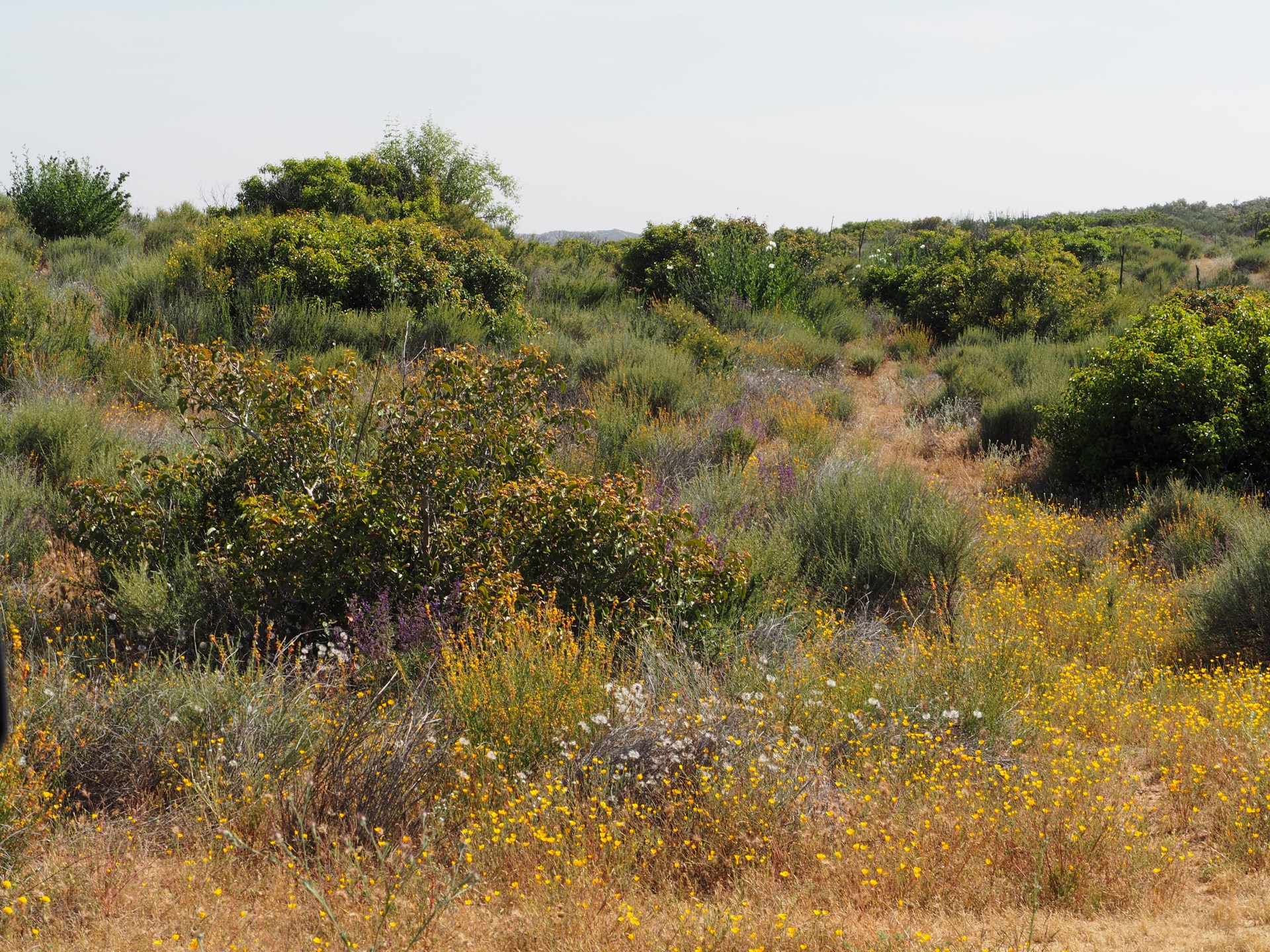
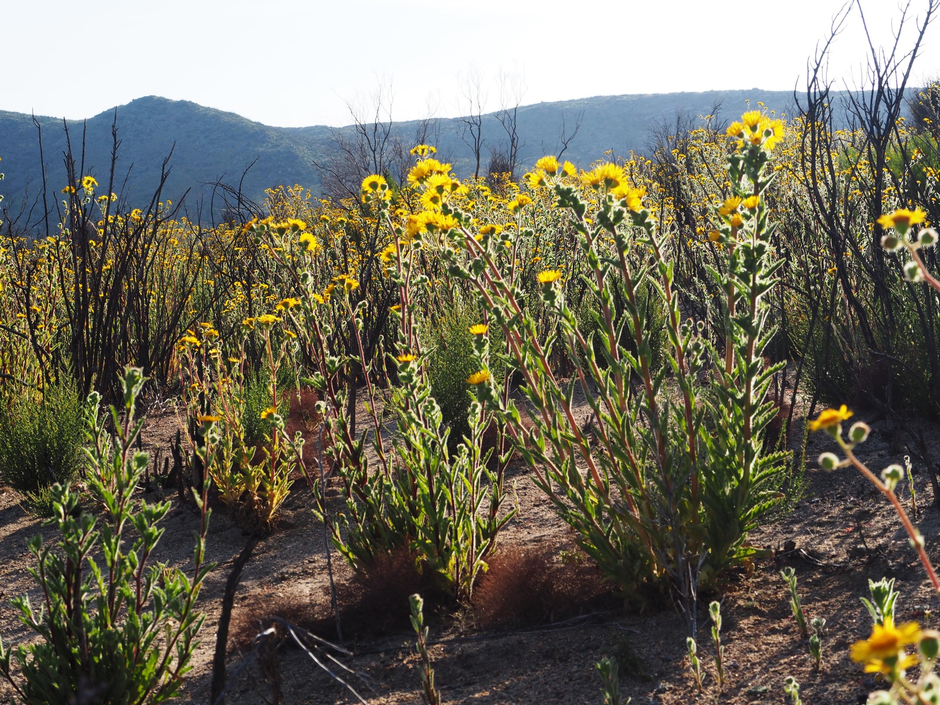
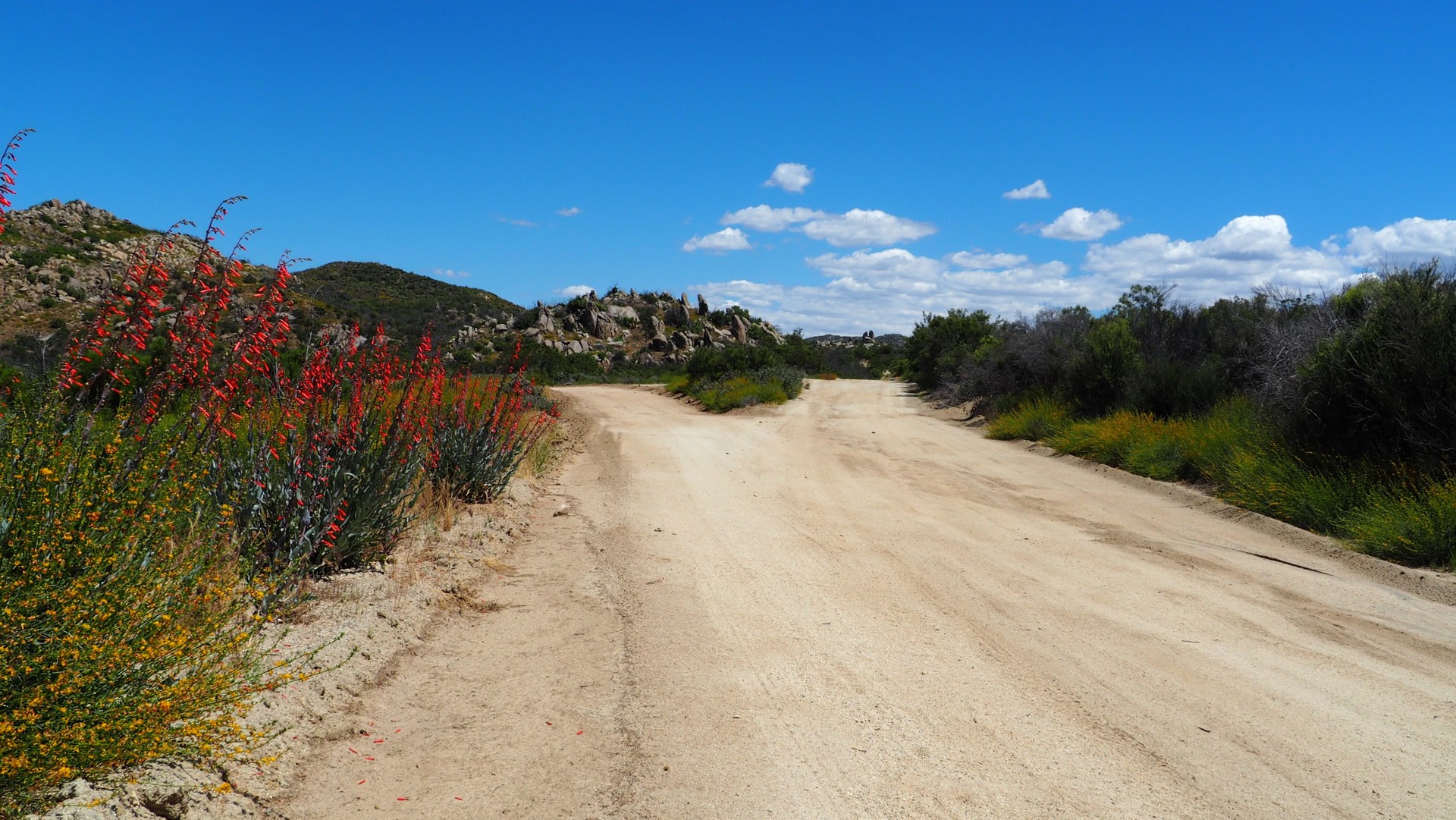
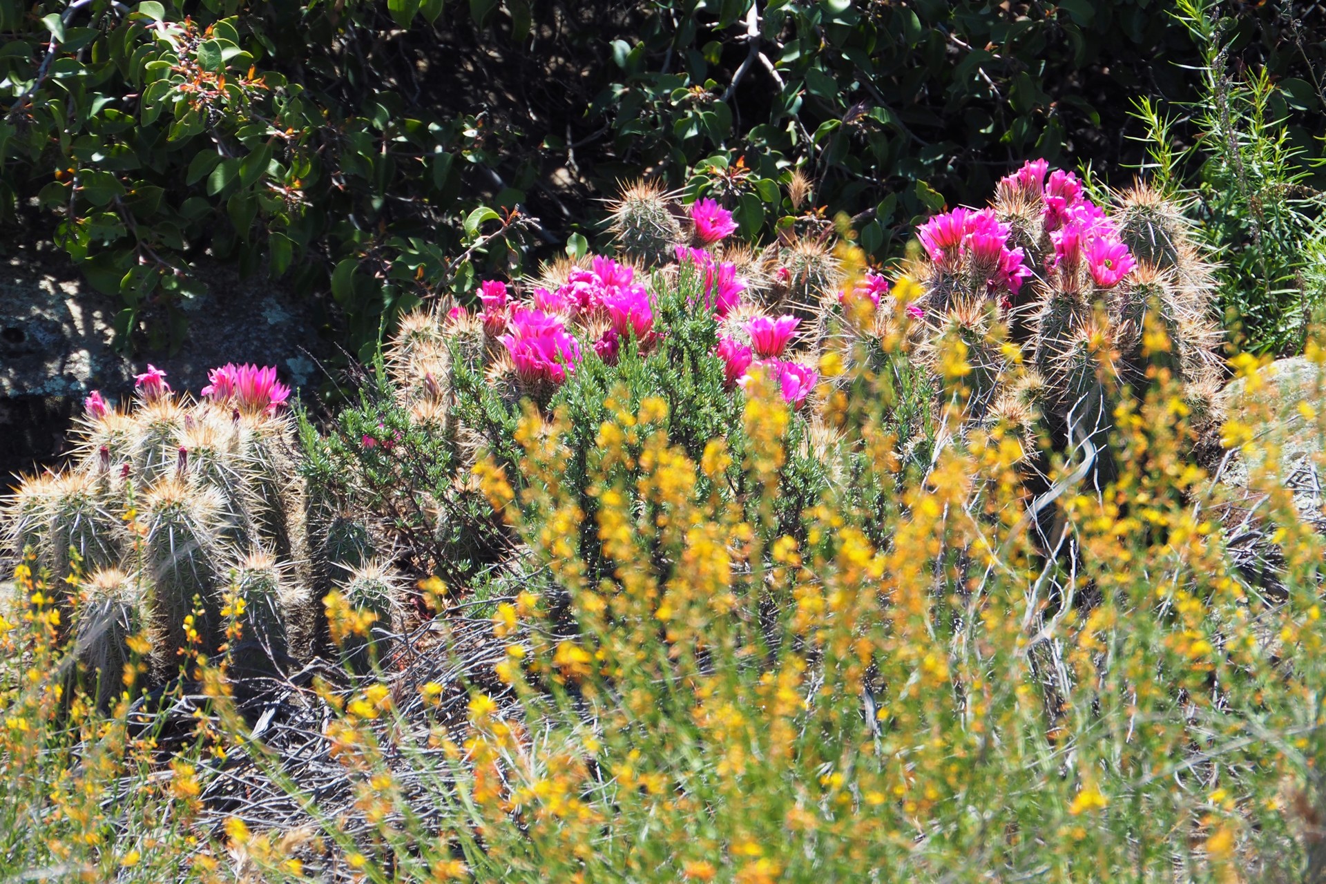
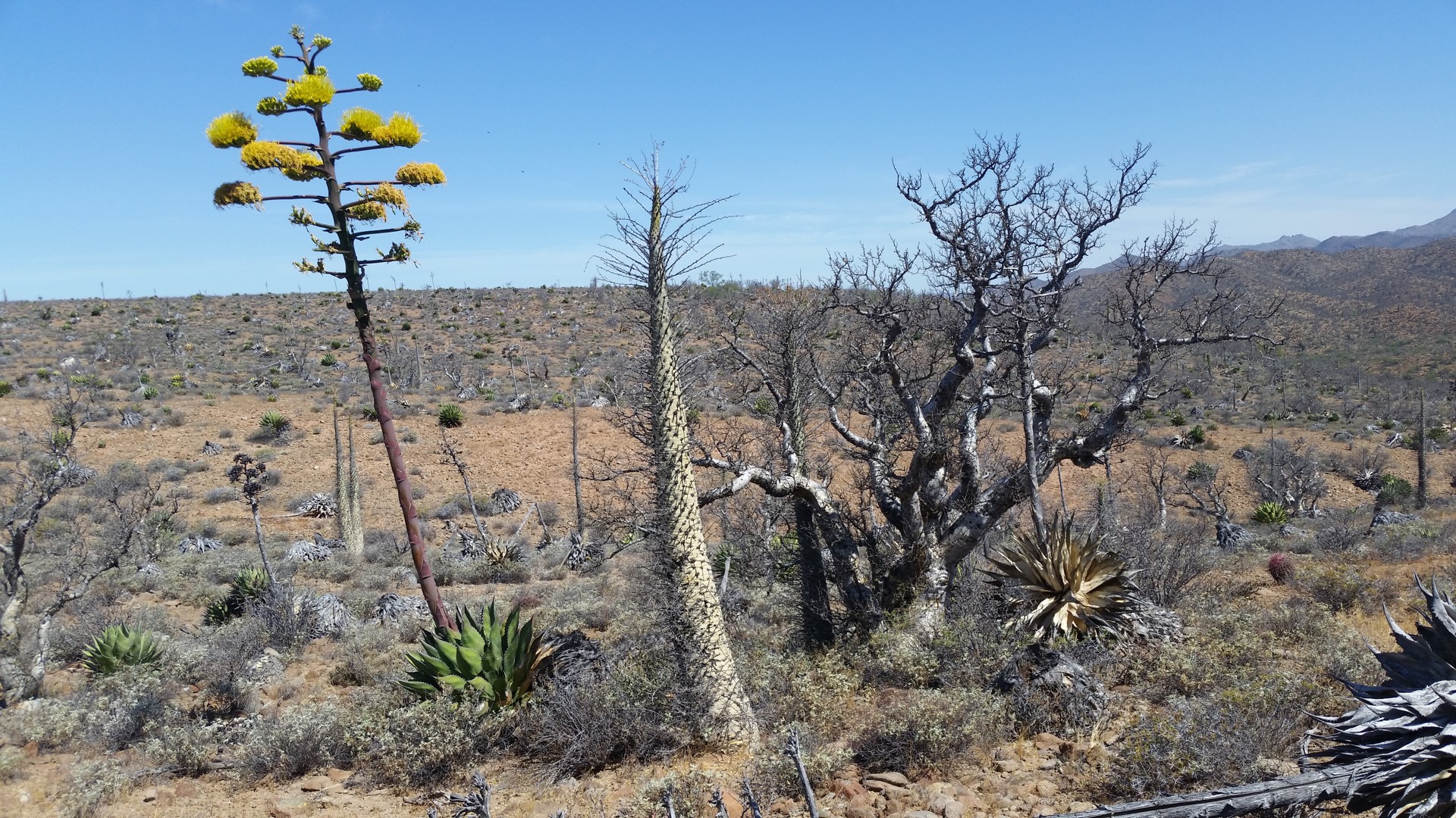
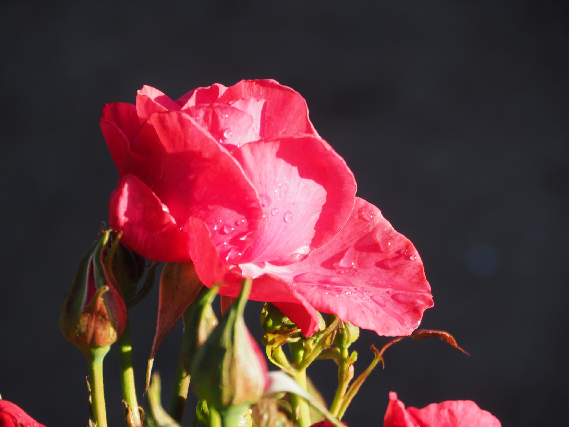
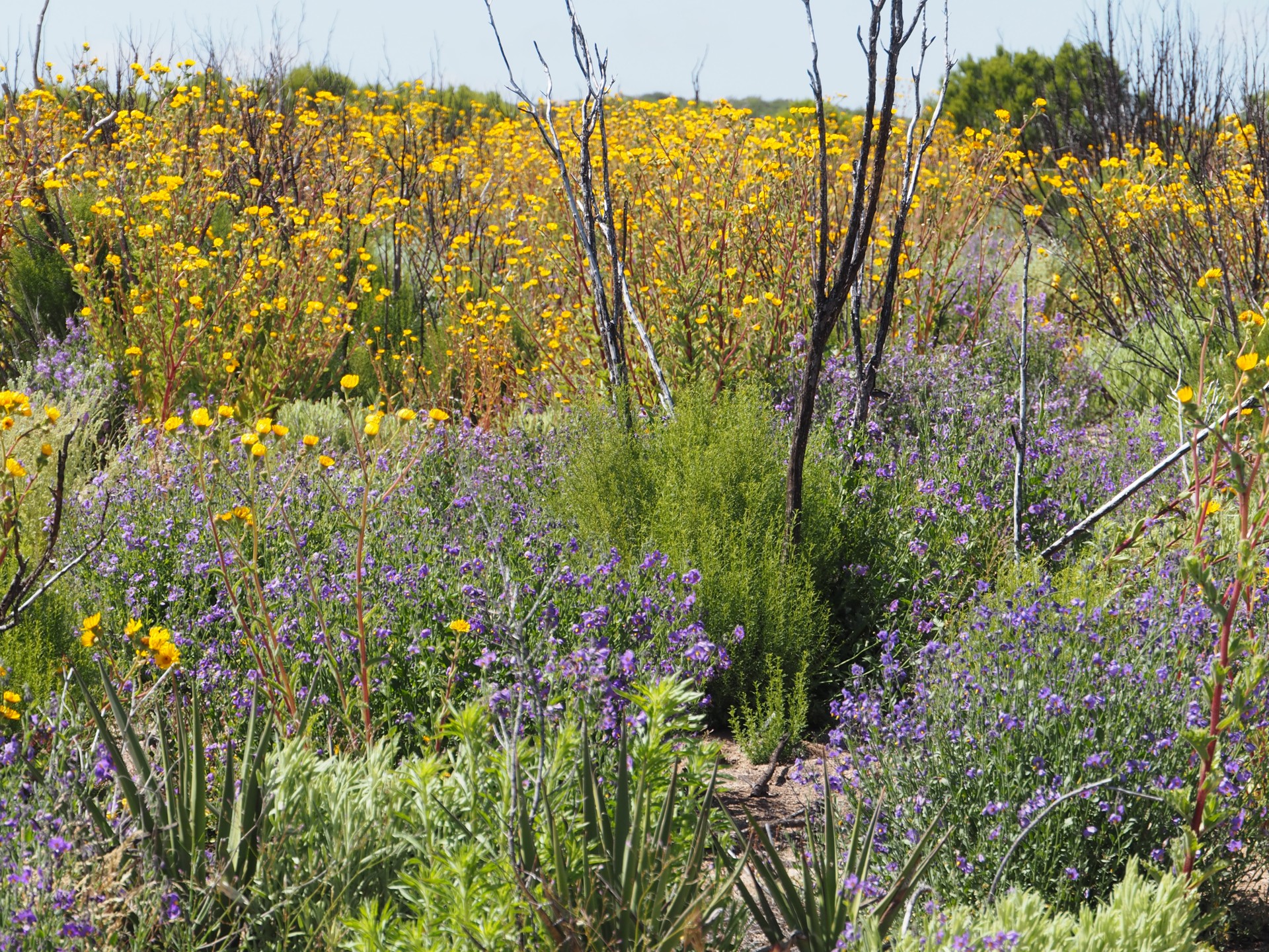
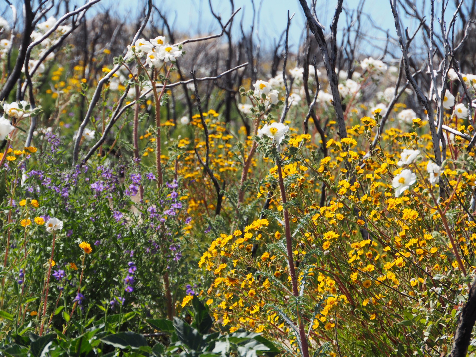
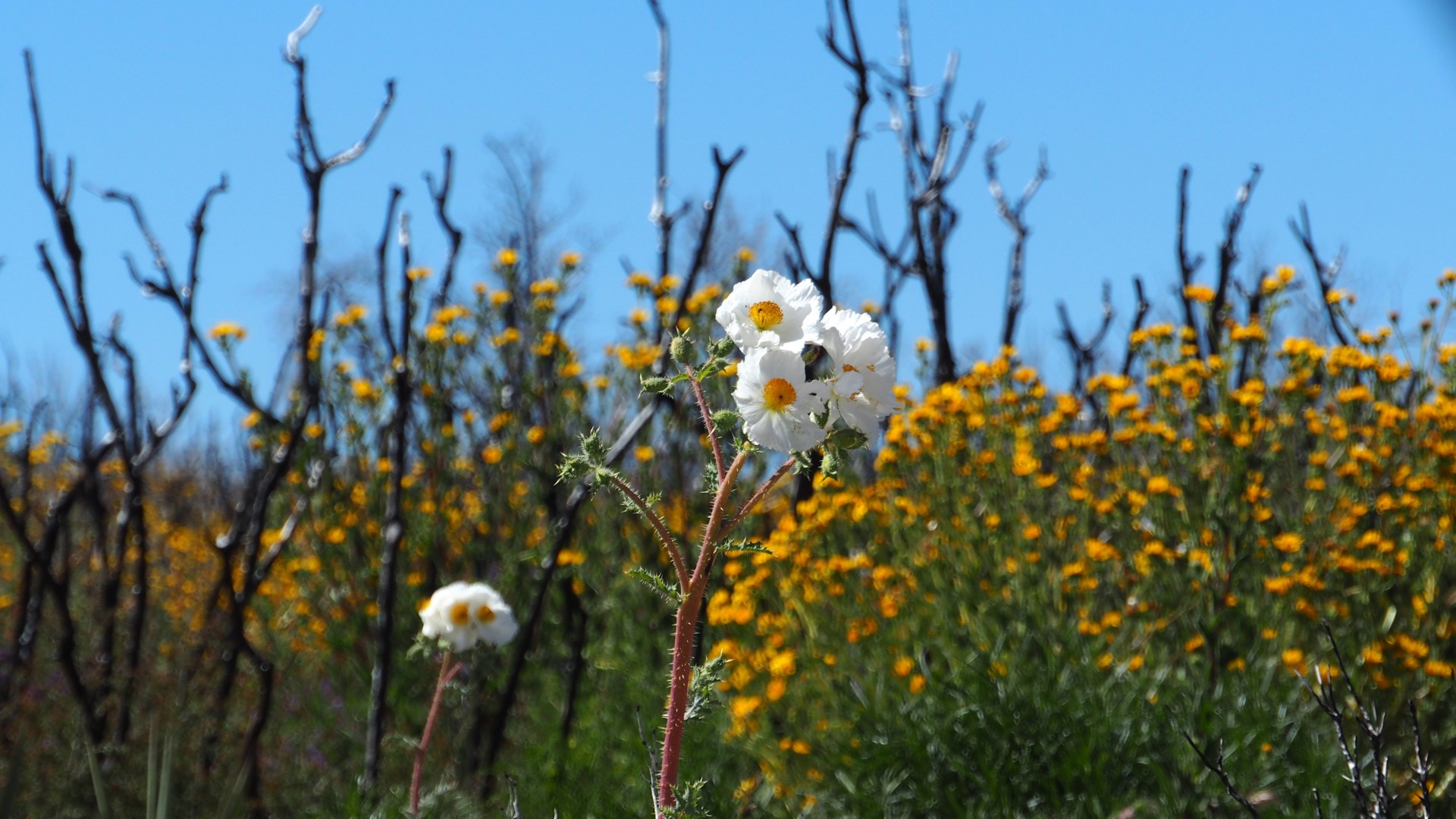
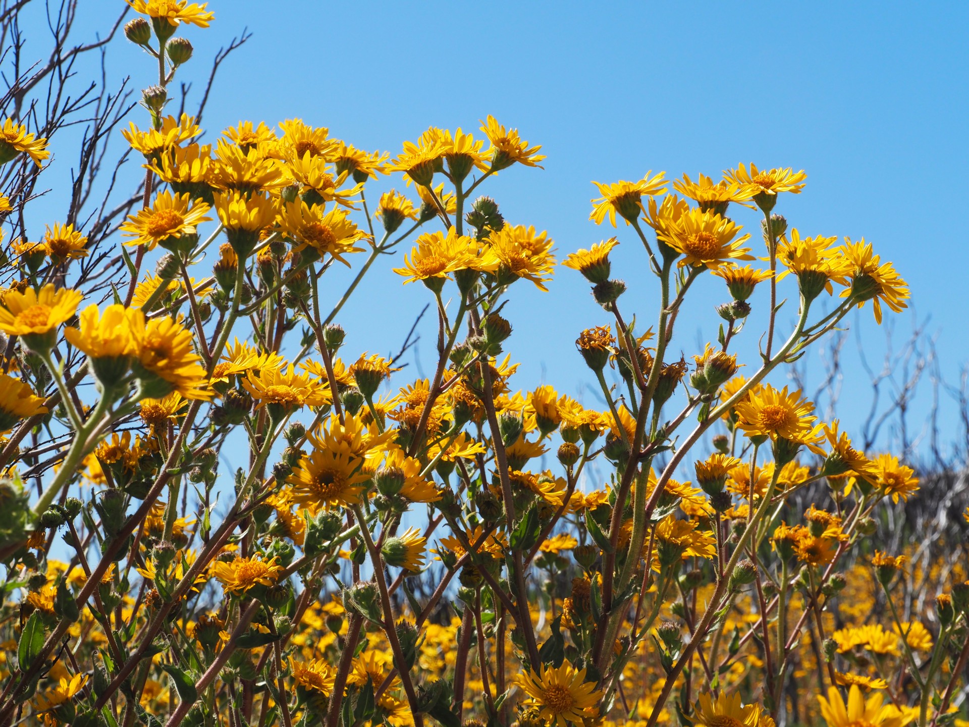
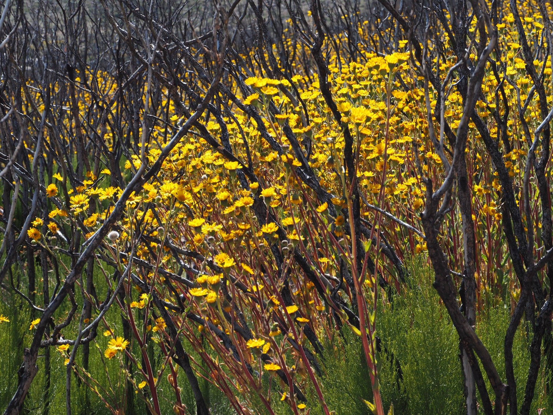
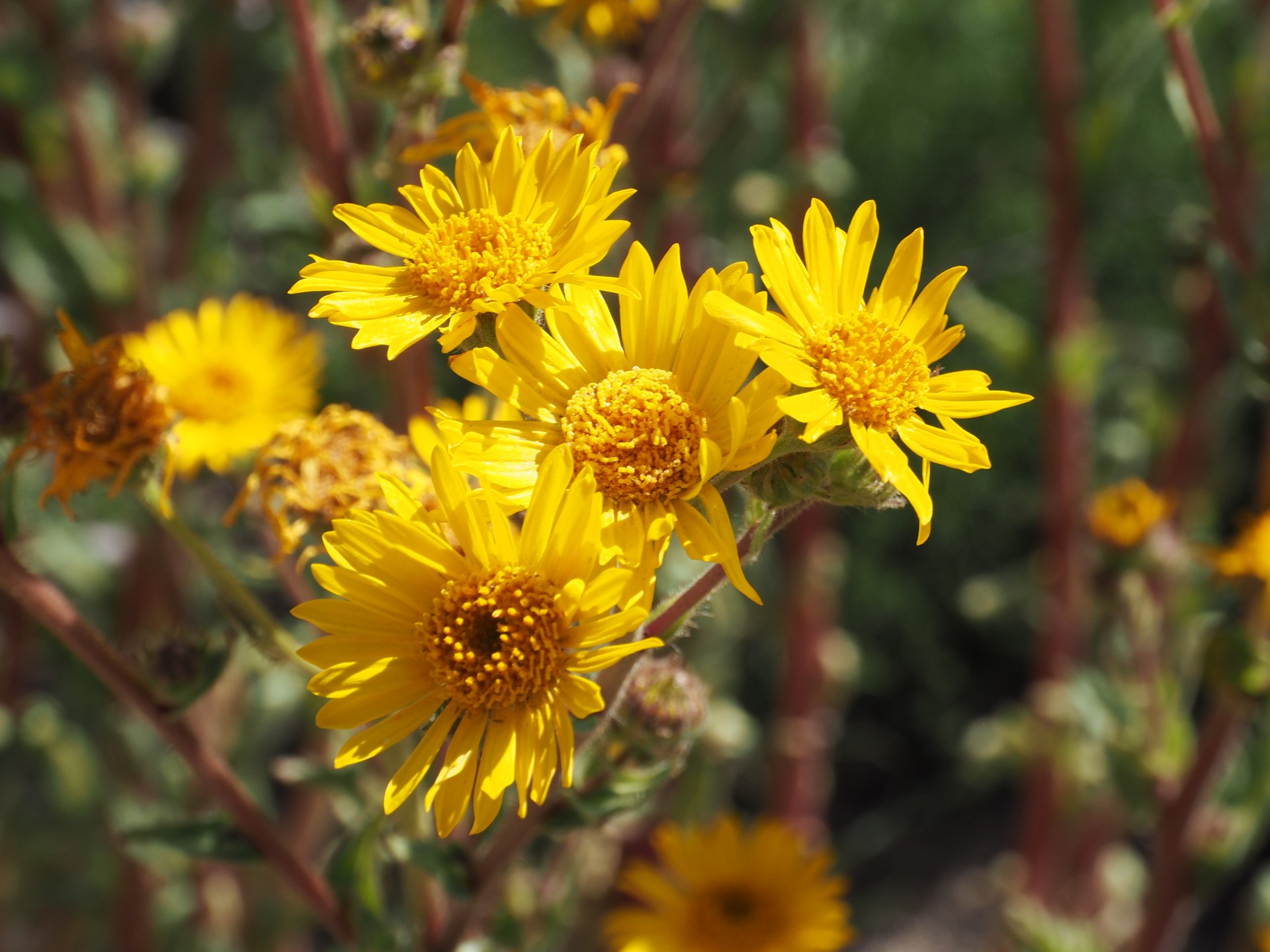
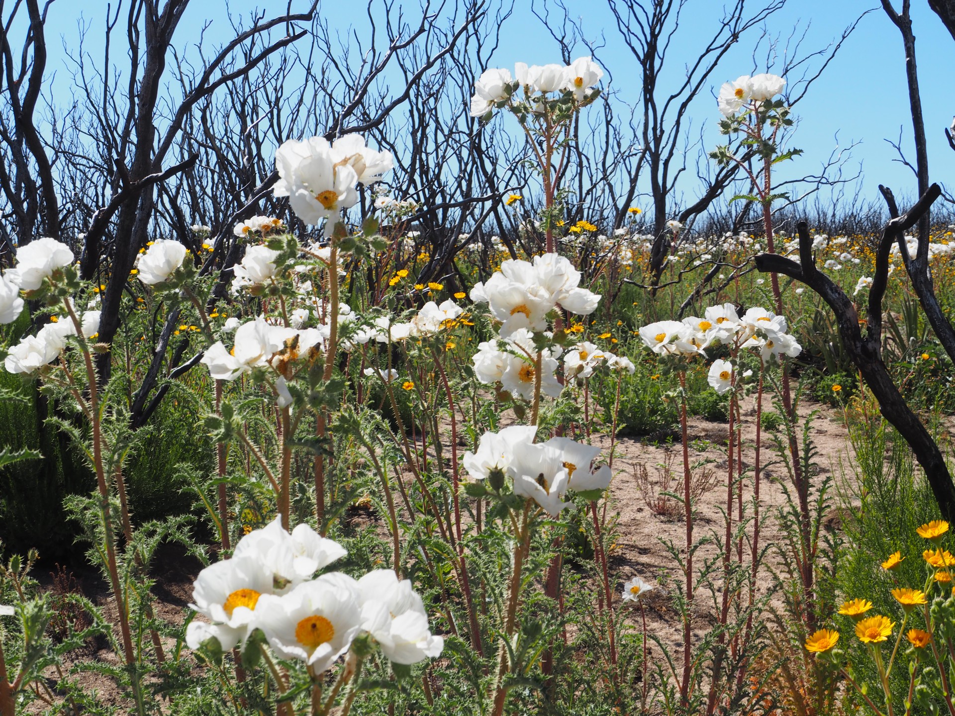
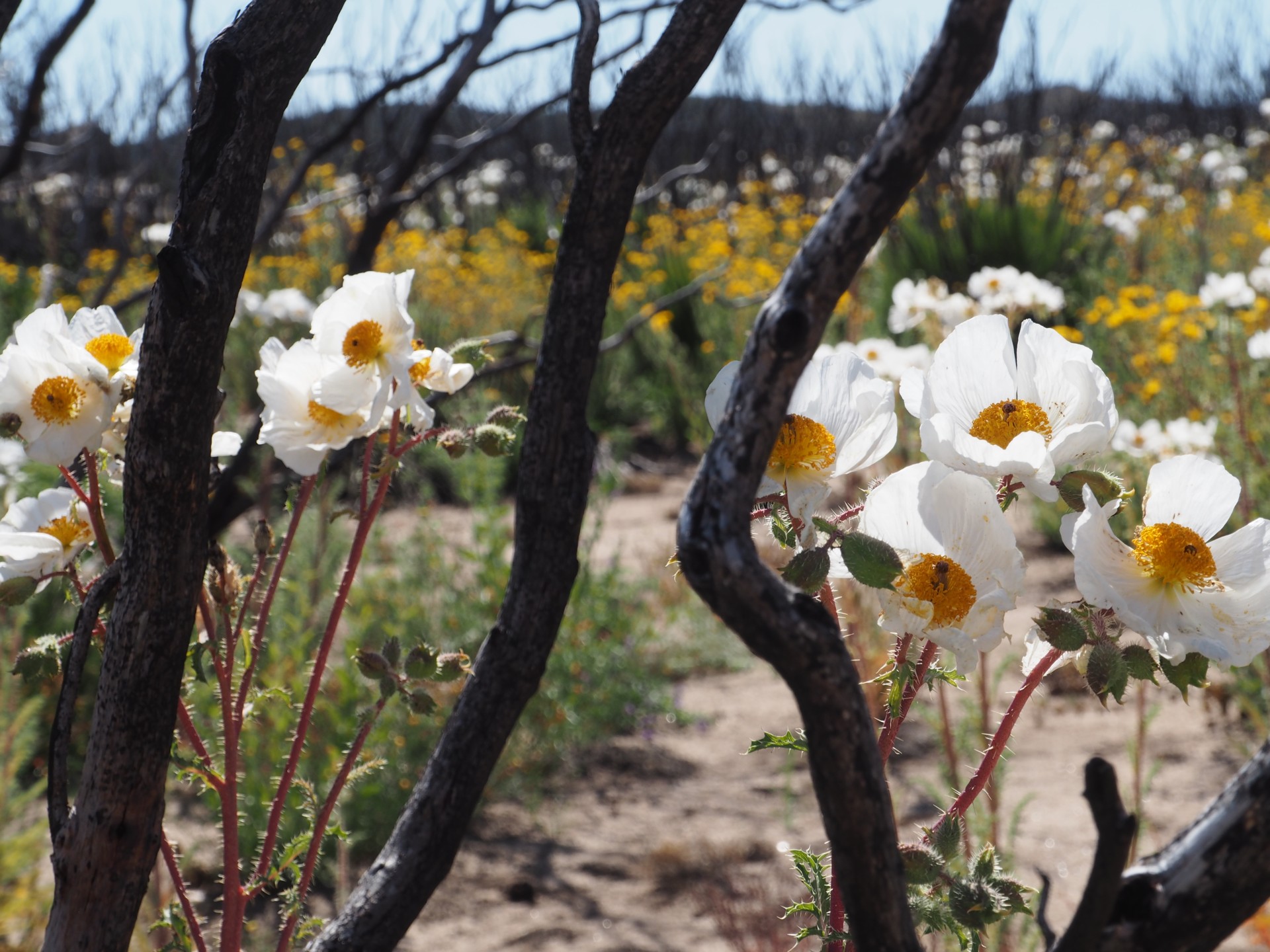
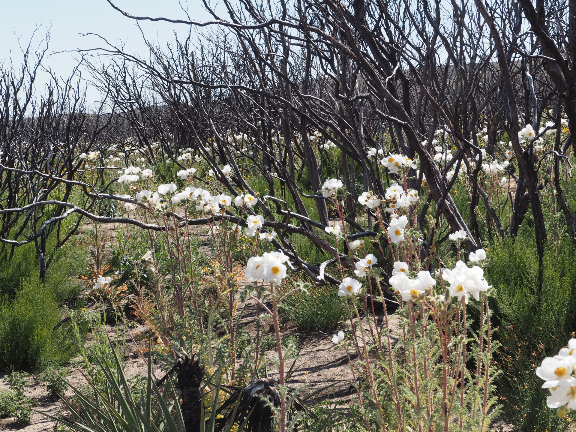
The desert is in its superbloom - after a long and very wet winter. Prickly poppy flowers sway and flutter in soft wind in places of past brush fires; there are islands of blue, purple, and red lupins in the sea of schoolbus-yellow brittlebrush nearly three feet tall. Occasionally we drive through lakes of small pink flowers covering the entire ground.
 |
 |
 |
If I am not mistaken, it is not far from Tecate where Chris uses up the fading digital phone service to communicate the beauty of the drive to our friends North of the border, just to be met with somewhat sarcastic comments.
We're going to revisit this matter later.
Chris is busy zooming in and out the Garmin road network, and generally making my driving completely brainless. We are slowly but relentlessly climbing, and the trees appear and become frequent around the road. Every now and then we see road signs - handmade pointing to the private ranches, and sometimes - government issue, indicating the general direction towards the road to Laguna Hanson. The lake is not yet in our plan - oh yes, we don't have a plan.
 |
 |
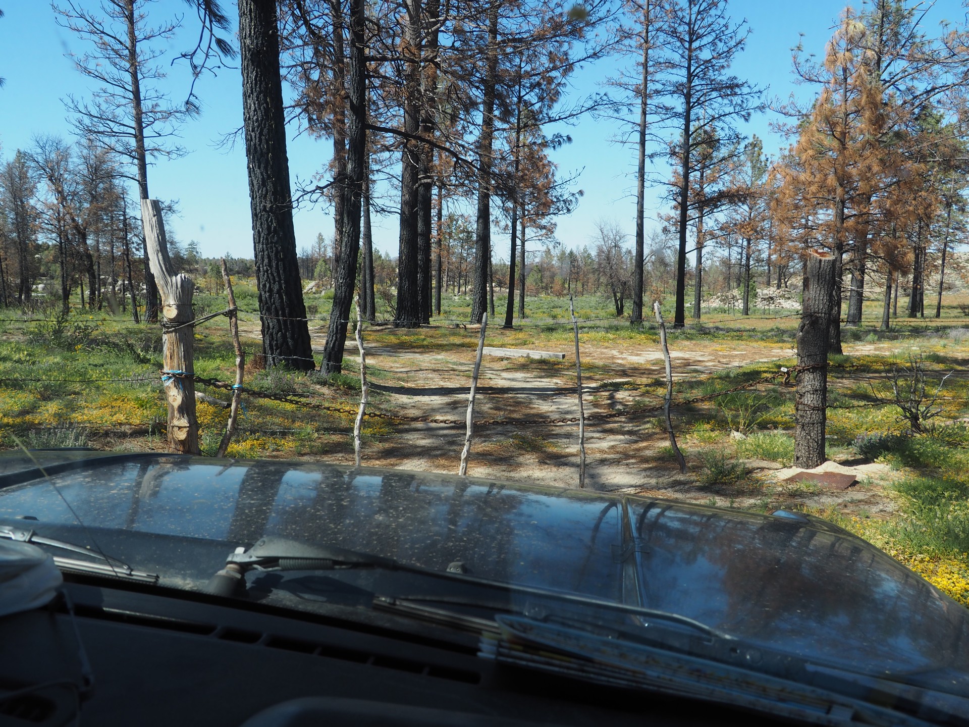
We drift generally South-East, and only become aware of time when the shadows become longer. In one washboard section, I hear a rattle that I try to convince myself to originate from some loose luggage. An inspection reveals that luggage is indeed loose, but so is the right rear shock absorber - one of those lifetime-warrantied Bilstein units. We decide to deal with it later. After a while, we see a sign advertising cabins at Rancho Casa Verde, and take the offered turn.
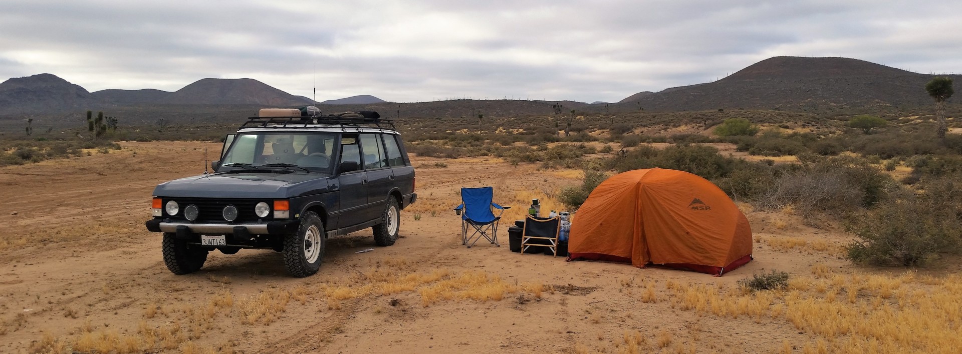
The sun is almost down when we spot something clearly made for visitors - like two shower stalls and concrete campsite tables. There's a house nearby - locked as well as the showers. We unpack and set up camp. Beer and whiskey come out first from the Range Rover. We sit back and enjoy the company of a few flies and more than a few mosquitoes. DEET is employed.
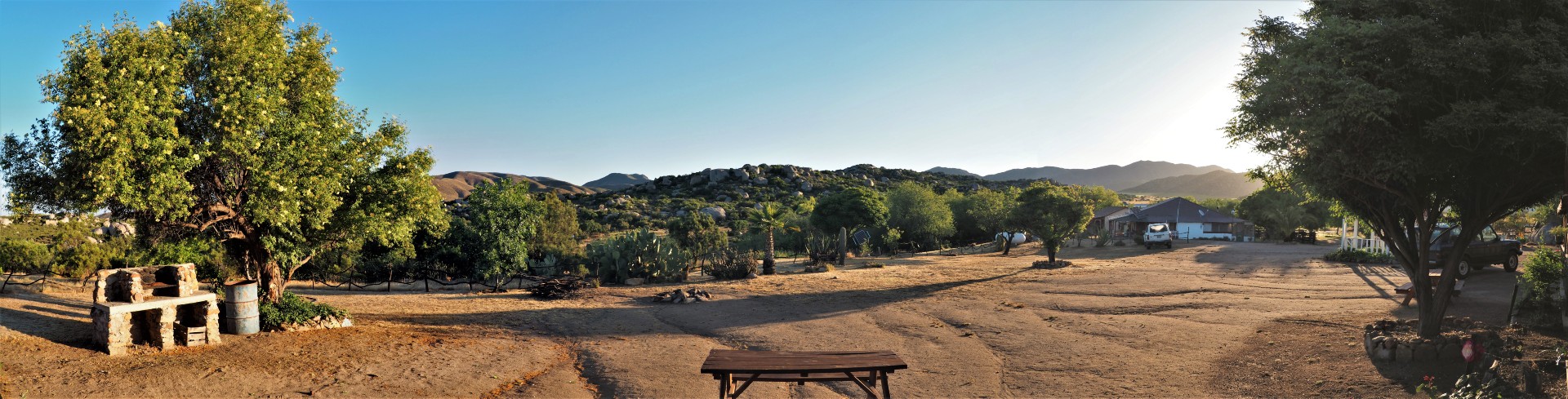
After our second sip of Michter's Bourbon, Chris suggests a short hike. I am already less concerned about my right foot in an orthopedic boot, and we make our way down a sandy road under the light of our headlamps. Less than a half of a mile away, we see neat buildings set up around a rough square. One of them seems to be inhabited; we see a Mexican couple inside watching TV. We use our combined knowledge of Spanish to inquire about whether it is okay to stay where we are, and whether it is better to move here. Señor Alberto tries his best to make any sense of our blabbering, and takes us on a tour of the grounds, with a great clubhouse complete with a pool table and working TV. We agree on a modest amount that covers our camping near the cabins and desauyno, and hobble back to the truck.
The move is the simplest ever. The boxes are simply tossed inside, and the tent is relocated to the roof rack of the Range Rover for a few minutes. The new place is awesome - flat, clean, and free of flying menace. We ask about firewood, and before we know, señor Alberto already has the campfire going. Still full from the generous lunch in Tecate, we forgo the dinner, and relax with our drinks. One of the couple's dogs is super friendly, and relaxes near our feet.
The night at 4500 ft above sea level is cool. Chris must be freezing in the tent and a lightweight sleeping bag. Sleeping in a long wheelbase Range Rover is a delight.
The morning sun makes my sleeping bag plain hot by half past seven in the morning. I try to make little noise getting out of the truck, but the acres of velcro on the ortho boot do not help at all.
 |
 |
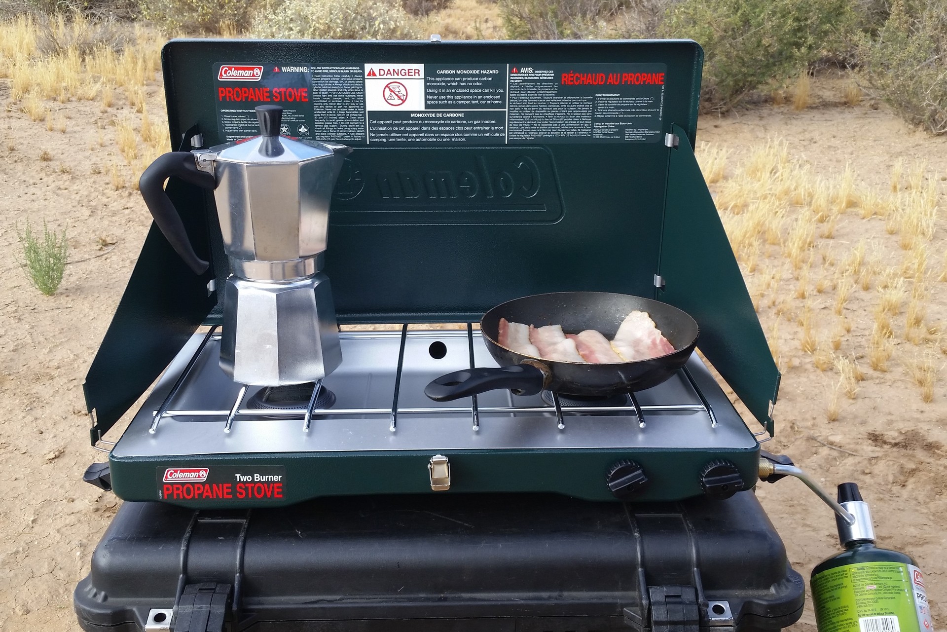
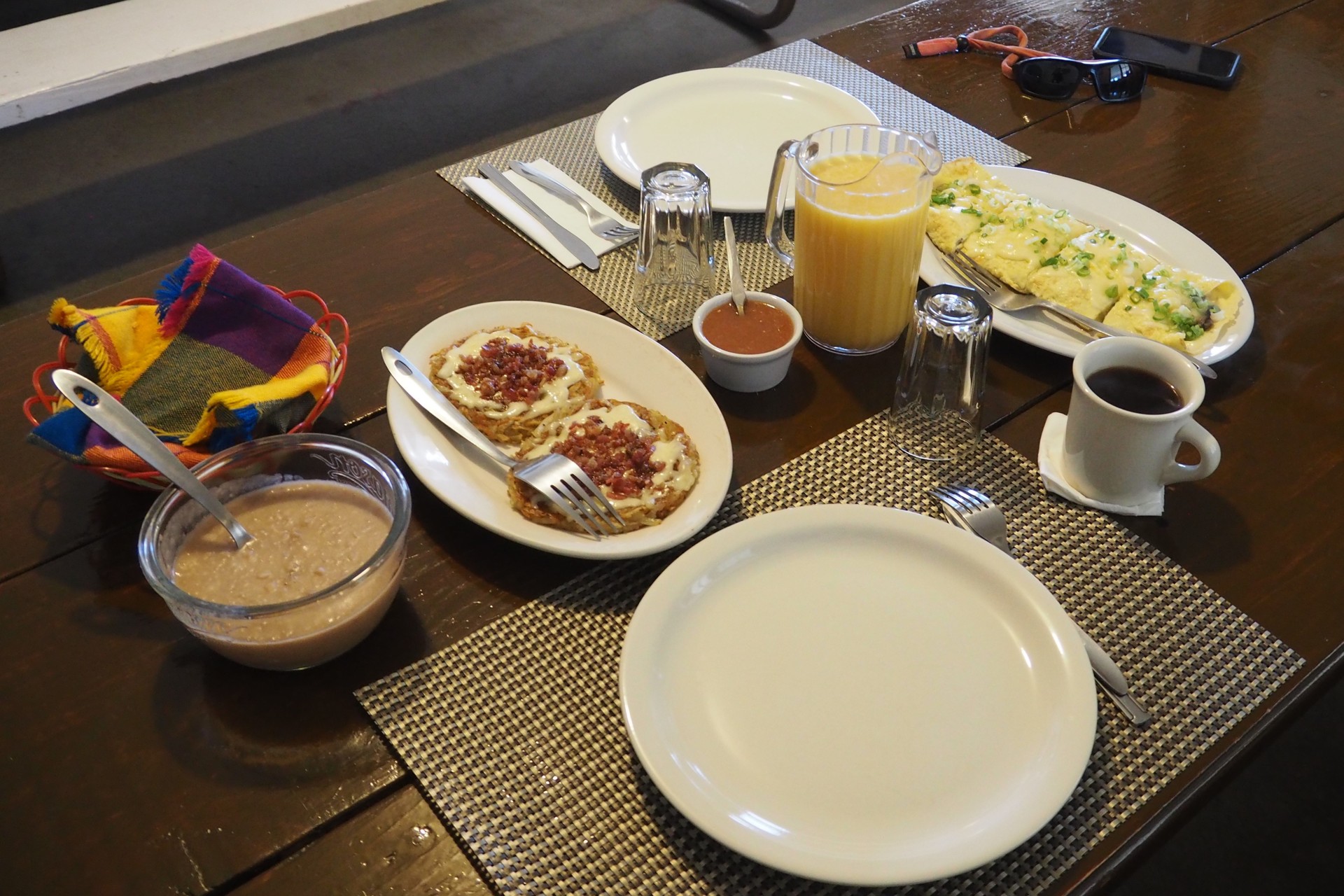
Alberto is already up, doing numerous chores around the ranch in a typical Mexican fashion - without any fuss or hurry, but relentless. He sees me unpacking the Coleman propane stove, comes over, and talks me into having coffee and breakfast prepared by him and his wife Marie. Chris emerges from the tent, and I talk him into the same. Soon, we find ourselves sitting in the relative dark of the ranch's dining room, with steaming mugs of not-too-strong coffee with a dash of cinnamon. I never knew that hot coffee could be a refreshing drink!
The coffee and food are made on a wood-fired, cast-iron stove. The breakfast is fried chopped beef with pico de gallo and refried beans, with handmade flour tortillas under the cloth wrap. The food is fantastic. We feel like we could stay in this place forever, but urge to keep going won.
However, the first order of business after breakfast is the rear shock replacement. We find that, likely to avoid stress fracture and separation of eyelet and stud (so common for OME shocks), Bilstein elected to joint the eyelet and the stud with about 10mm of fine thread. It didn't take many washboard miles for the stud to rotate itself free of the eyelet. The spare Bilstein rear shock (of the identical design) is retrieved from my 150-lb box of supplies, and is in place after... I find that I picked an ant colony as a place to lay down in the dirt.
It takes longer to rid myself of ants in every possible place than to replace the shock. The truck is re-packed, and we're rolling again.
Our no-plan for the day included a potential trip to Parque Nacional Constitucion de 1857 (Laguna Hanson), and a visit to and potential stay at Mike's Sky Rancho. The road was mapped out using the Garmin, and soon we stop at the Park entrance and for some reason decide to skip it.
The pavement is about twenty easy miles away, and we spend about an hour or so on two-lane, undivided, stretch of Baja Highway 3. In town of Lázaro Cárdenas (one of seven towns named after the famous Presidente in Mexico, two of which are in Baja California Norte about 80 miles apart), we top off the gas, and Chris begins an uphill battle with Verizon for digital services for his iPhone. I hate to stick a needle into this haystack of hurt, but the Samsung Android phone slaved to the same provider had no issues here. After about half an hour of futile efforts to improve our comms, we procure another pack of water bottles (damn I hate those in my vehicle!), some other useless junk, and hit the road again to the turn-off to Mike's.
 |
 |
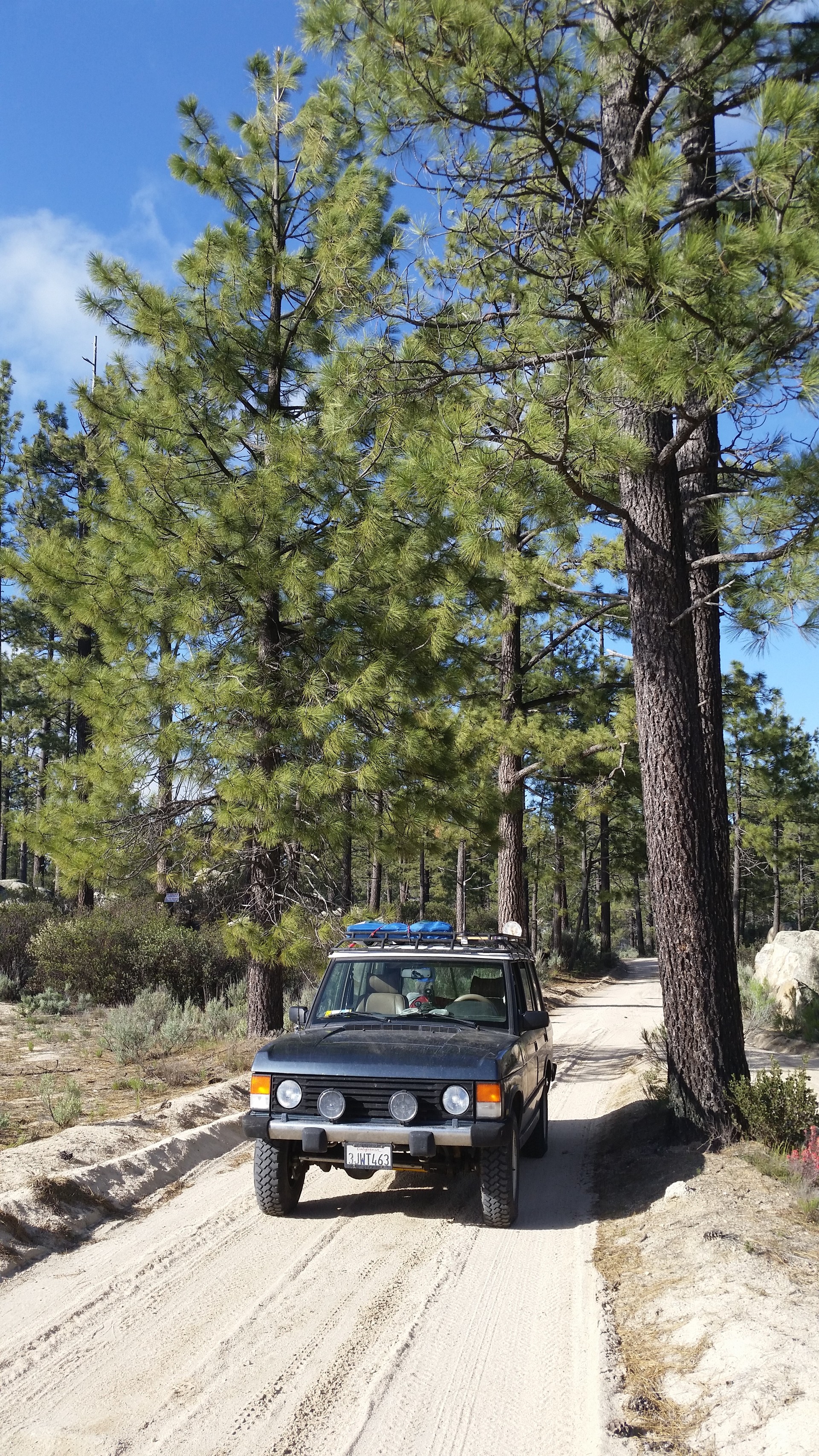
The road to Mike's Sky Rancho is part of Baja California racing circuit - the very existence of the rancho is due to the racing. From the highway South, the road looks like an endless and near-straight expanse of densely-packed sand, perfectly suited for a high-speed jaunt. It doesn't stay that way for long, however. In about twenty miles to Mike's, the road gains almost 1500 ft in elevation, and it is by no means a monotonous climb (in purely mathematical sense).
 |
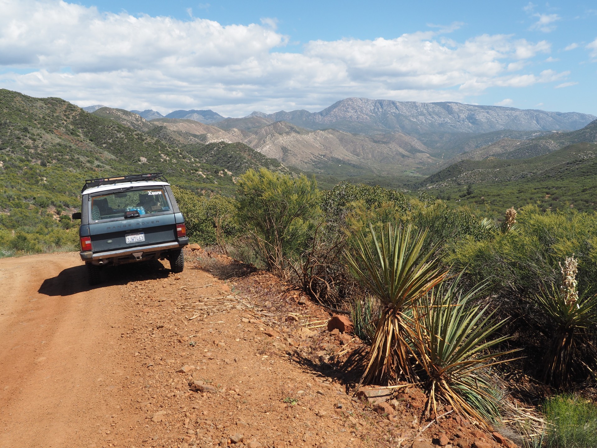
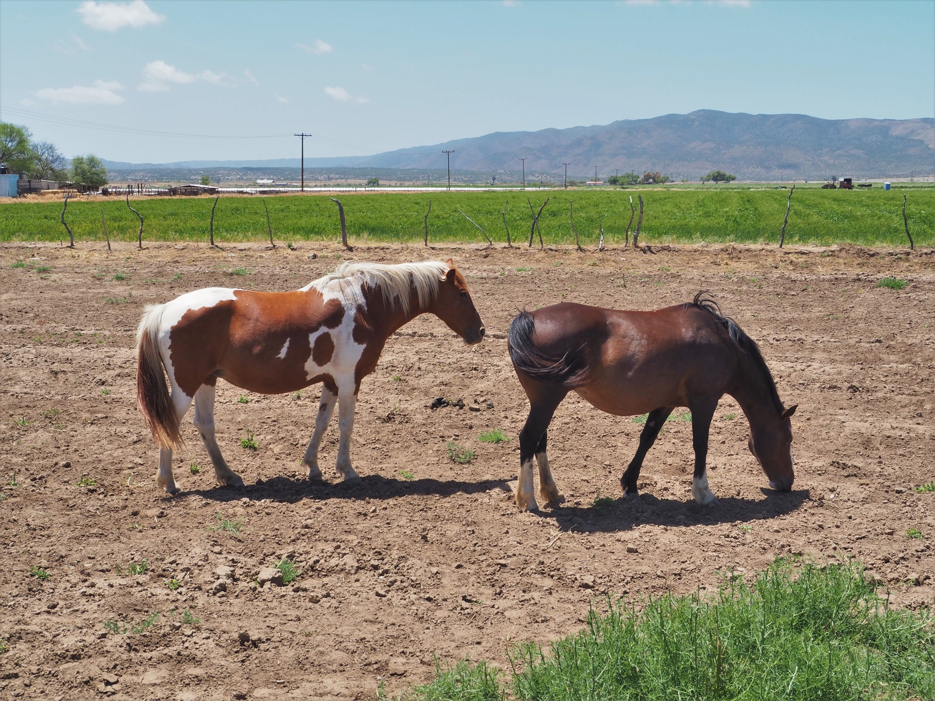
The road crests some mountain passes and offers incredible views of canyons hearly half a kilometer deep. There are cattle and horses wandering along and across the road, and occasional ranch houses and what looks like rental cabins. We know we can't own land in Mexico, but that doesn't stop us from discussing in great detail our plans for land improvement in case we did own some. The road dips down, crosses the shallow creek, and we are staring at a dirt mound with a few vehicles in various state of deconstruction and white-walled buildings.
 |
 |
 |
 |
We made it to Mike's. No other vehicles are in sight.
We are greeted by two friendly dogs, and walk over to the premises. The rancho is laid out in a traditional Mexican style, in a near-square, with buildings around the swimming pool in the center. A row of italian cypresses behind the buildings adds a nice touch. We're almost in an anticipation of spending a night at Mikes, and looking for somebody to check us in.
 |
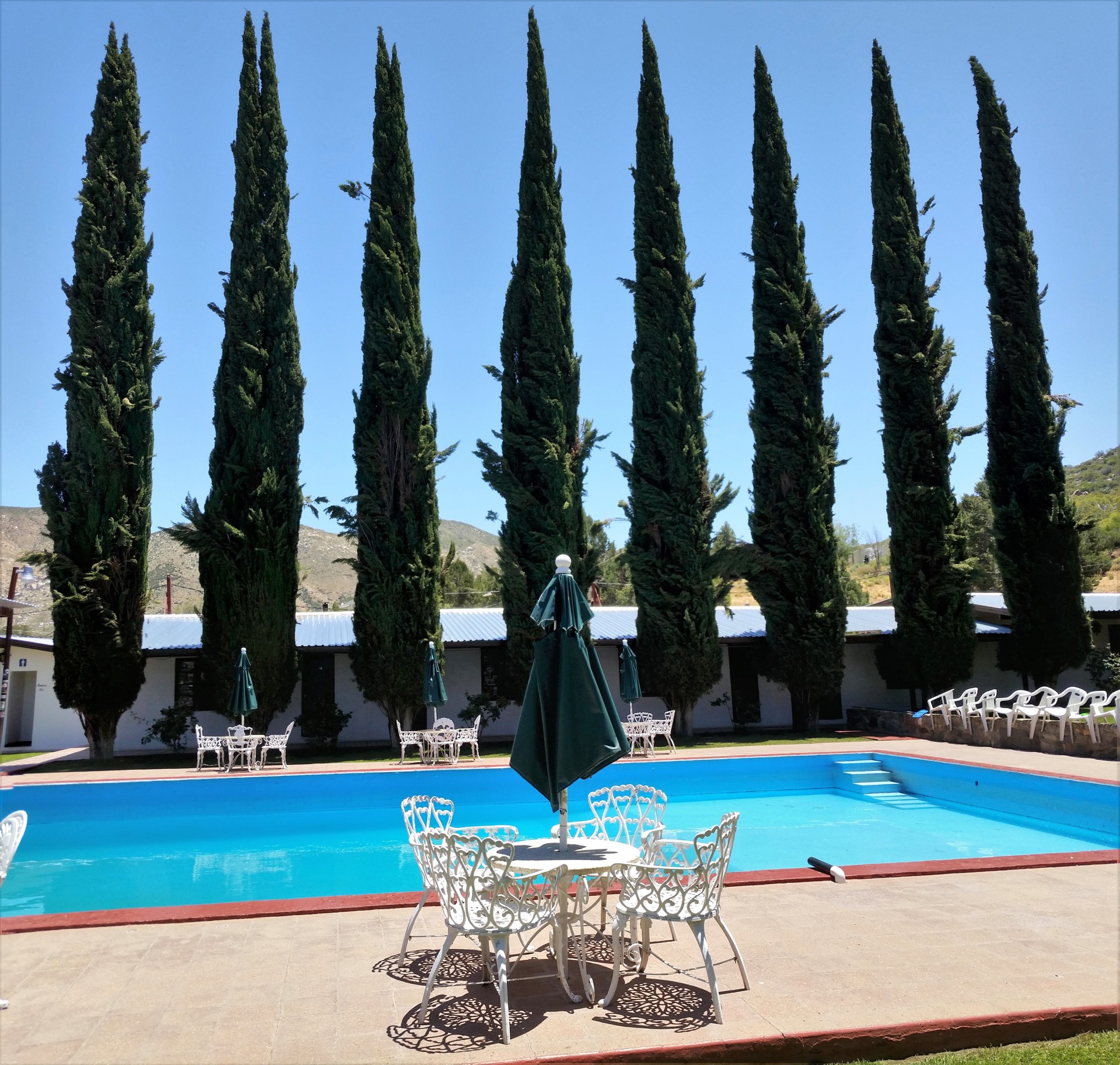 |
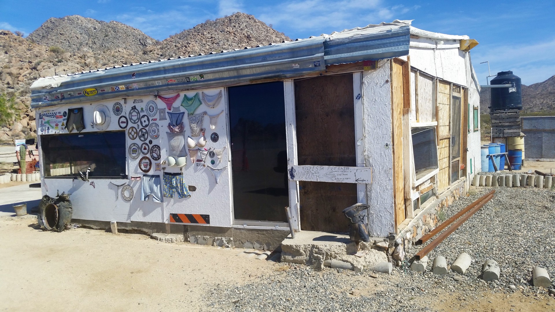
Well, we are checked in. Camping (on dirt nearby or close to the creek with unavoidable insect life) plus a dinner and a breakfast tally up to $70 U.S. a person. Seventy bucks. For camping and two meals. We do appreciate the difficulty of hauling in the supplies from Lázaro Cárdenas, but... couldn't they throw in at least a lap dance?
The sticker shock makes us look around, and notice that the pool hasn't been cleaned in weeks, and the toilets are barely above Mexican gas station grade. I chalk it off to the dead mid-week (surely the bikers will flood the place in a few days!), but there are really no reasons to stay - especially since we have about three hours till sunset. Somewhat underwhelmed, we return back to the road, and head North towards Highway 3 - and on to San Felipe.
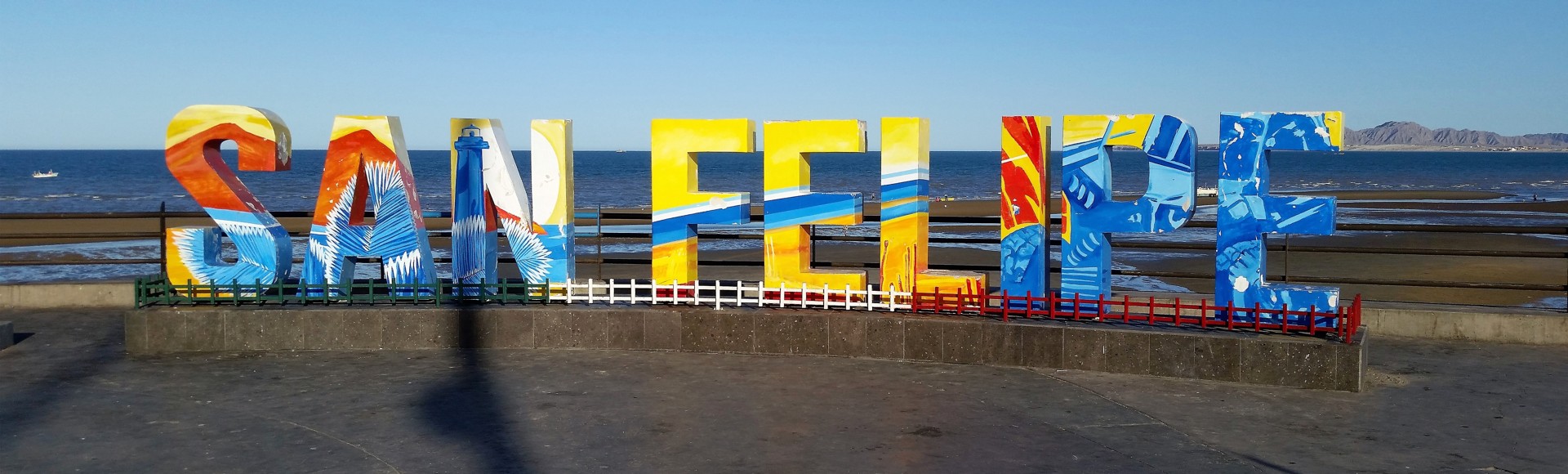 |
Two and a half hours later, we park the Range Rover at the Malecon, take photos, and look for a place to eat. Either Yelp or Google reviews point us to a cafe a few blocks away, where we have the worst meal of the trip. Chris discovers a wildlife in the midst of pico de gallo, allows it to fly away, and we break out the phones for an AirBnB search.
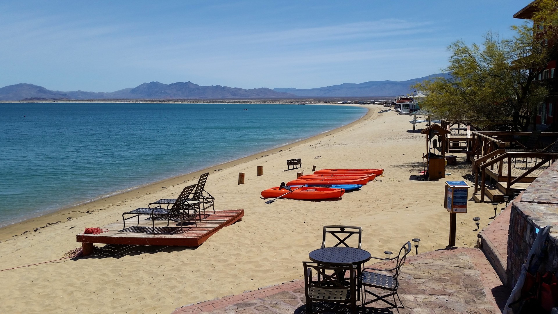
$320 U.S. (you read that right!) and half an hour later, we meet with a heavily-tattoeed gentleman named Erick at a Pemex station, and find ourselves in a palatial two-bedroom, two-bathroom apartment at the fifth floor, overlooking the entire bay of San Felipe. The place is spotlessly clean, and devoid of any sign of life. Air conditioning works perfectly, and hot water is at our beck and call. We cast away the shoes and sit down at the balcony, with glasses of Bourbon in our hands.
 |
 |
In half an hour, the insect community of San Felipe discovers two warm-blooded mammals outside, and gathers for the meal. We retire inside and turn in.
 |
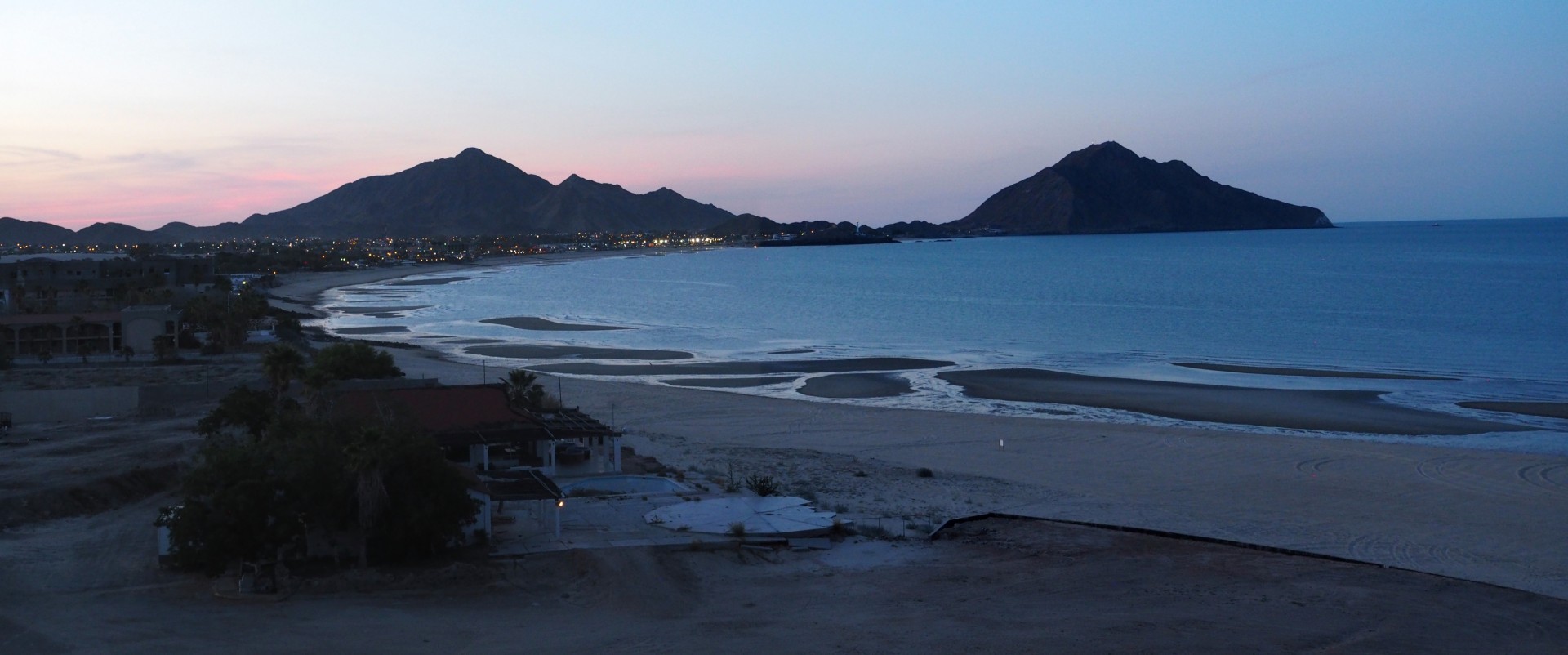
We both wake up at the eye-piercing sunrise and take our fill of photos. It takes another hour for us to start making coffee. I ponder the myriad of insect bites on my lower legs and remember the half-hour we spent lounging on the balcony... What a place San Felipe is.
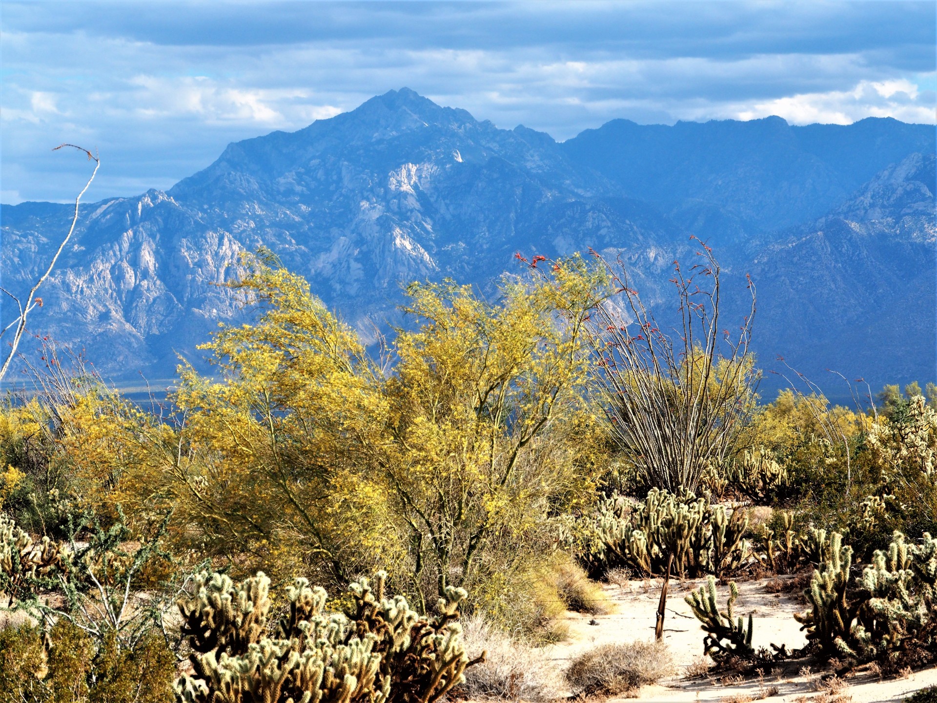
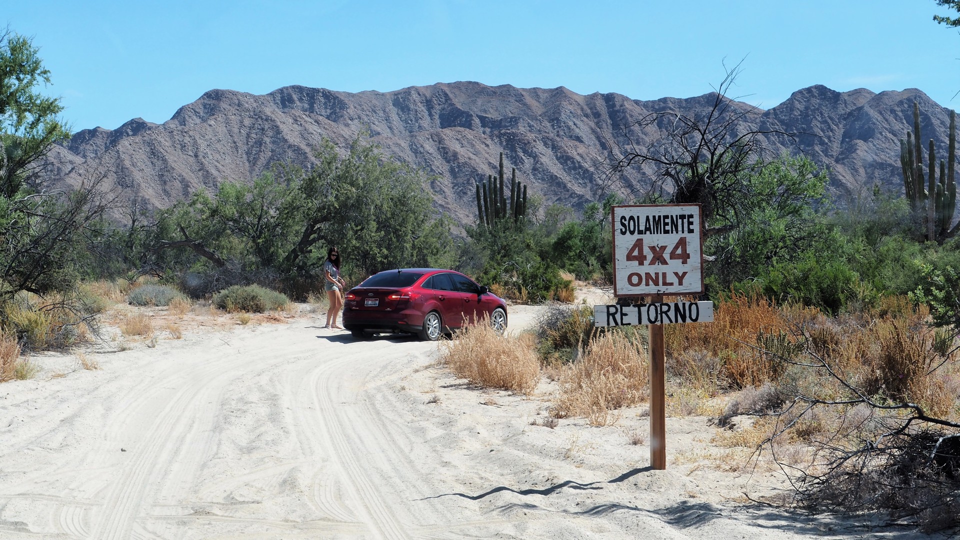
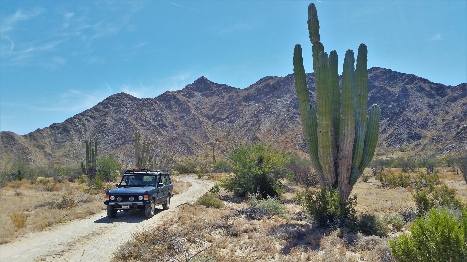
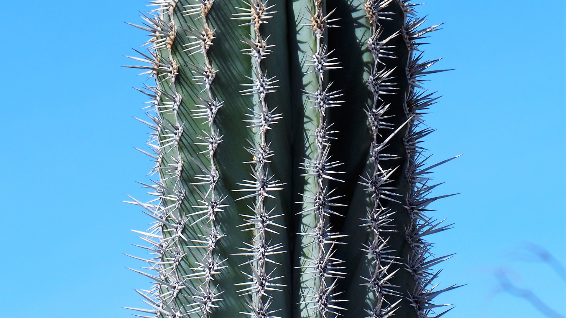
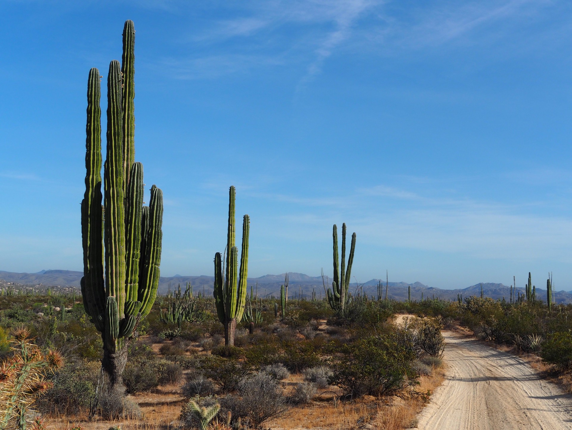
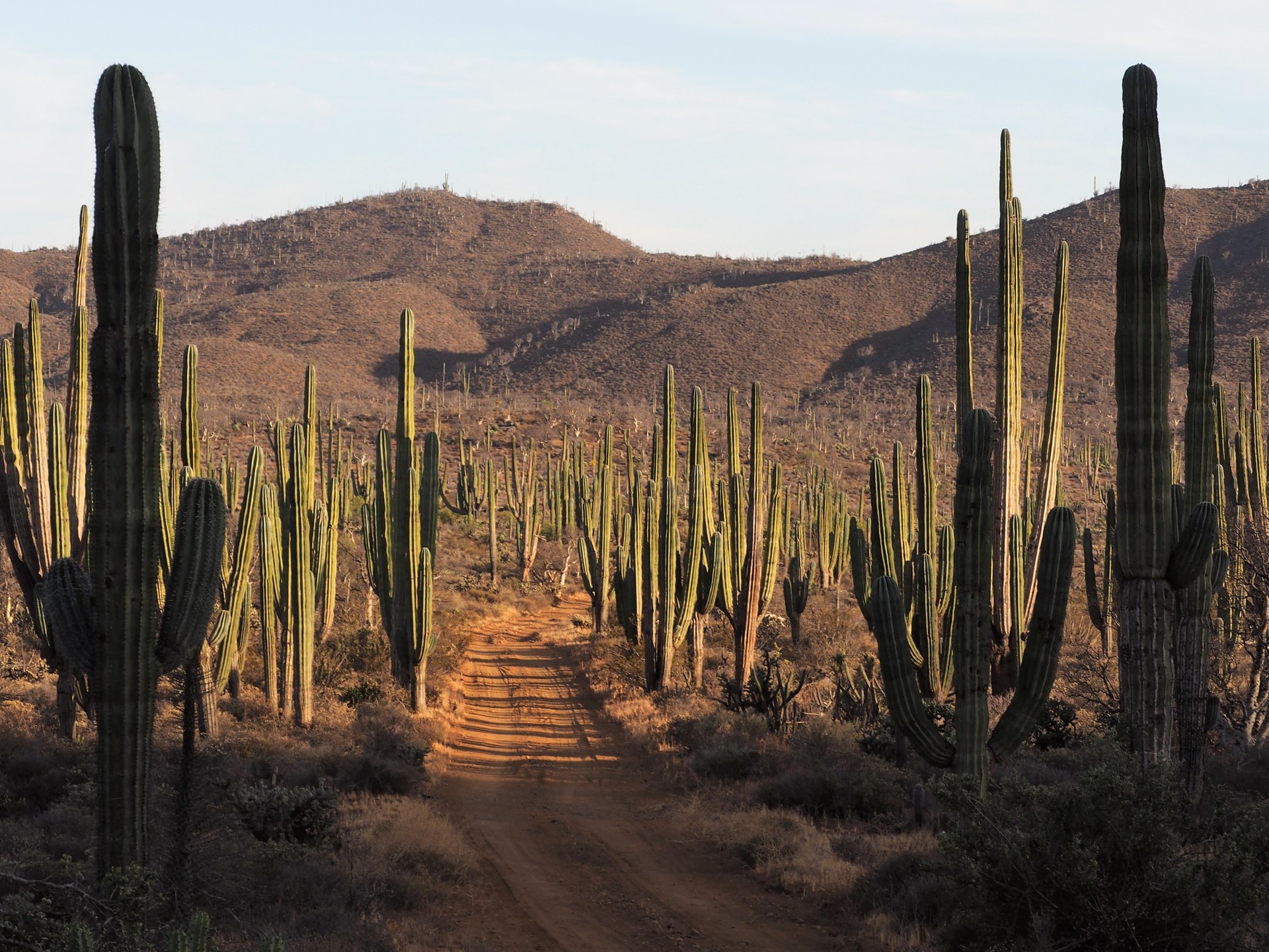
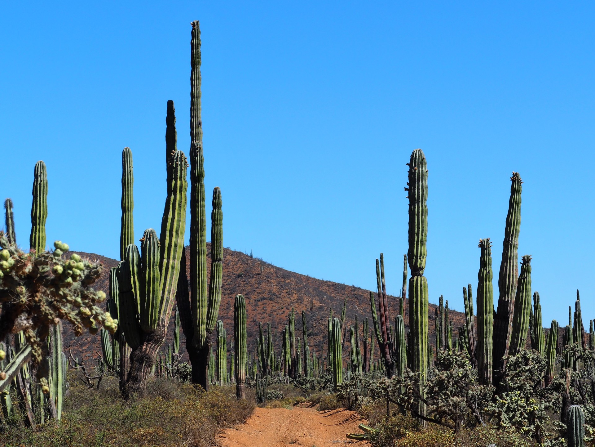
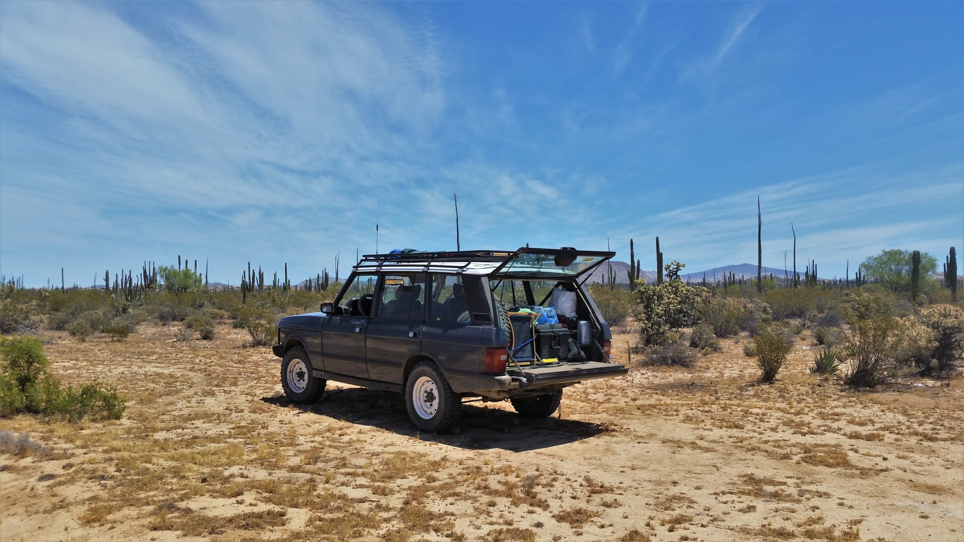
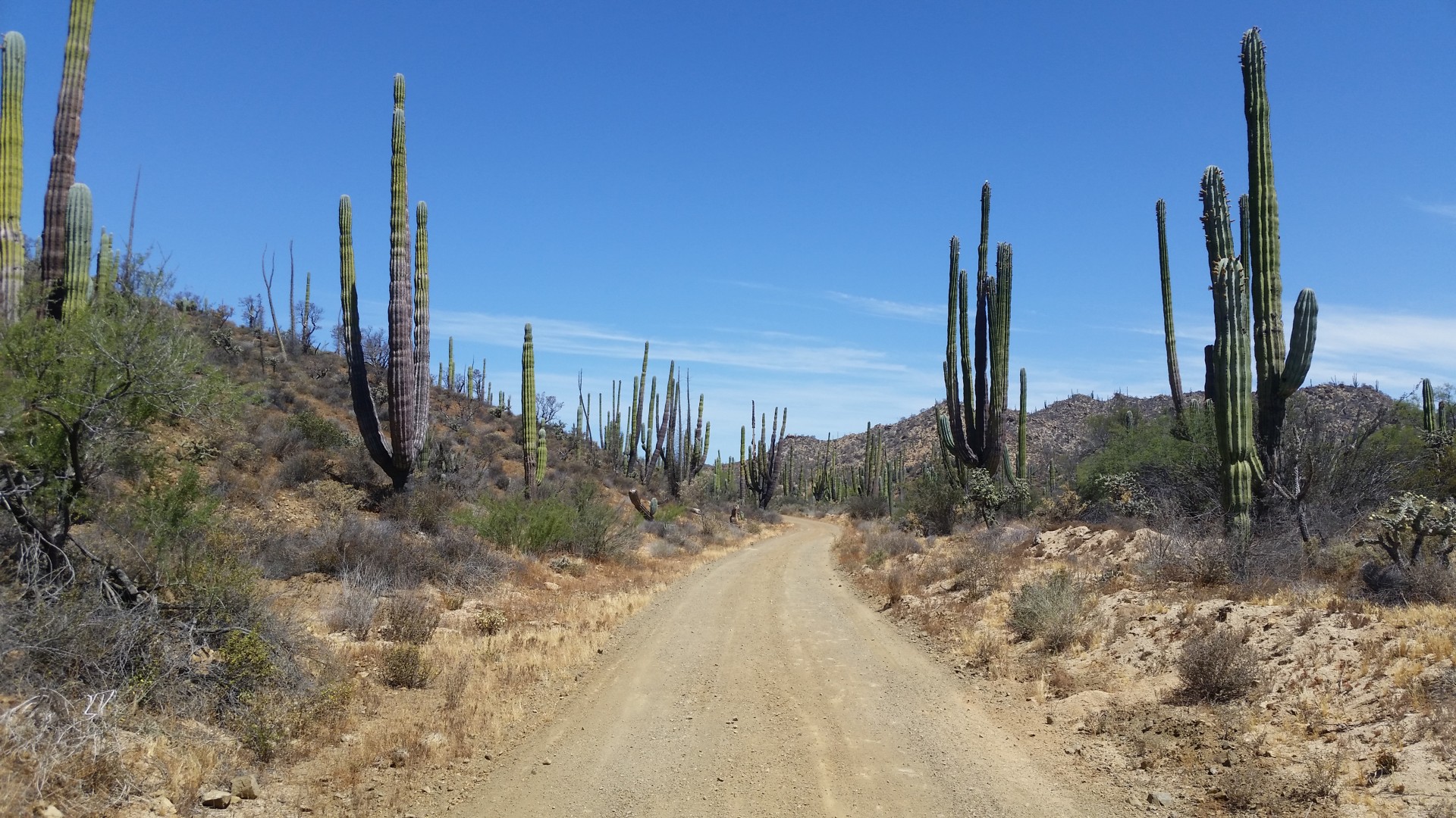
By the time we're packed and ready, it is already very hot. We make our way to Highway 5, and enjoy smooth pavement on our way towards the Valle de los Gigantes - a park with a grove of large saguaros.
There we have a boost to our masculinity, observing a car stuck in sand about fifteen feet past the sign saying "Solamente 4x4 Only." The car treads back carefully, and we plow on. Sand does get deep sometimes, but nothing to worry about. The saguaros somehow do not appear as spectacular as I remember them from 22 years ago.
 |
 |
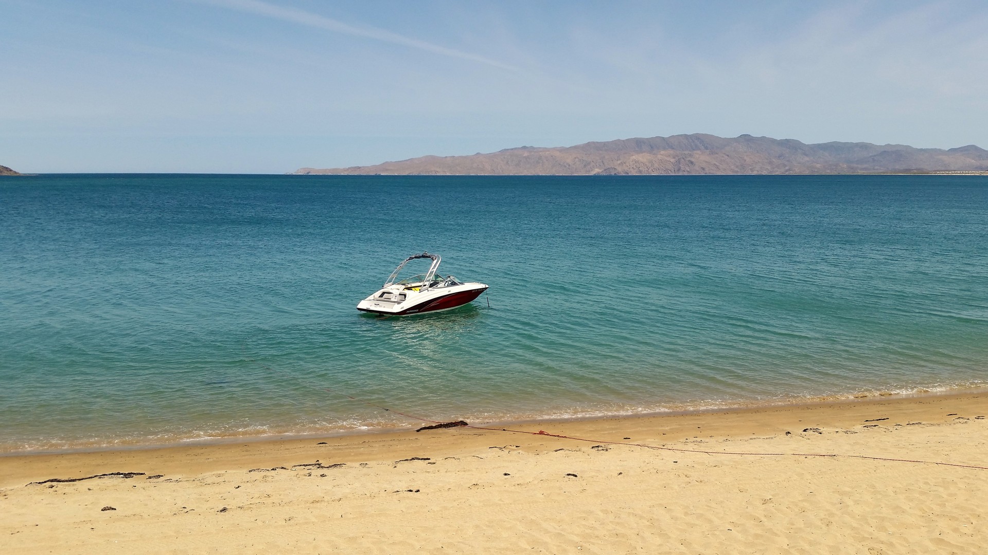
We leave the Valley of the Giants, turn South, and spend some time looking for a place to dip our feet into the Sea of Cortez. An opportunity presents itself as a little expat village with a sandbar - we roll onto the beach with the swagger and confidence suitable for a Range Rover.
The dinky 7.5-inch wide tires dig into soft sand quickly, and I resist the temptation to drive on the wet sand for a while. At a certain point, our swagger and confidence expire, I whip the truck around, and we walk to the water.
 |
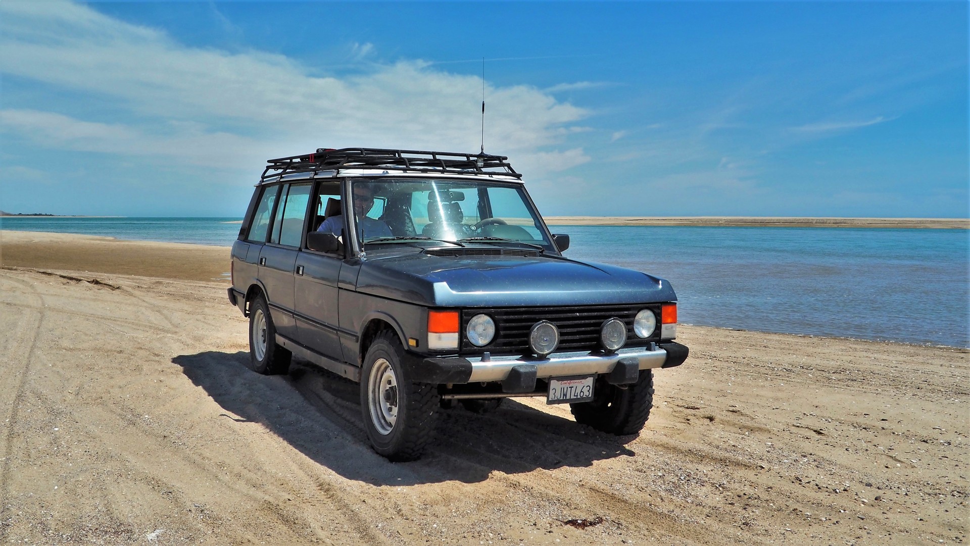 |
The sand quickly reminds me that it is not a place for someone with a torn Achilles tendon, so I bail. Soon Chris has enough of little crabs crawling around his feet, and we take a bunch of photos.
Something catches my attention at the perifery of my vision - holy hell... The tide is rising! The Sea of Cortez is famous for its fifteen-foot tides - but even knowing that I am unprepared for the speed of advance of the waterline - helped with the very shallow beach slope, the water is closing in at the pace of a foot every couple of seconds!
Now we're in a hurry to leave the beach - and we do have a sense of relief when the tires hit the broken pavement.
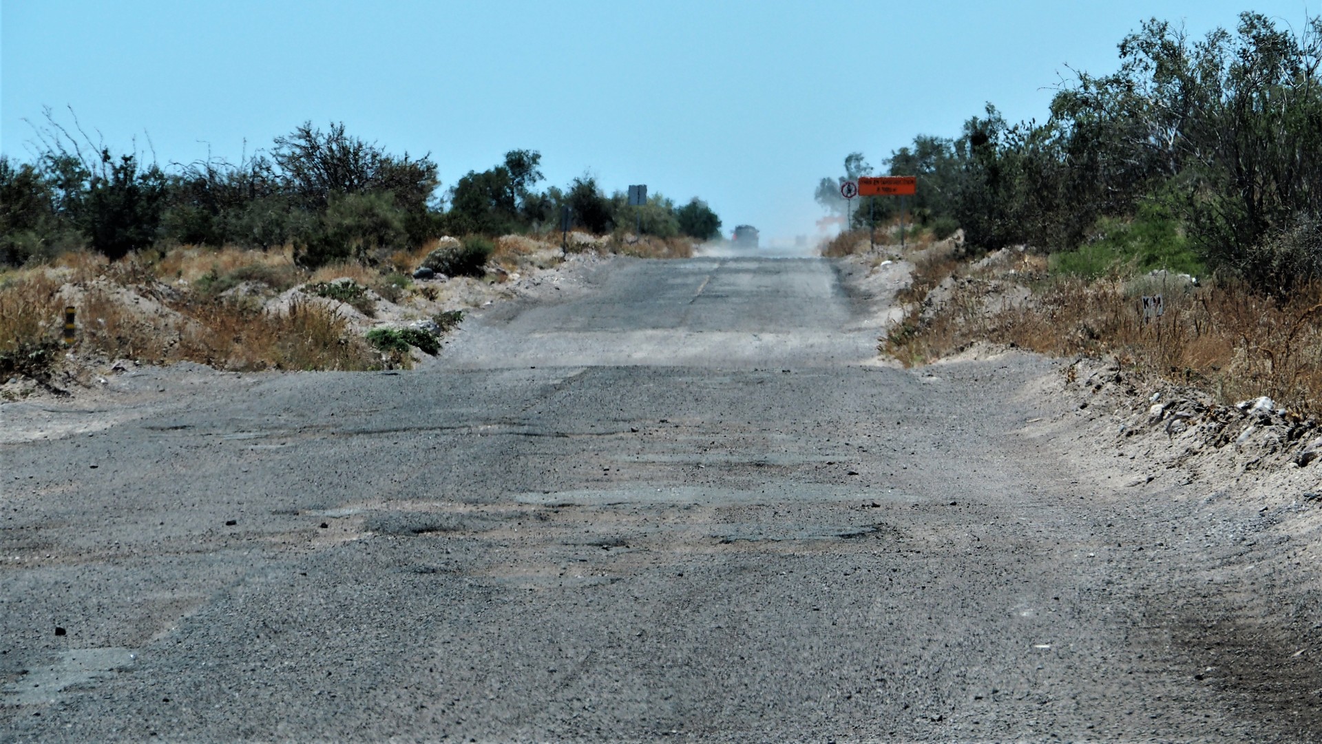
Soon we are back on the road, which all of a sudden loses its smooth pavement. Now it looks like a typical Russian backcountry highway right after the snow melt. We wish we were on a dirt road, and judging by the shoulders of the road, we aren't the only ones. A few miles later we see the road repair crew; the direction of their progress makes us think the rest of the way South to Coco's Corner is going to be sweet.
 |
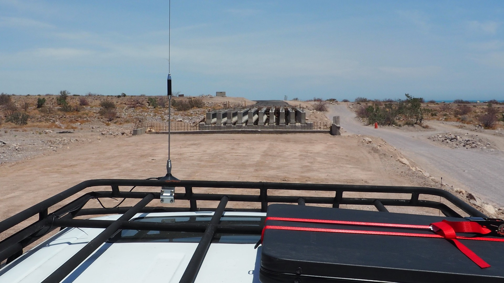 |
Little do we know... Soon we arrive to our first broken bridge over an arroyo. A missing section of the bridge is indicated by a small pile of rocks deposited about 20 feet before; we both wonder how far would it be seen at night. As we trudge along the bypass, we are overtaken by four guys in a Ford Raptor pickup on huge tires - the tire size definitely brings some advantage.
 |
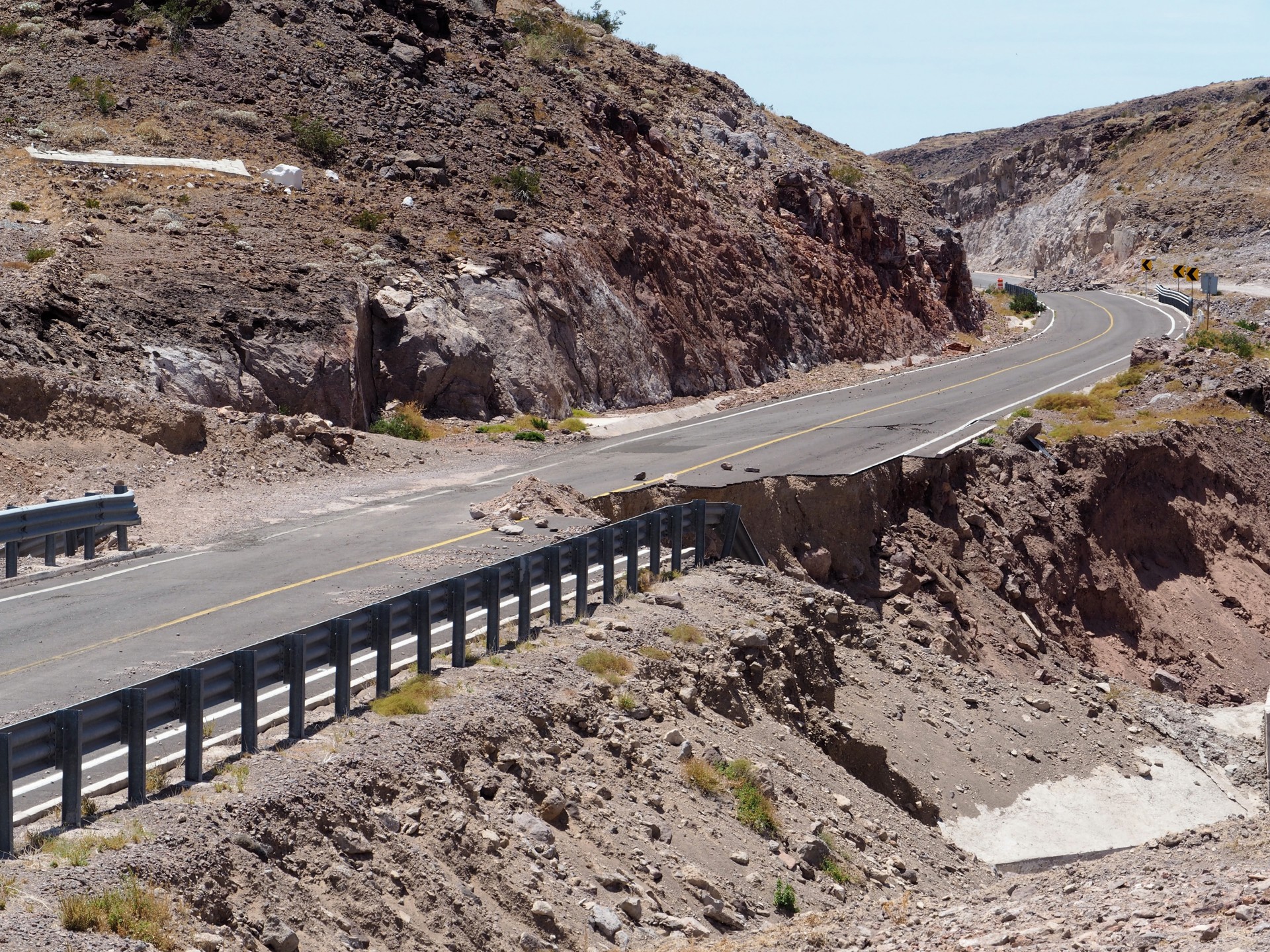 |
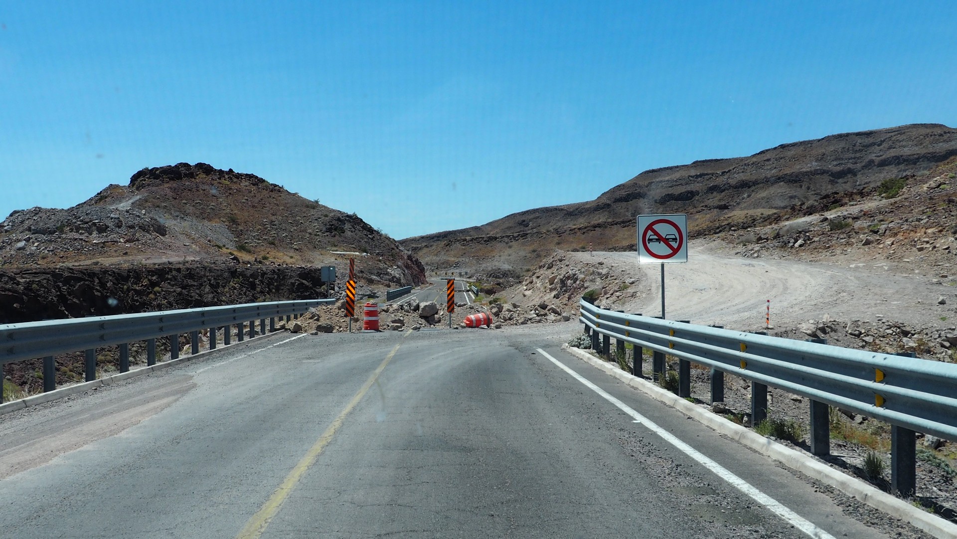
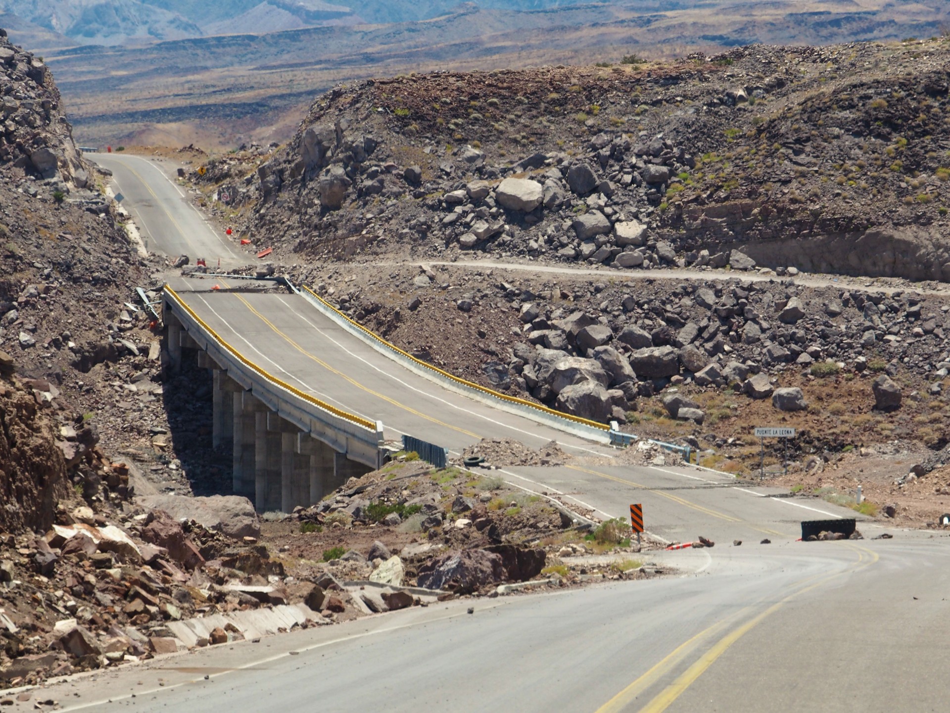
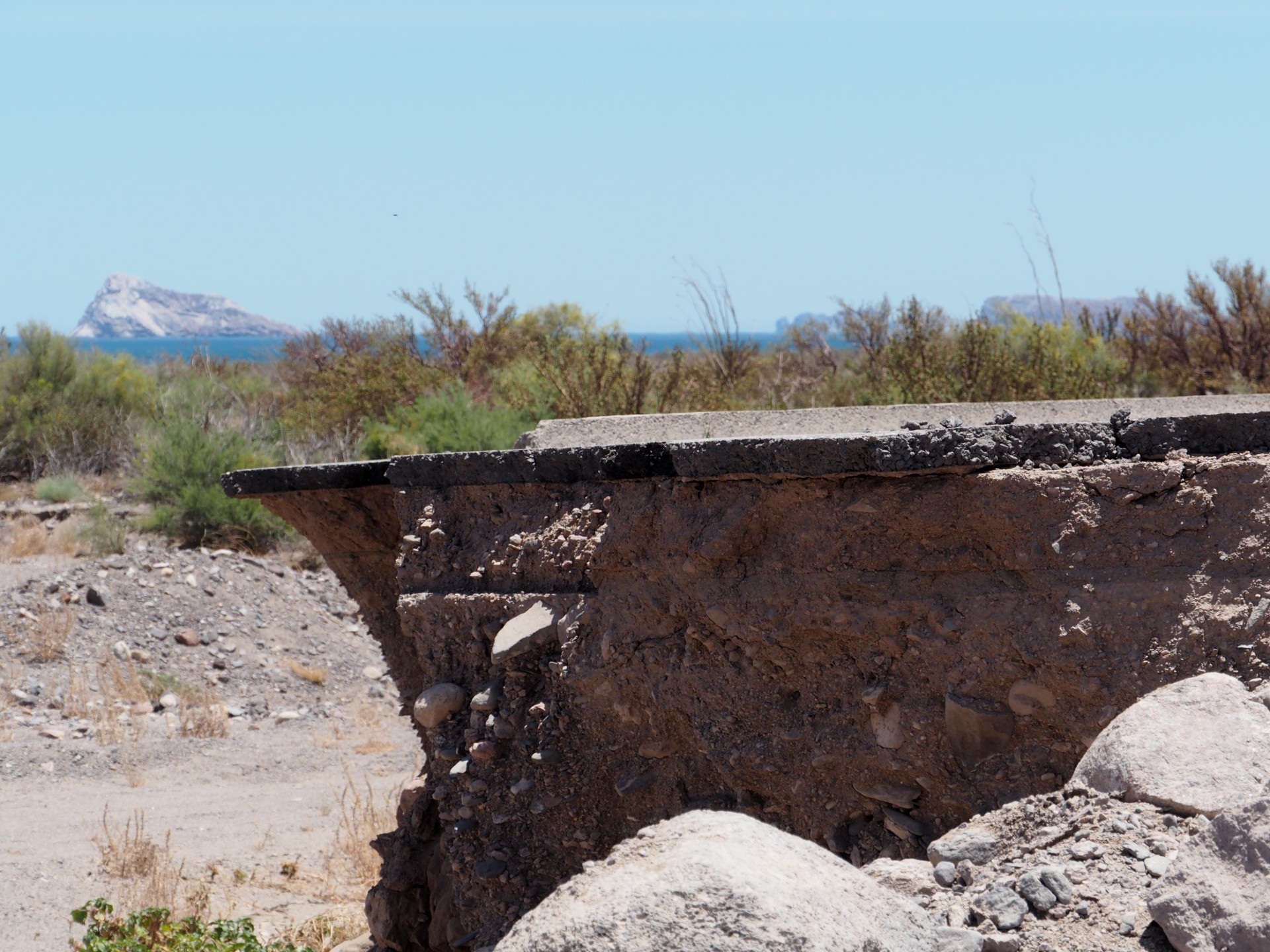
For the next two hours or so, we are busy looking for the next broken bridge, finding the bypass, driving around the bridge, and reclaiming pavement again. Every now and then the bypass (for the bridge with fallen sections) goes under the same bridge - which does not inspire much confidence. The "straights" between the bridges also have washed-out sections, occasionally marked by rock piles and rare orange cones. We take a peek at the road construction while taking one of the innumerable bypasses, and see that two inches of asphalt are laid down straight on dirt, which melts away at any hint of precipitation. It also dawns on us that the pavement on the "other" side of the crumbled sections is likely biding its time to cave in. No wonder Mexicans tend to drive along the centerline of the road.
 |
 |
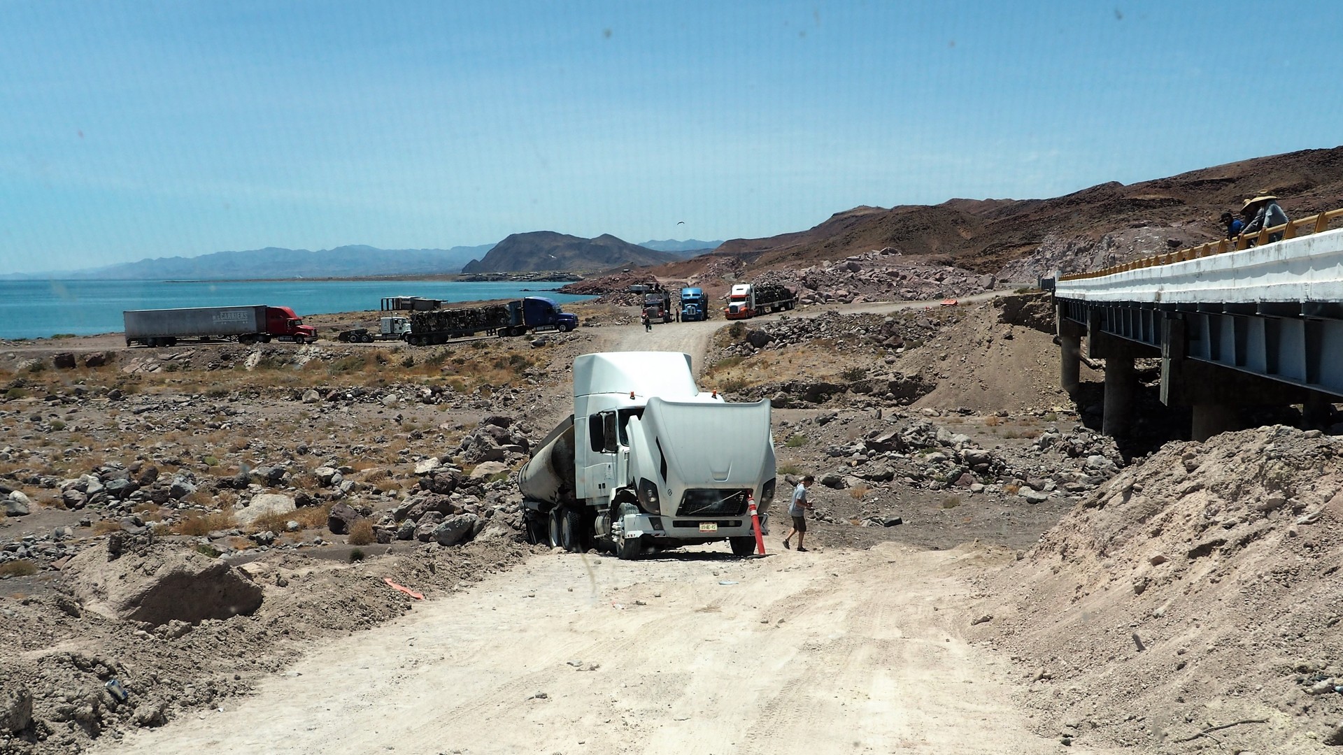 |
All of a sudden we come upon some commotion on the road. A bunch of big rigs is congregated before yet another broken bridge, and we see the Ford Raptor again, with its occupants out and not looking certain about what to do. It appears that a tanker truck full of tar (doubtlessly destined to the repair crew we met earlier) stalled trying to climb a very steep section of the bypass, and the rear wheels of the trailer slid off the makeshift ramp. The tar is pouring out of the tank and into the arroyo, about a couple of hundred feet from the beach. There's about eight to ten feet of space on the ramp to get around the cab of the truck; the driver of the Raptor tiptoes through the narrows, with its right wheels pushing dirt and rocks down a 20-foot slope. The much-narrower Range Rover has an easy time scrambling through, but it looks like it's going to be the last vehicle to get past the truck in the whole day. There's already a sizable group of big rigs and motorhomes on the other side of the arroyo, and some are considering turning around. It will be a long wait before a large wrecker is brought in.
We're on Baja time, aren't we?
We plan on stopping somewhere around Puertecitos - but miss it entirely. The gas gauge dropped to about a quarter of a tank since Lázaro Cárdenas; we have two full 5-gallon cans, so it is not that much of a concern. The road makes its way closer to the coast, and we are greeted with the sight of a chain of islands - Isla El Muerto and Isla San Luis are the largest of them. We stop to take photos of the islands, and the truck is immediately full of bees. The bees are not aggressive towards us, they only want to make the Range Rover their home. The only help comes from a pressurized can of DEET; bees reluctantly leave - hopefully, all of them.
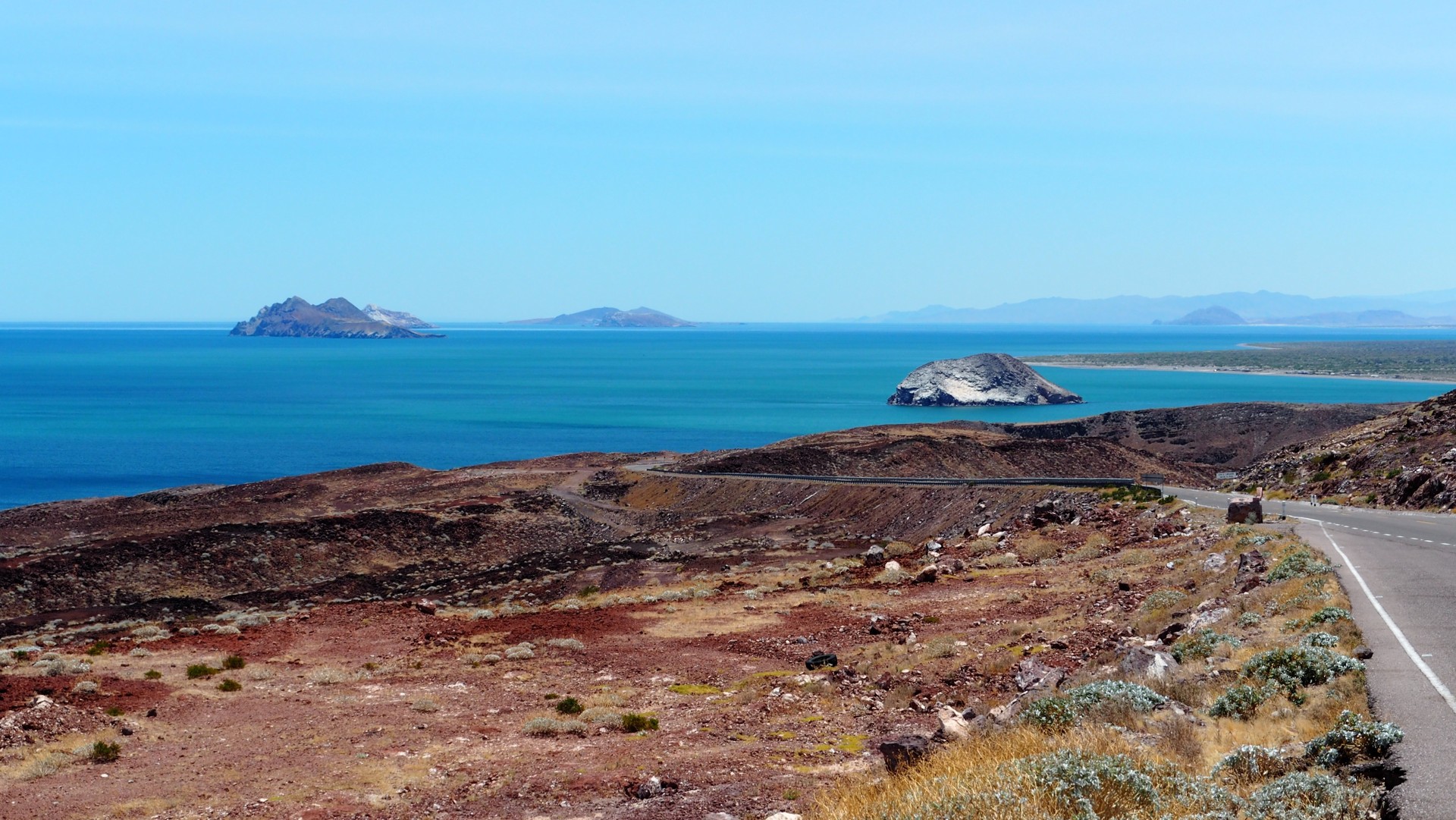 |
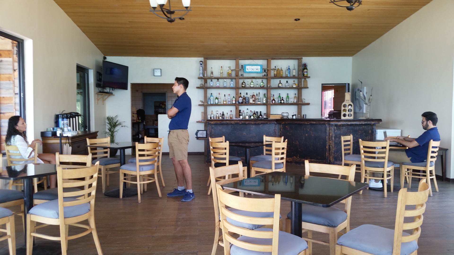
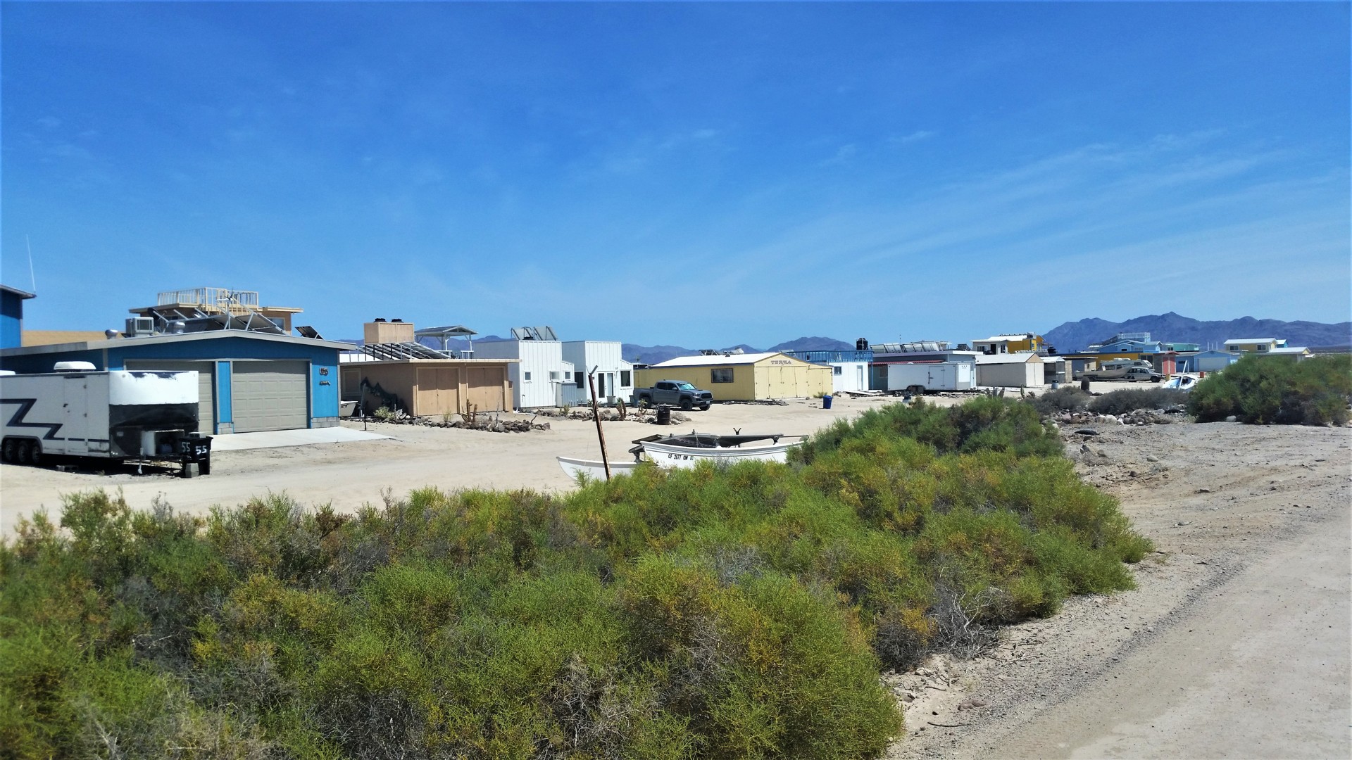
In about 20 miles, we drive through a military checkpoint - since my first trip to Baja two decades ago, these have become less frequent and less intimidating. It is also helped by the change in uniform color from dark green to former US Marine Corps desert pixelated kind. The Pemex station is a few hundred feet away; we fuel up and talk to the group of four Mexican guys from that black Ford Raptor pickup (they haven't made much more headway than us, it turns out). They are adamant about us having lunch at the Alfonsino's - a hotel and restaurant in Bahía San Luís Gonzaga ("Gonzaga Bay"). We oblige and take a left turn right after the gas station; a security guard writes down our names and license plate, and lets us in the gate. The road leads straight towards the shore, along a dirt airstrip with a lonely Cessna 152 under wraps, and then bends to the left - along a 300-ft-wide sandbar with a couple of dozens of houses, ending at Alfonsino's. We park the truck and walk into the restaurant.
 |
 |
 |
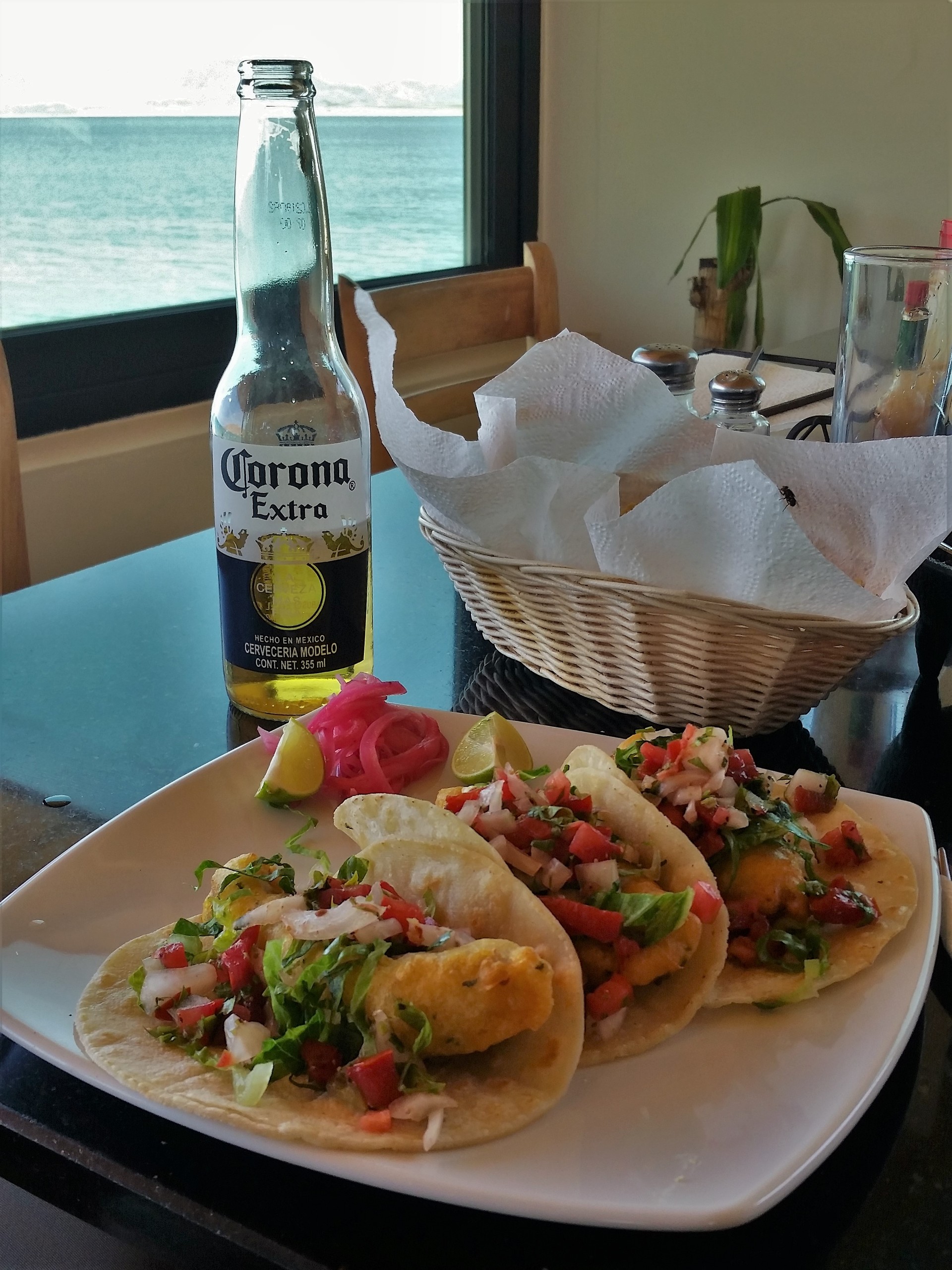
A couple of customers are inside - a good-looking lady and a "hipster" type pecking away at his laptop. The bay lays nearly still outside, with a lonely boat bobbing gently; several kayaks are laid out near the entrance. The place looks like a beautiful family getaway! We don't know what to expect of the food - but Alfonsino's $8 plates of three fish tacos were one of the best meals of the trip. The bar looks inviting - but we still have a lot of ground to cover. We take a few photos and leave.
 |
 |
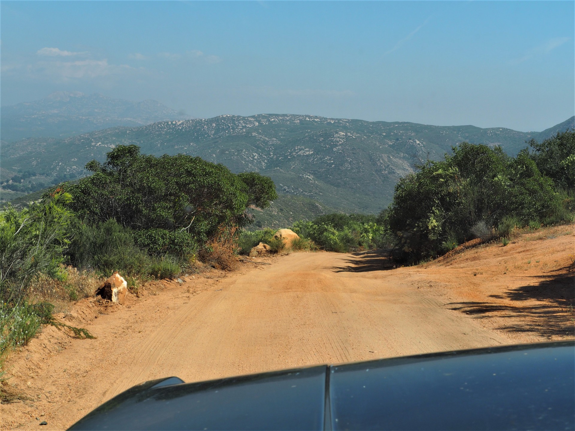
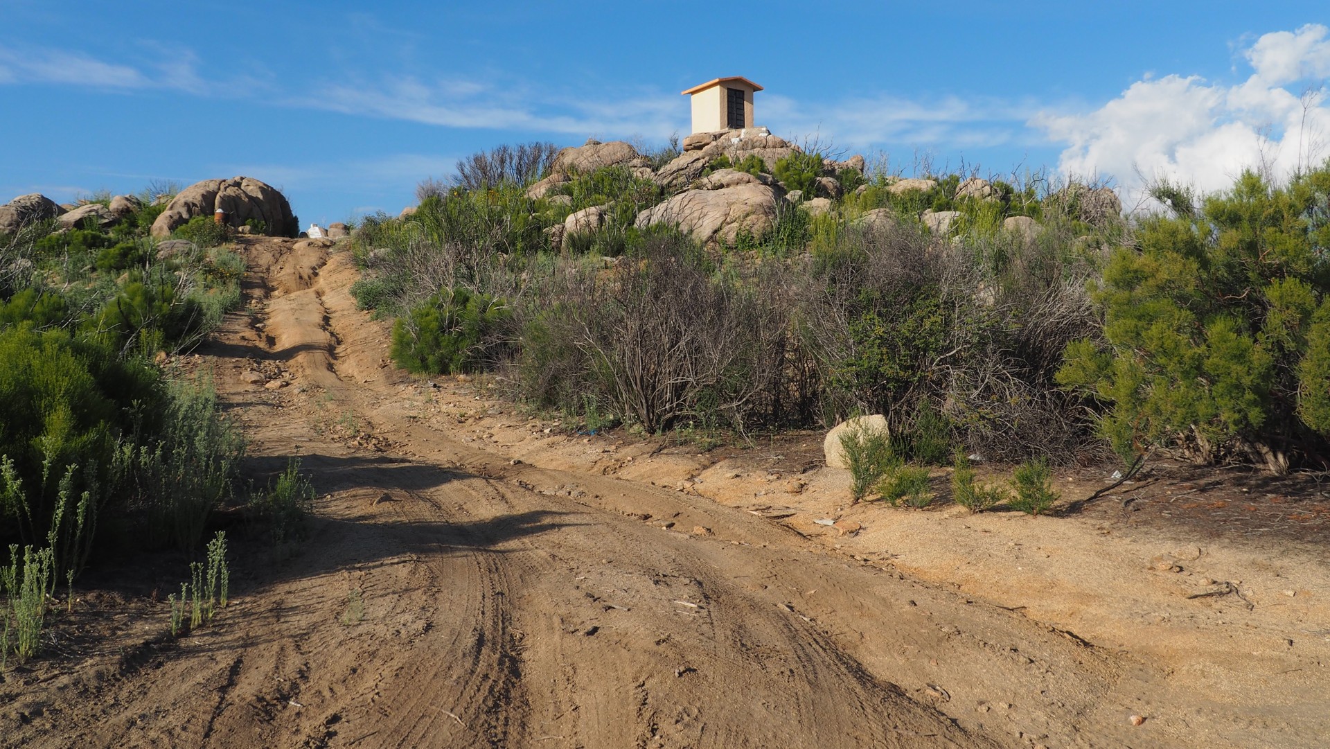
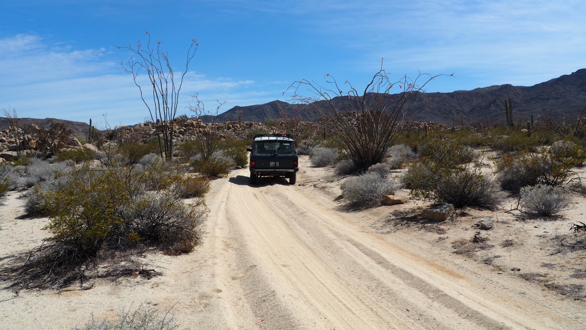
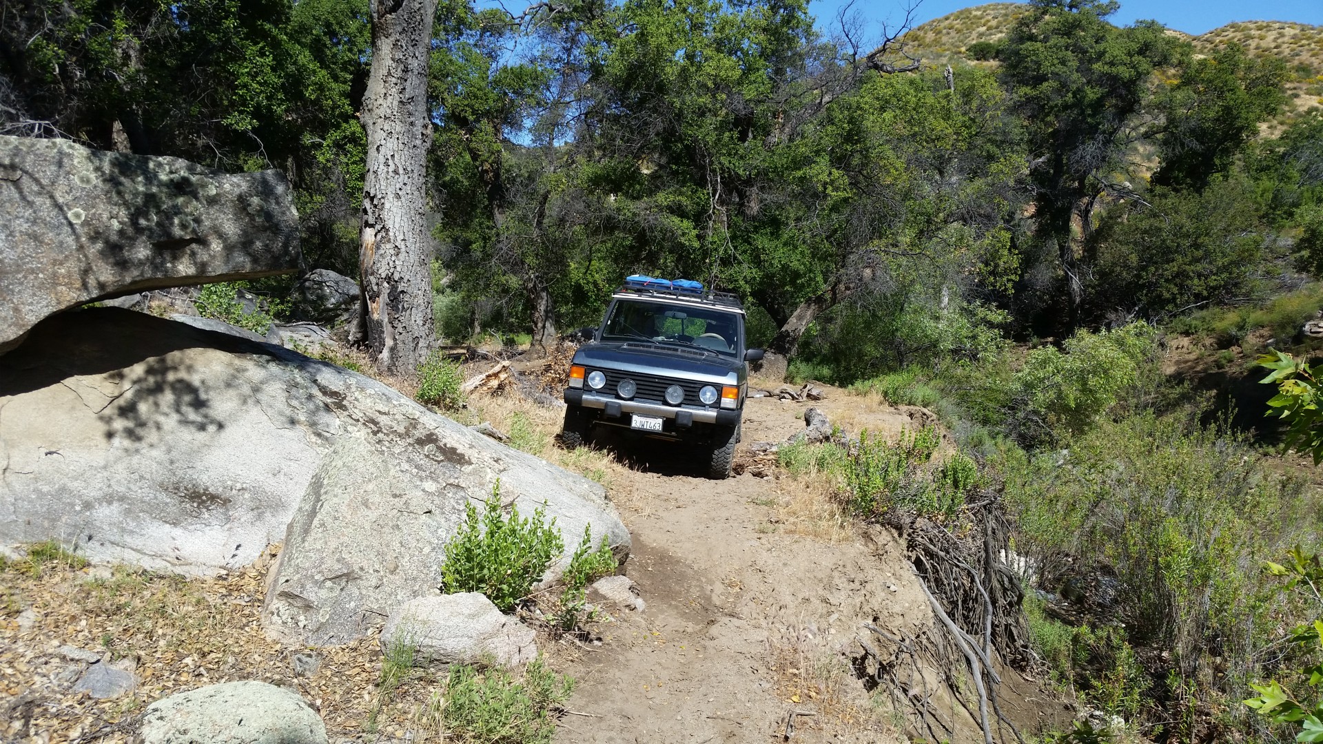
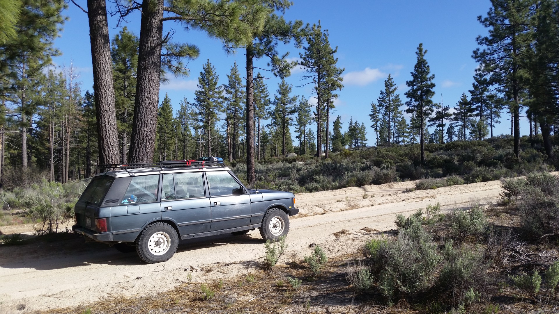
Before the trip, I have spent some time looking for dirt roads and trails crossing the southern tail of Sierra Nevada so we wouldn't have to drive all the way South to reconnect to Ruta Transpeninsular - Highway 1. I have not found any, unfortunately - because the Eastern slopes of Sierra Nevada are much steeper and harsher than the Western. Yet, Chris shows me one on Garmin. We have to check it out, even if we miss seeing Coco's Corner. It takes a while to find the turn-off and verify that it is the right trail. In common Baja fashion, it starts off as a nice dirt road - and progresses quickly to a rutted dirt road, then to a rocky road, then to a very rocky road. It reaches an abandoned mine, after which it appears very faint and unused for many years. We push our luck as far as we think prudent with a single vehicle - and bail out at the first boulder field.
 |
 |
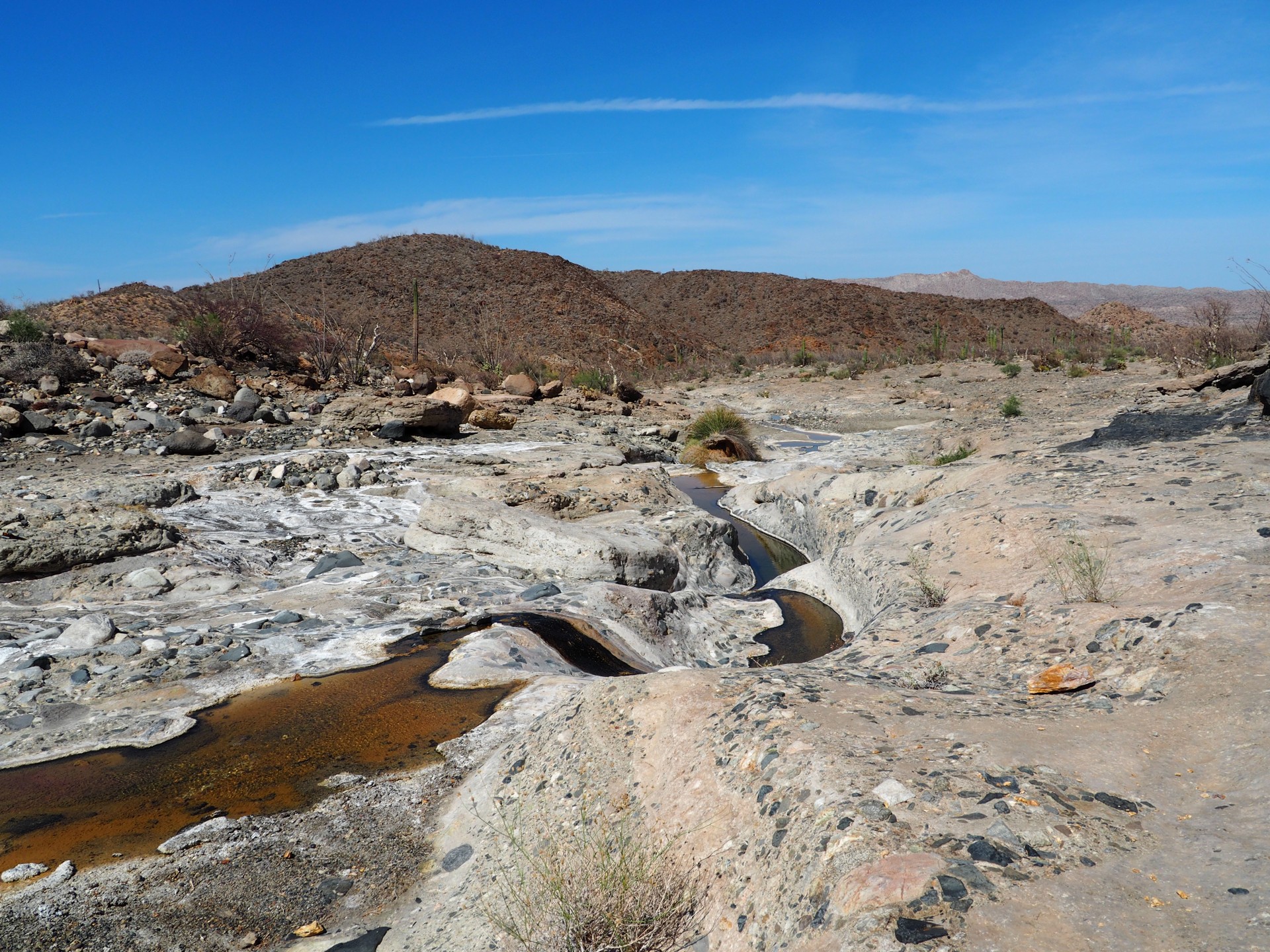 |
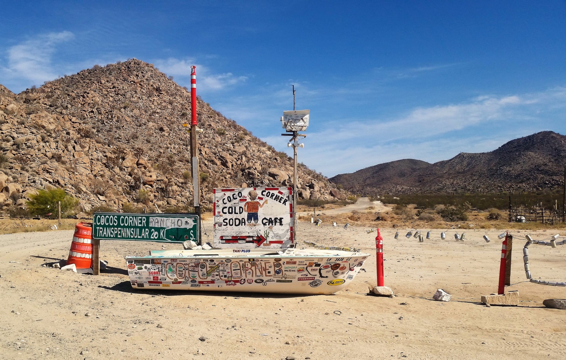
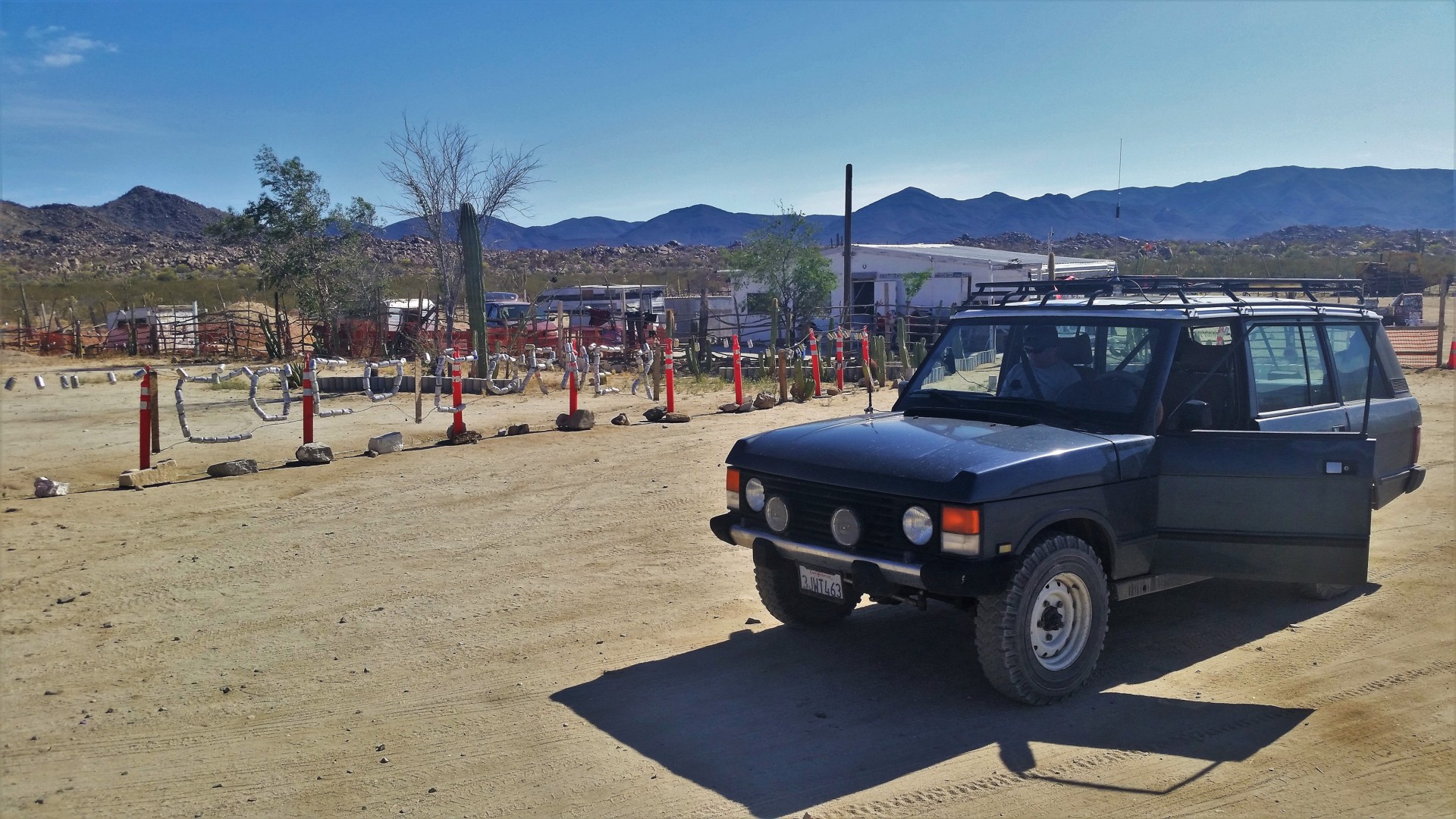
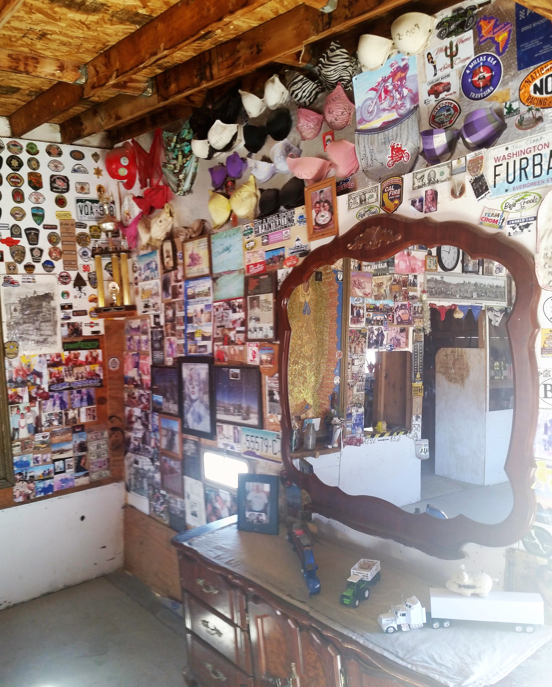
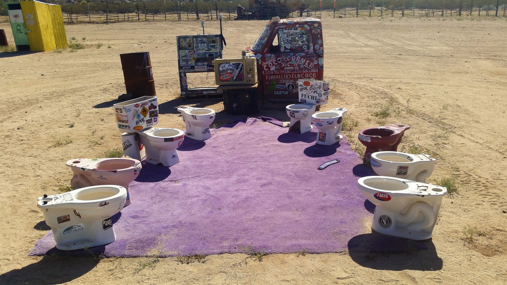
We are back on Highway 5, which by now has no pavement at all and remains to be a graded gravel road until 1. Along the road, we stop to visit one of Baja California's legends - Coco's Corner - and have a cold Pacifico as well. Soon, the highway will be paved somewhat away from Coco's, and the place may disappear.
 |
 |
 |
 |
 |
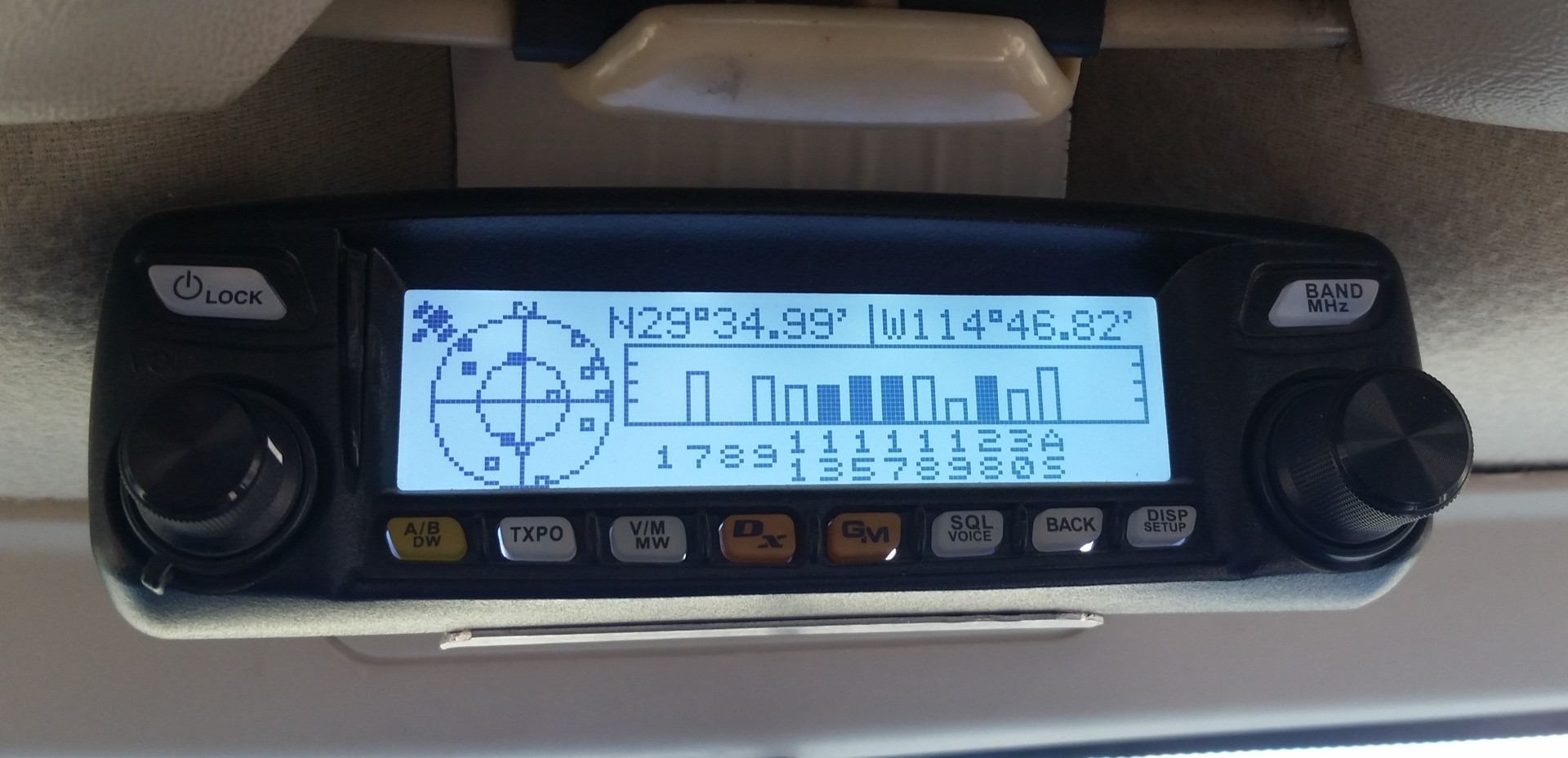
We leave Coco's Corner, and in half-hour's time we reach the Southern-most point of our trip - 29°23'06.5"N 114°22'56.9"W, about 100 miles North of Baja California Sur. We take the right turn on Carretera Transpeninsular, and rumble towards the North.
Chris inquires if I'd be okay with camping at the Pacific coast. Of course I would, why would I not? There is a catch, however - we must leave pavement about 10 km after a little town of San Antonio de las Minas, and... we only have the "as the crow flies" sense of distance to the coast. This distance is about 30 miles, and it is already 5 in the afternoon, leaving us about 2.5 hours of daylight. We figure we'd always find ourselves a place to camp, and happily leave the pavement.
 |
 |
 |
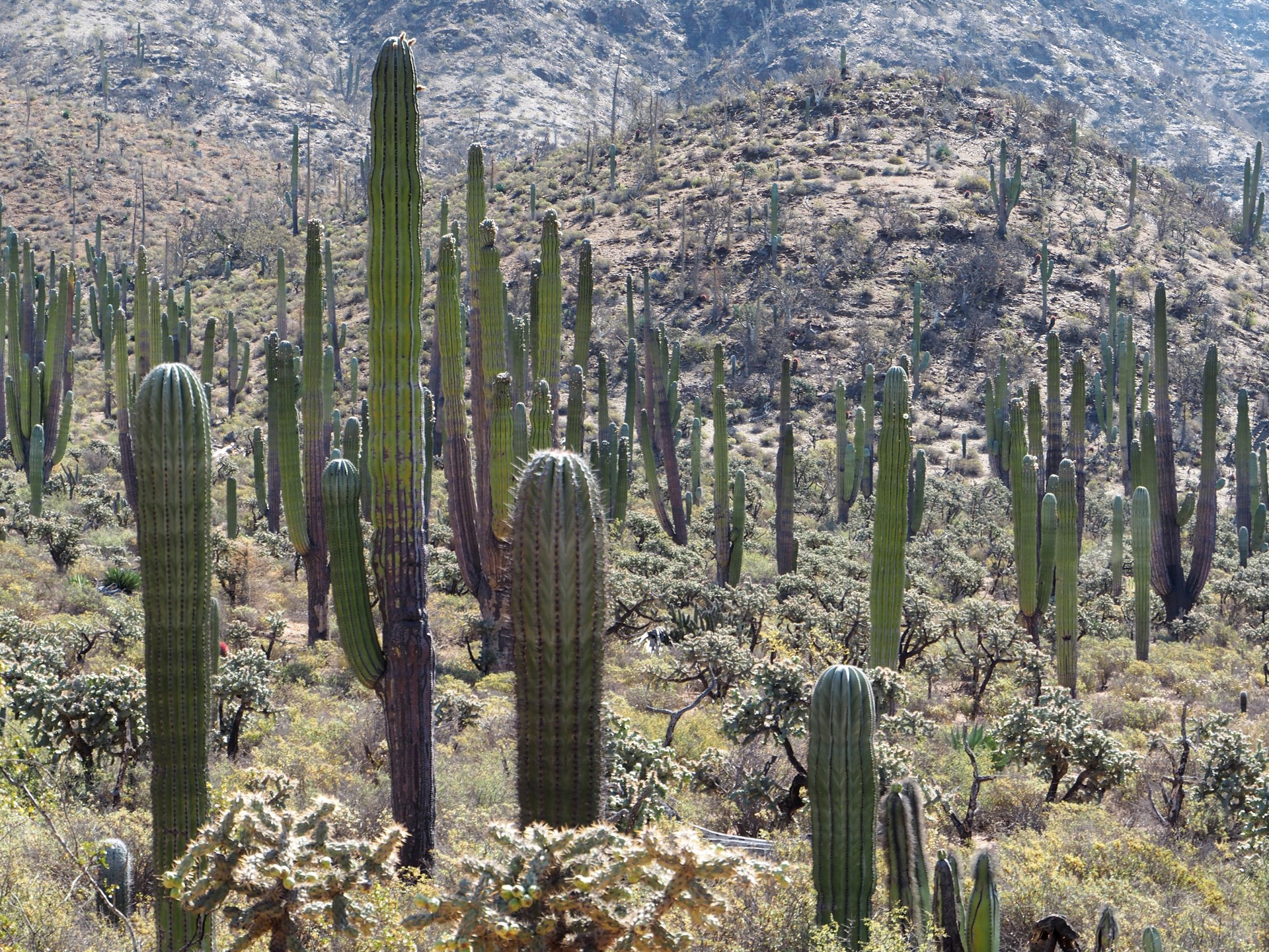
The road could hardly be more beautiful. We drive through a saguaro forest that makes Valle de los Gigantes look like a pitiful community garden. The desert is full of wildlife - we have to slow down for jackrabbits or a mama quail with ten little ones crossing the road; hawks are aloft in droves; a shade of a large cat quickly disappears in the brush. We see yellow flowers of agave plants and red tops of ocotillos more and more often. It seems to get cooler with every mile we make it towards the Pacific - or it simply gets later in the day? We spot a perfect tent campsite along the way - complete with a trash bin (who ever empties those?), a locked up toilet, and a nice concrete pad for a tent. The sun is still up, however, and we continue on.
 |
 |
 |
Fast forward an hour.
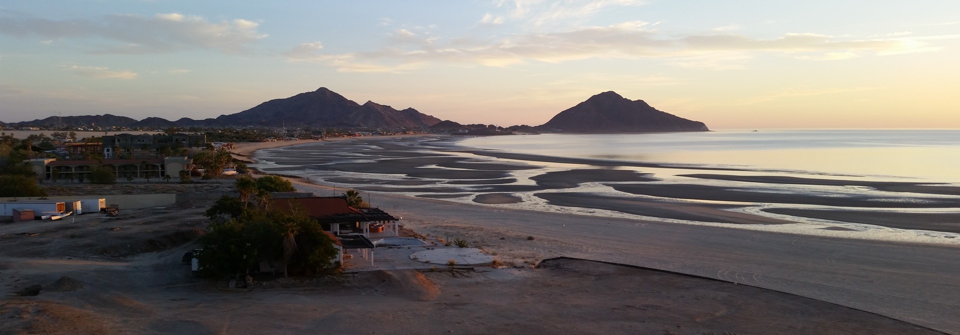
We are near the ocean. Sun is setting into the bank of fog a few miles off the coast; vegetation becomes sparse and appears less healthy as inland - must be the result of an occasional salt fog. We pass a few ranch houses that appear shuttered, and take the fork of the road promising beach-side camping. And here comes the beach.
We are standing on a 20-foot-high bluff overlooking a rocky beach washed by a pounding 6 to 8 foot surf. Ground is wet, it is very windy, chilly, and humid. The campground is composed by a locked-up and boarded-up building with decaying plumbing and electrical fixtures, an unfinished multi-stall toilet, and a few more man-made features of unclear purpose. Tent camping here is out of question.
Chris looks at the Garmin and wonders if the little fishing village of Puerto Faro San José has places to stay and to have a beer. We return to the truck and trundle across the narrow peninsula towards the village.
Boy is that village something.
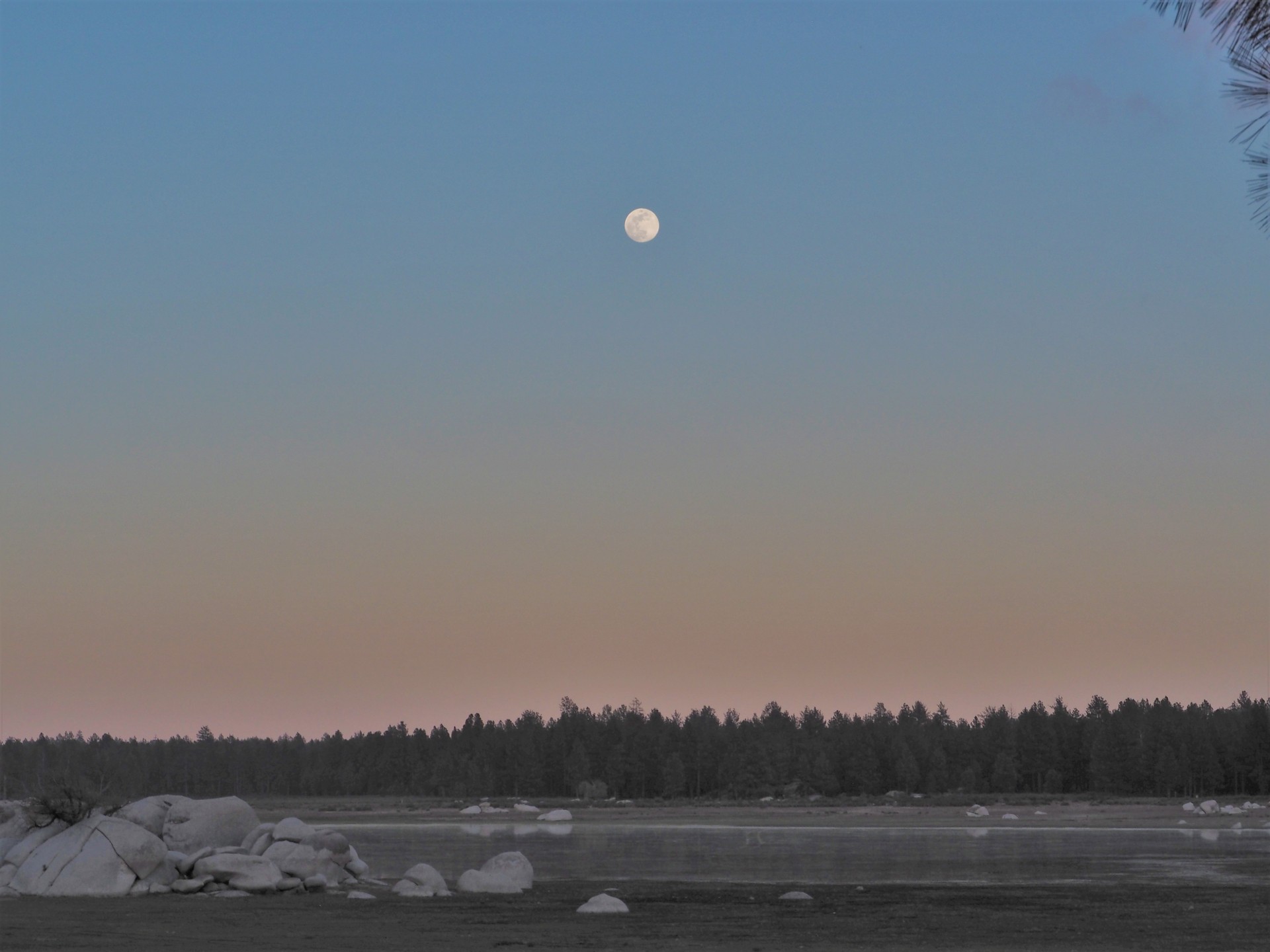
In the light of nearly-full Moon we see four or five clapboard shacks, seemingly made out of whatever the sea dropped off at the rocky beach - planks, pieces of tarp, bucket lids - you name it. One or two of them has satellite TV dishes, however; a couple of pickup trucks axle-deep in mud seem not to have moved in a while. A few panga boats are strewn between the houses and on the rocky beach. The place appears completely lifeless, yet a few dogs show up and bark up the storm. The place is completely eerie; none of us has any inclination to knock on any doors or camp close by. In the retrospect, most likely, the village inhabitants (all three of them, according to a Baja California's government assessment) are frightened of us more than we are of them.
Chris suggests returning to the tent campsite we spotted earlier, that we now call "Slab City." The place is in two and a half hour's drive, however, and it is already half past eight. I pick a different dirt road in hopes of finding a better spot closer, but it meanders back and forth across a large arroyo. We stop, aim the Hella 1000 lights higher up in the sky, and swap seats. Chris continues driving along the trail - it seems not to have been driven on for many months, and every now and then it almost vanishes in tall grasses of the arroyo. Close to an hour into that trail, it starts inching upwards - occasionally crossing a deep gully or some rocky outcropping. Bizarrely, we see a cluster of bright lights in the distance - is it a ranch house or a mine?
Nope, it is an ofrenda likely built on a gravesite, adorned by solar-powered LED lights. What a spooky thing to come across! A pitch-dark ranch house sits a few hundred feet away from the road.
The next hour passes in near silence, punctuated with lame attempts to record a video of progressively more technical driving. All of a sudden we find ourselves on a perfectly flat, dry, free of vegetation, and yet elevated patch of ground. It is close to 11 pm, and we've been on the road for fourteen hours already. Chris pulls over, and we set up the camp.
I can't light up the Coleman propane stove - something must be wrong with it. An attempt to jam the shraeder valve open in the propane feed results in a neat two-foot fireball and some singed hair on the back of my hand - but doesn't help the process. My comments on the Coleman stoves' Chinese origin regardless of whether one is bought at WalMart or REI are met with skepticism on Chris' part, and we turn in without a thought of an evening meal.
Nothing, really nothing, bothers us in our sleep.
Tomorrow will show that this place is the only suitable campsite in about 60 miles of the road.
 |
I wake up early; the sight of dense and low clouds jolts me out of sleep with a thought of having to drive this road in rain. I talk myself into believing that this is simply a coastal fog, and drift away again. It takes the morning sun about an hour to drive me out of comfort of the sleeping bag inside the Range Rover. I tiptoe out and take a short walk - there's a ranch about a quarter mile from our campsite, but no one seems to be around. My morning attempt to light up the Coleman stove is successful (which somewhat attests of our diminished mental facilities last night), and an Italian percolator is busy making us a rich mix of Kona and Peruvian coffee.
 |
 |
Chris wakes up and joins the coffee-and-cheese-and-ham breakfast. Life gets better. The road we're in is actually shown in National Geographic map despite the lack of use, and we can guess that we're about an hour or so away from pavement. We pack our belongings and fire up the truck. The engine seems to make faint low-end tapping sound - but I've known myself to be paranoid about these things. Soon, we are rolling through the same saguaro forest towards Highway 1.
 |
 |
 |
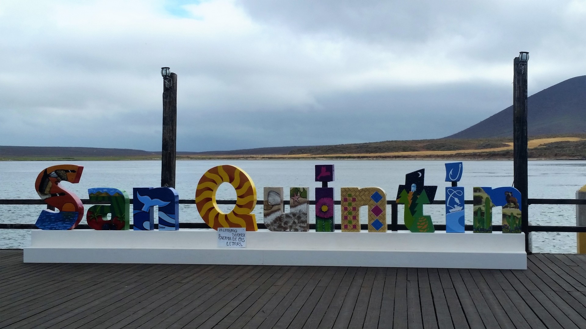
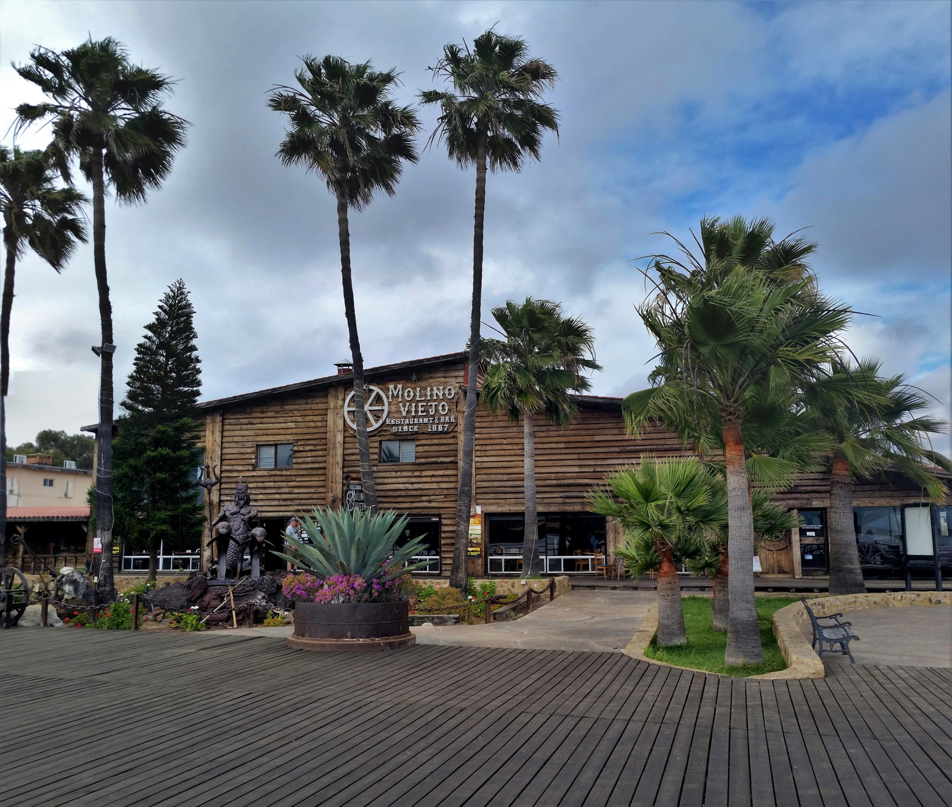
The pavement meets us with a noticeable big rig traffic. This section of Carrera Transpeninsular is narrow, and with steep grades, sharp turns, and limited visibility. Chris is less than impressed by me passing the tractor-trailers in the oncoming traffic lane - but it can't be helped if we want to get anywhere. One hundred and fifteen kilometers and an hour and a half later, we're at the Pemex station in El Rosario. All of a sudden we have cell phone coverage and digital services, so we pay our debt to social engagements by posting photos on Facebook or Instagram or whatnot, and trying to communicate our well-being to our significant others. We also look up something worthwhile to check out along the road, and decide to have lunch in Molino Viejo beach-side restaurant in San Quintin, another hour away.
 |
 |
 |
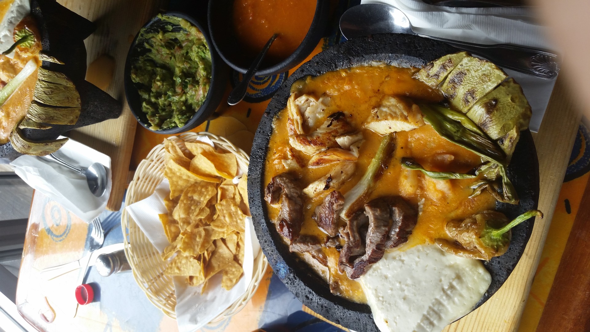 |
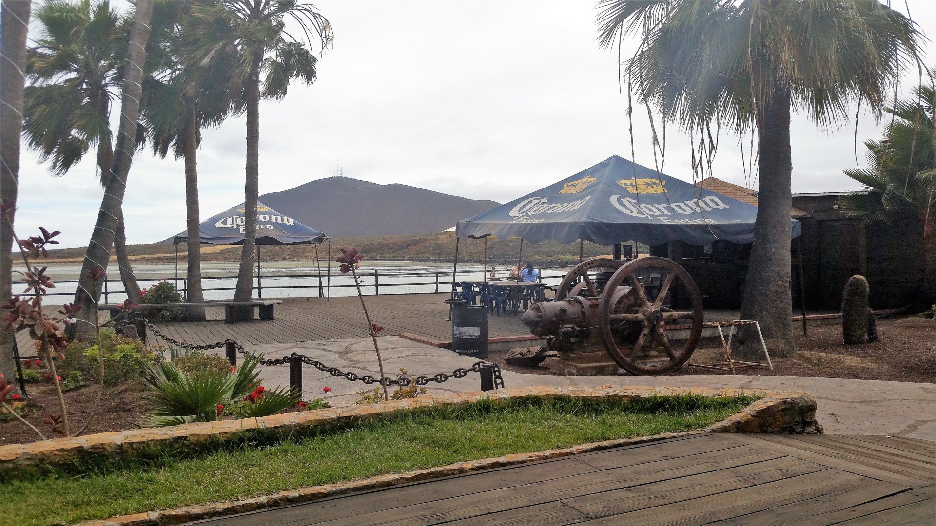
The restaurant is clearly geared towards the gringos - spacious, clean, with a plank boardwalk, some old gas engine on display outside. We take our table and order appetizers - shrimp quesadilla, essentially, "Por dos." Should have ordered "por uno," but we don't know better. By the time the appetizers are consumed, we are full - but the main courses are already ordered. We are terrified. Near the bottom of the first Negro Modelo, the main dish arrives. It is like a relleno soup, with a "surf and turf" addition - shrimp, fish, chicken, carne asada, and a leaf of prickly pear cactus thrown in for a good measure.
It takes me another beer to chase down most - definitely not all - of my main course. Chris is struggling as well. The food is delicious, but one has to inquire about the serving sizes in order not to have a heart attack before leaving the restaurant.
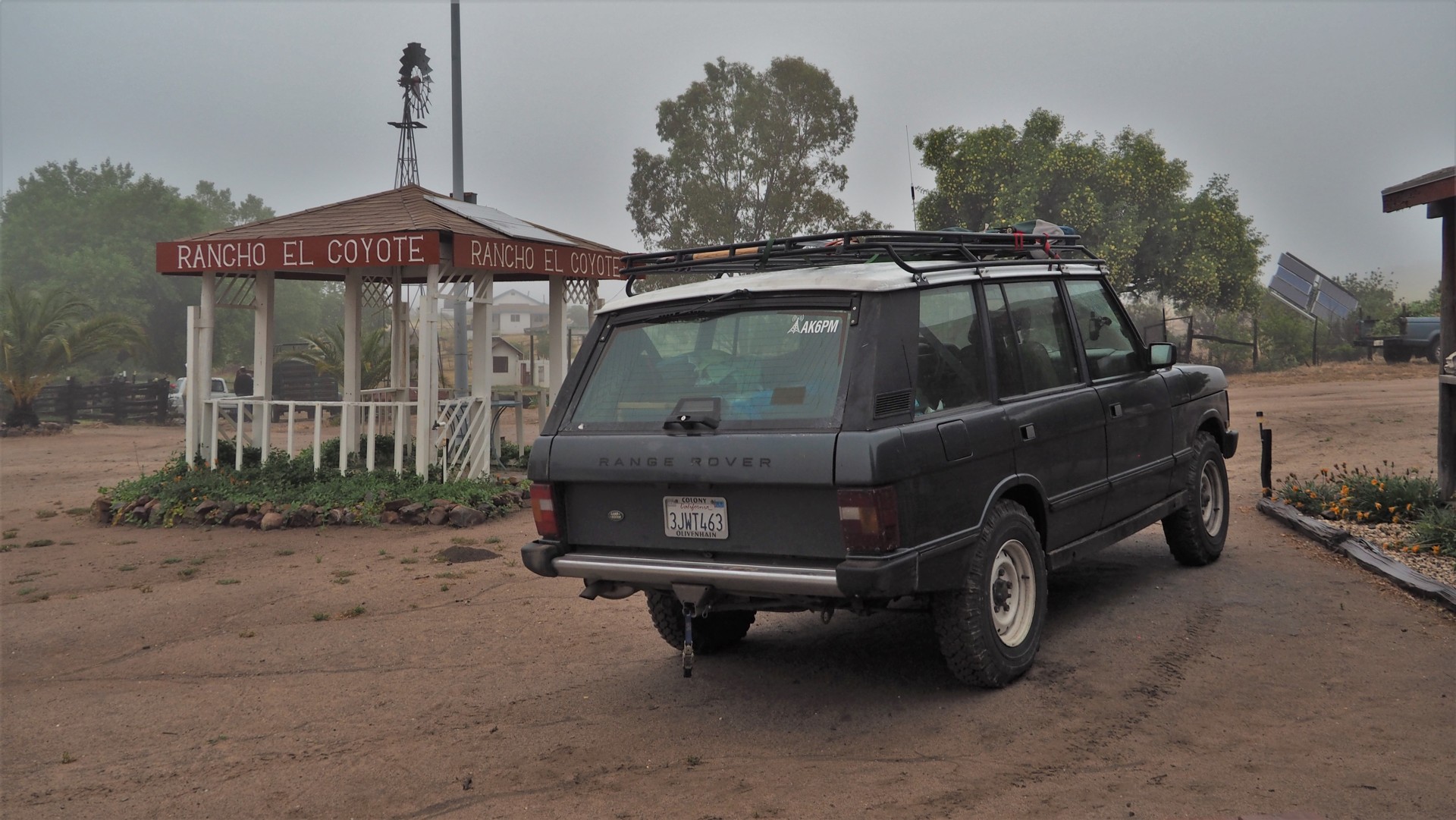
We emerge from the restaurant breathing shallowly and with glazed eyes near four in the afternoon. The vague notion of a plan for the day includes driving towards the astronomical observatory in Parque Nacional Sierra de San Pedro Mártir - easily four hours away from San Quintin. Chris fiddles with the consumer electronics enough to learn about a marvellous place called Rancho El Coyote Meling, and reads me bits and pieces about it. We decide to spend a night at the Rancho, but the only means of contact is the landline in San Diego. We just have to chance it.
The lazy drive along the coastal stretch of Highway 1 ends with a turn towards the Park. The low clouds return, with a drizzle, then light rain; the road meanders up the Western slope of the mountain range, with sections being occasionally incredibly long and steep at the same time. By the time we reach the turn-off to the Rancho, we're already in the cloud, with visibility down to quarter a mile in places.
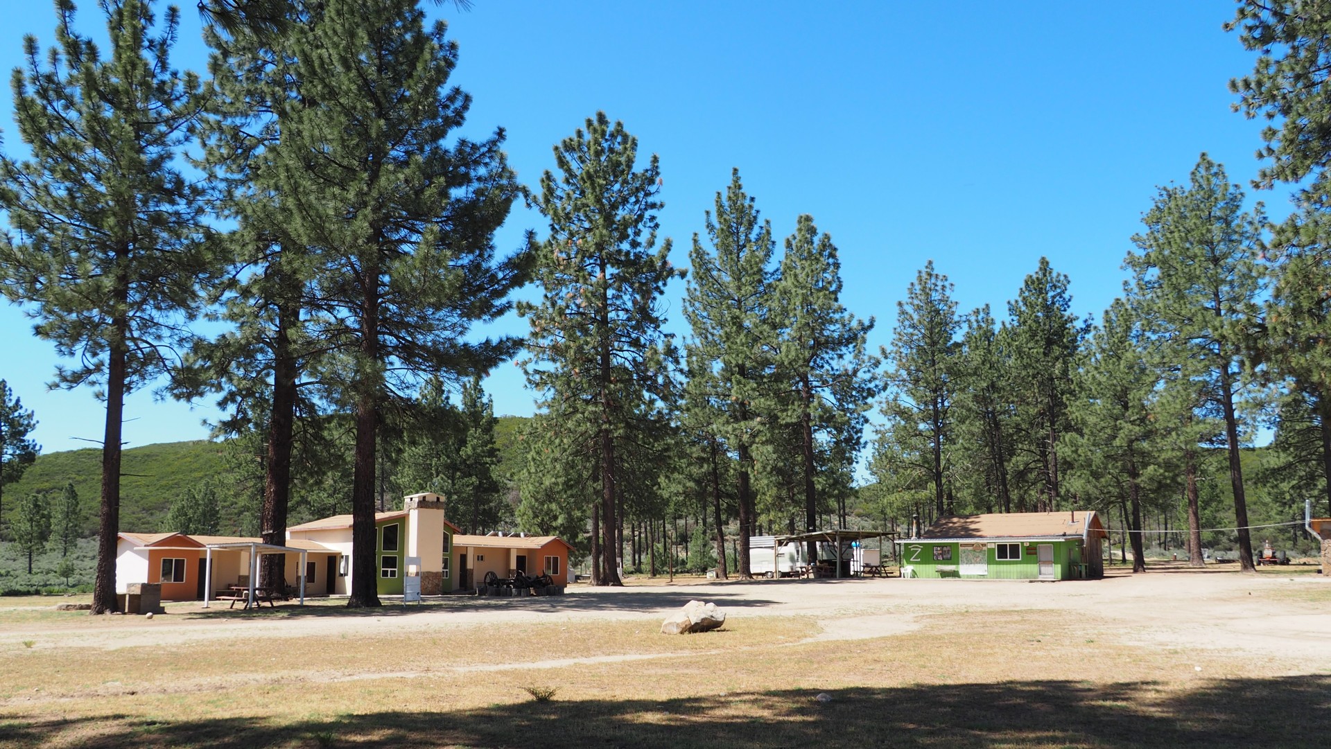
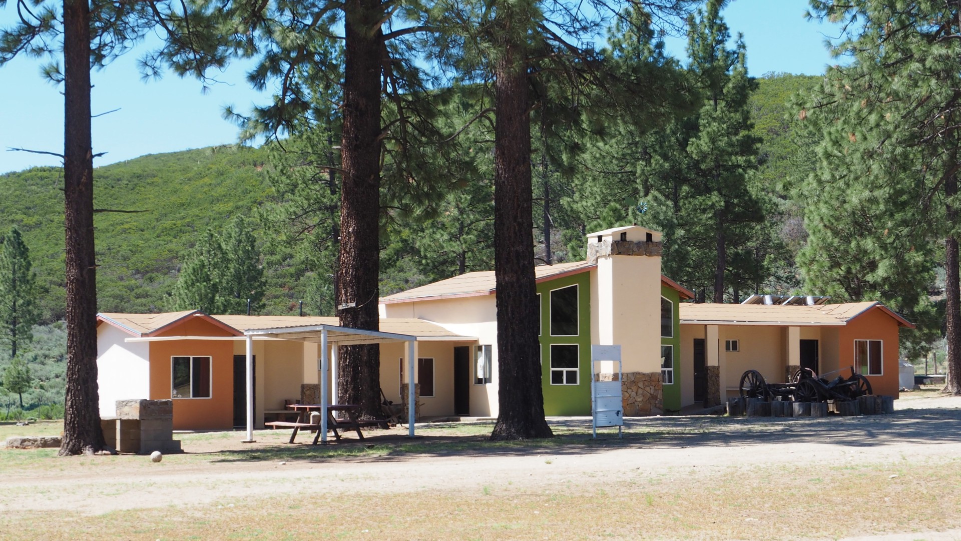
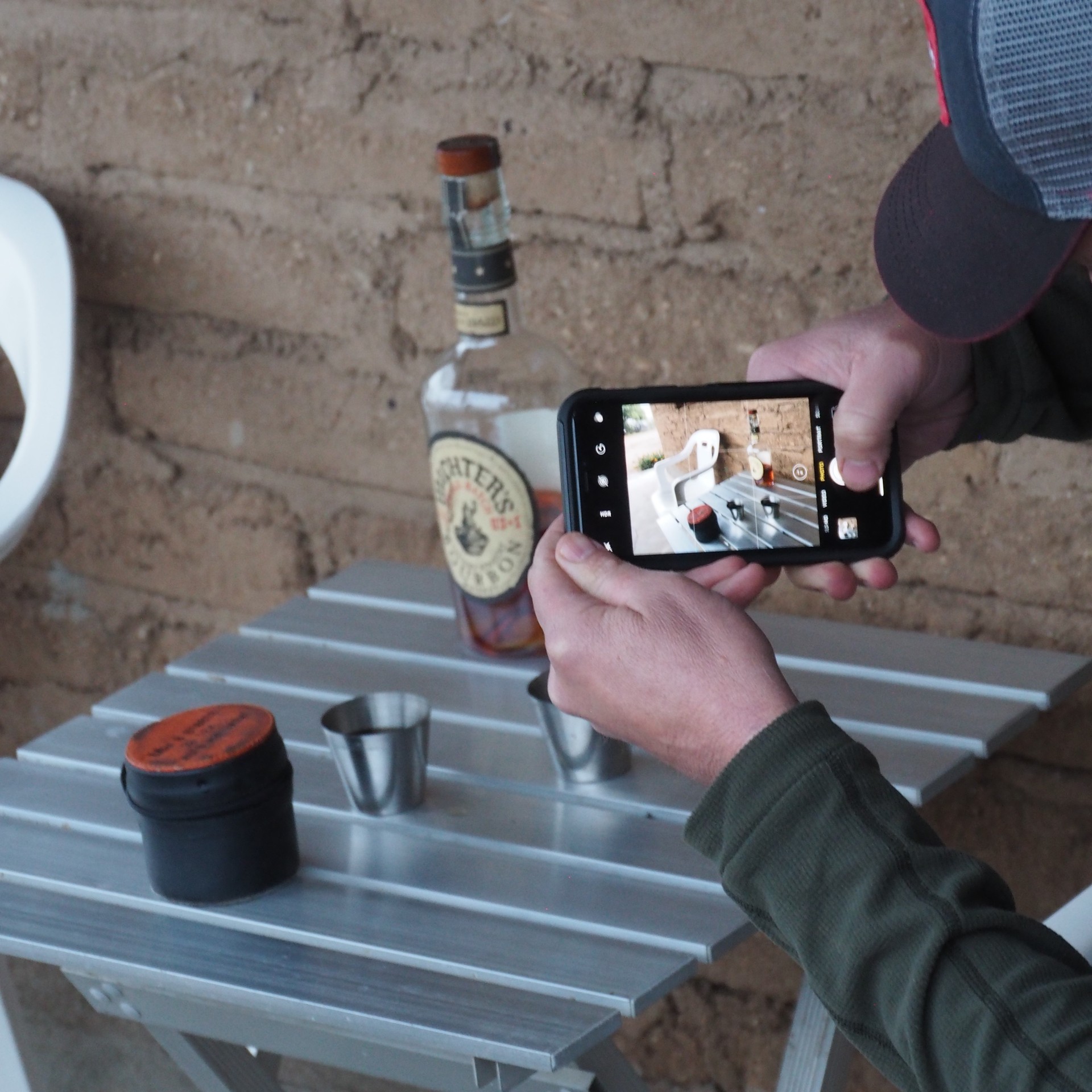
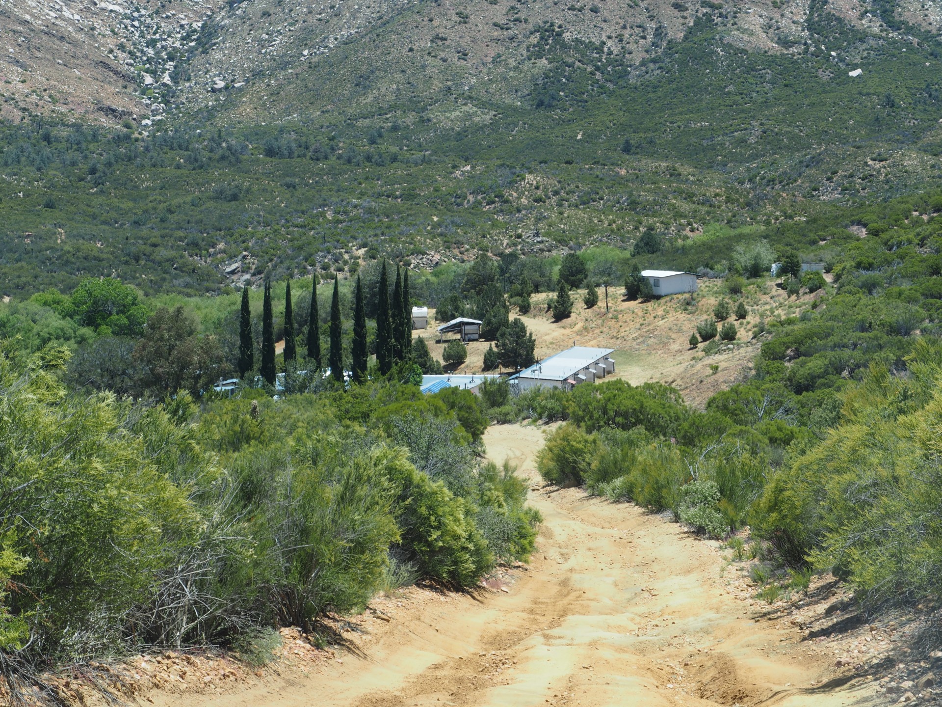
The road from pavement to the Rancho El Coyote is a pleasant couple of miles on a sandy driving, and soon we're through the gates and talking to a young member of the large Meling Johnson family about lodging. Fifty bucks a person land us a nice clean cabin, with six beds in two rooms to pick from, clean restroom, scalding-hot shower, and lightning-fast internet. We are asked to turn the lights off when we don't need them; cell phone coverage is inexistent. We are still sick of even thinking of food after our late lunch in San Quintin, but breakfast we will need - included in price. We settle in our rooms, and make our way back to the porch for a sip of Bourbon. This is phenomenal.
 |
 |
I ponder the fact that we haven't really driven that much in the whole day, despite having spent about 11 hours on the road, and fall asleep.
I am woken up by the cattle mooing outside.
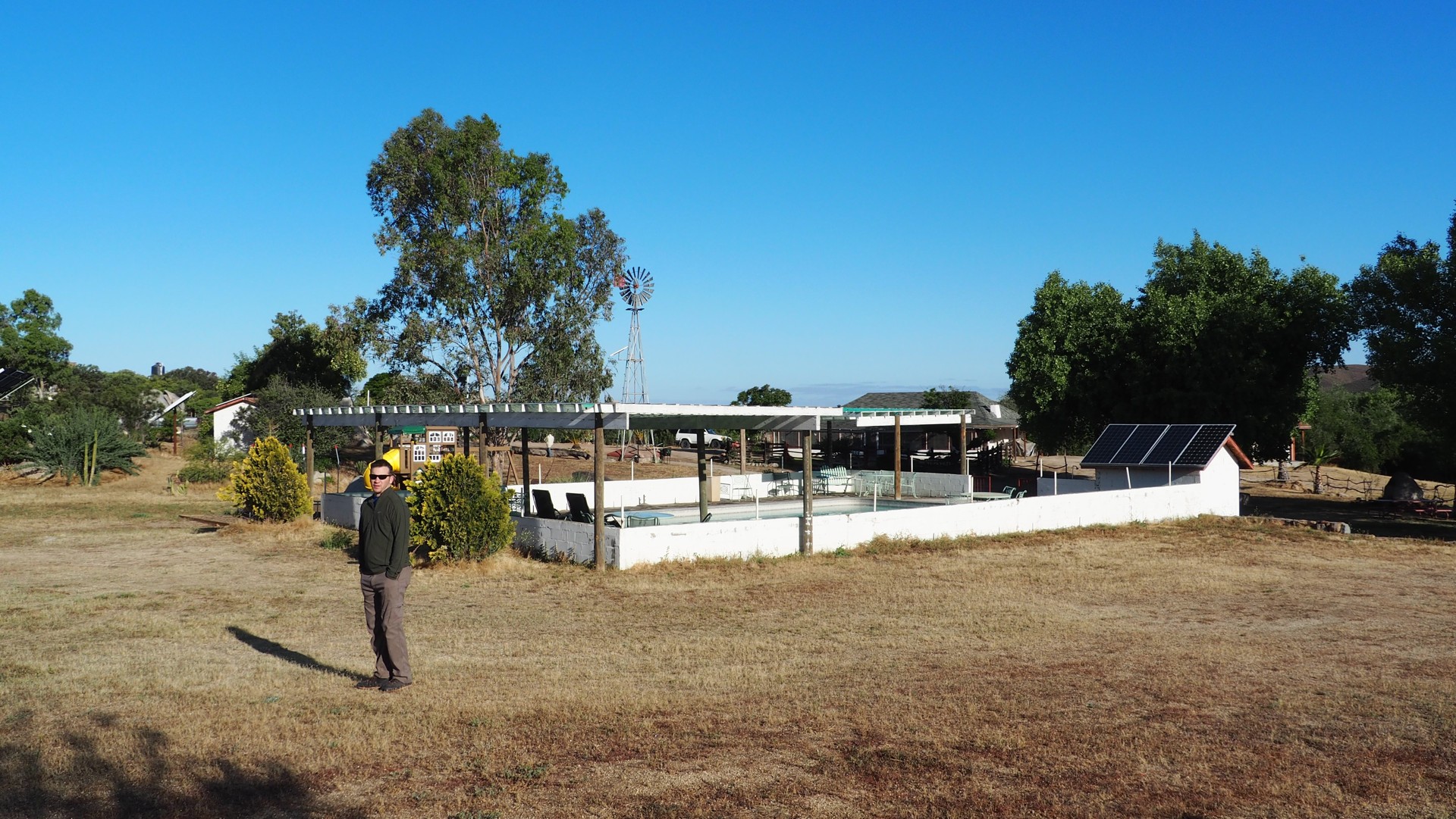
The morning is plain gorgeous - sunny, clear skies, and cool. I take a shower, get out, and hobble around for a while taking photos of the Rancho El Coyote's guest areas.
 |
 |
 |
 |
 |
 |
Coffee is waiting for us in the Rancho's diner, and breakfast is coming: beans, freshly-made flour tortillas, freshly-squeezed orange juice, and one giant omelette with mushrooms. It takes some work to put it all away.
 |
 |
 |
We decide against a trip to the observatory - it would add at least three hours, all on pavement - and head out on dirt road towards Mike's Sky Rancho instead. It is part of SCORE International's racing circuit, and is occasionally marked - "Wrong way" for us headed North instead of South.
The road becomes a bitch in a hurry.
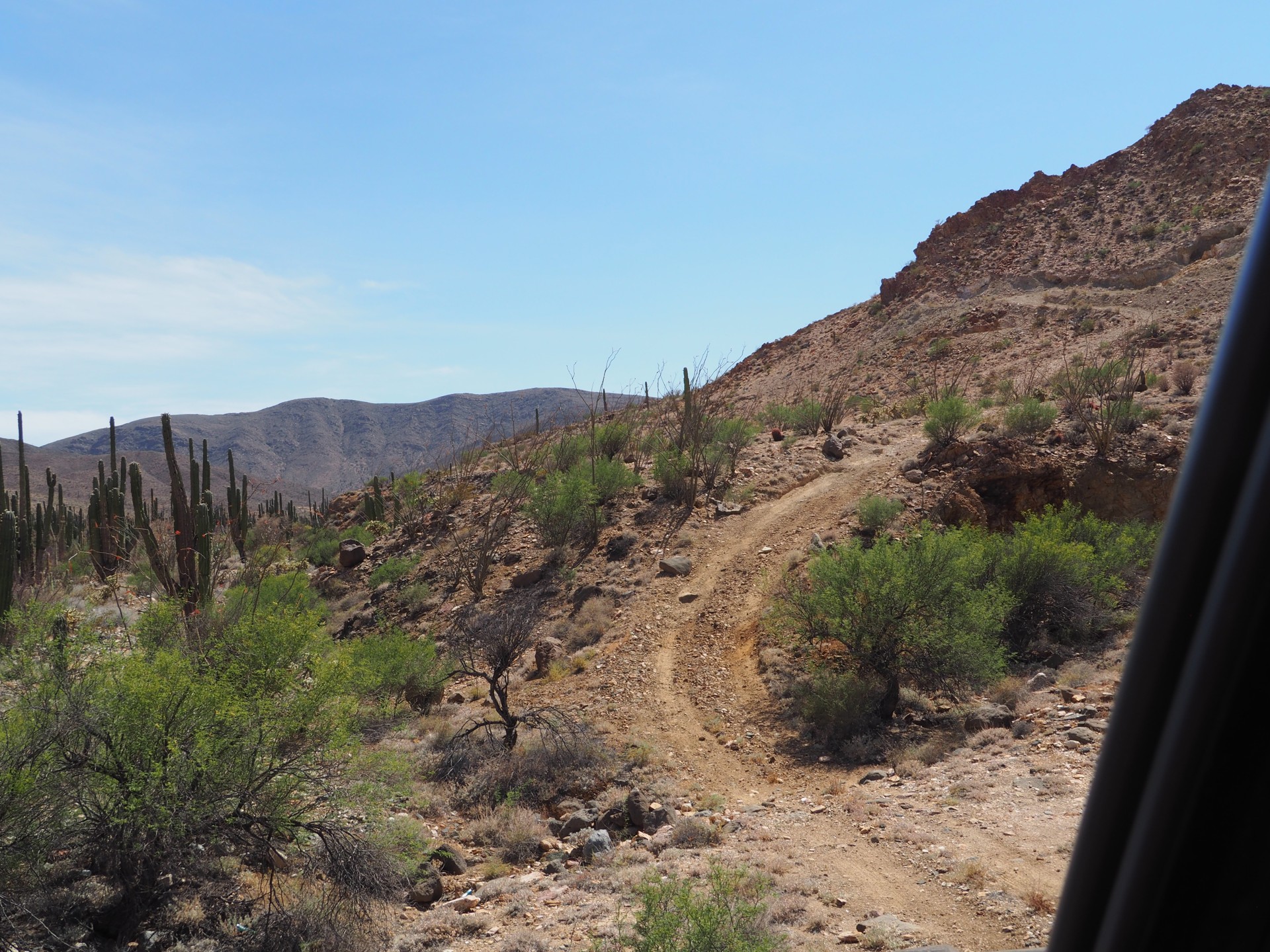
It is very much like an off-road trail common for Southern California - with sand, decomposed granite steps, boulders round and pointy, corkscrew crossings of narrow gullies. It will use all approach and departure and breakover angle your truck might have, as well as all available wheel travel. It is no Rubicon, definitely - a 4x4 capable of keeping at least three wheels on the ground should have no problems getting through without lockers or a winch.
But fast it is definitely not. It takes us nearly two hours to drive the 20 kilometers to Mike's Sky Rancho. Sometimes we take the wrong turns and end up in dead ends. It doesn't help matters that the replacement rear Bilstein shock absorber broke in the same exact manner as its predecessor; the fine threads on the original one appeared to be in better condition, so we reassembled the original shock with generous helping of JBWeld quick-setting epoxy, and reinstalled in in place.
 |
 |
|
After Mike's, the road vastly improves. We take a slightly different route Lázaro Cárdenas - passing through a very well-developed ranching and agricultural area.
 |
 |
 |
 |
 |
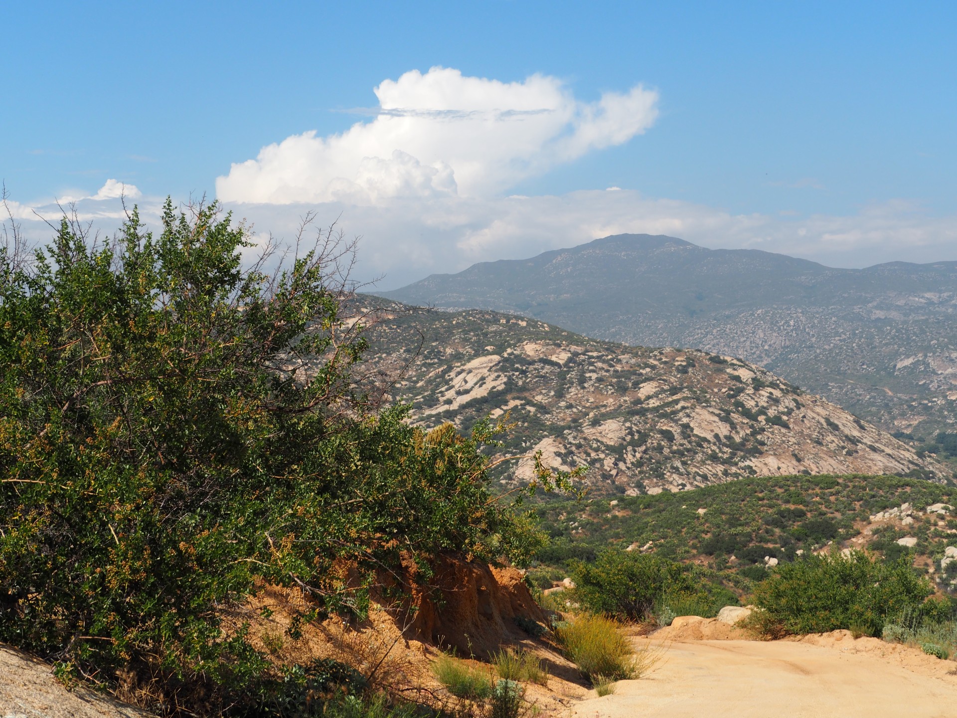
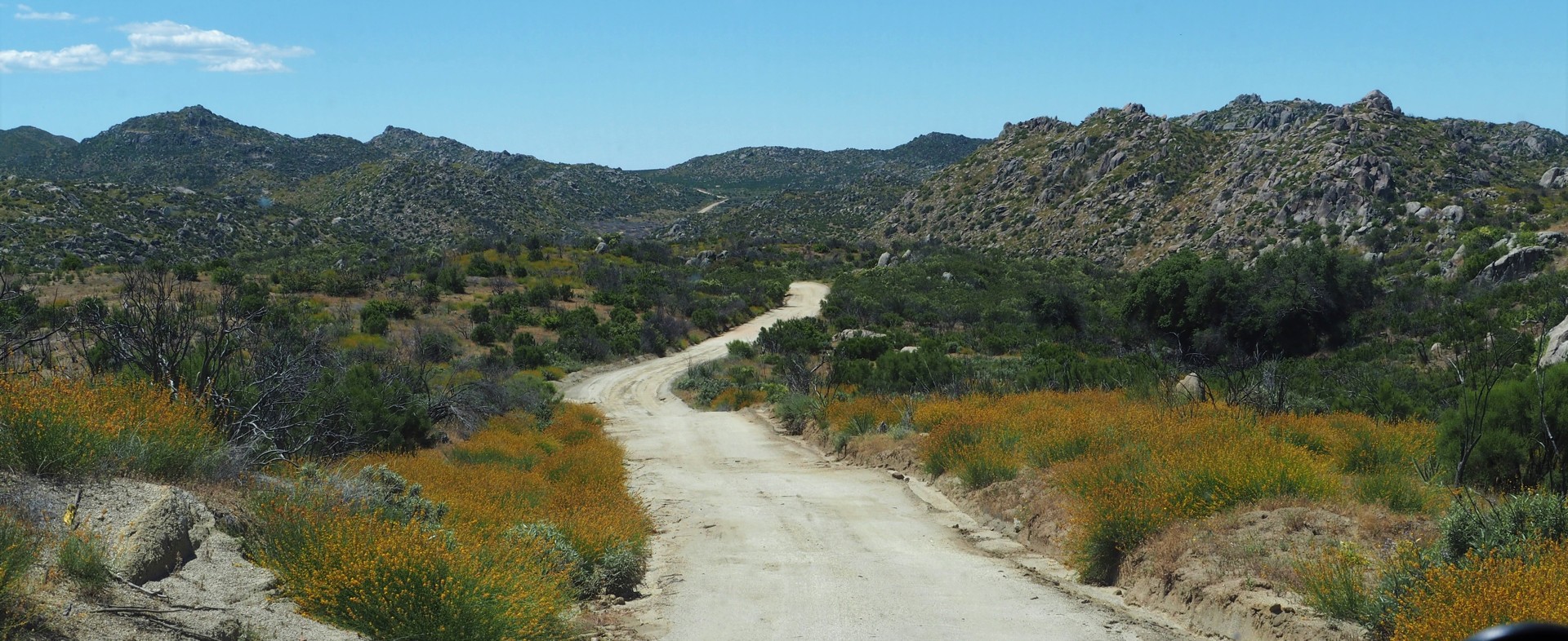
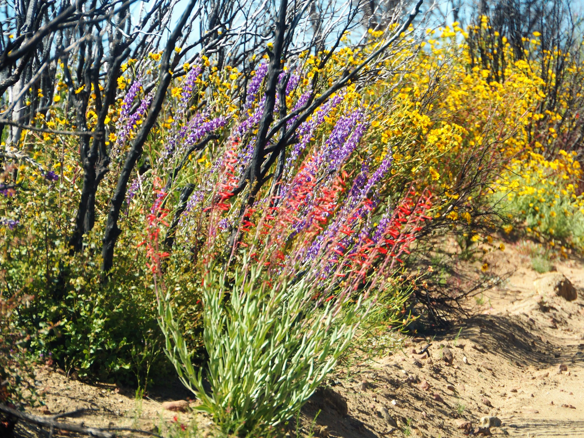
We fuel up at a Pemex station and exercise our feeble Spanish to find the only cajero automatico in town and extricate some pesos. Laguna Hanson and Parque Nacional Constitucion de 1857 are still on our list of things to see, and Chris plots a course that would avoid a long stretch of Highway 3. We head North-West on 3 and leave it as soon as we can, and find ourselves in a beautiful high desert, ravaged by a brush fire several years ago.
The desert is in its insane superbloom.
 |
 |
 |
 |
 |
 |
 |
 |
 |
 |
 |
 |
 |
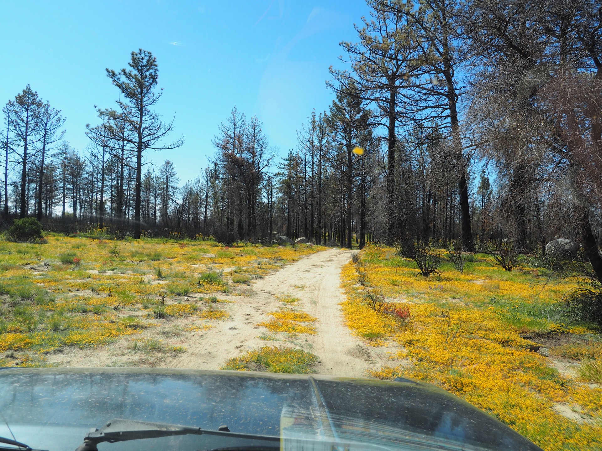
Even as the road gains in elevation and burnt brush is replaced by burnt pine trees, the yellow flower carpet never lets go.
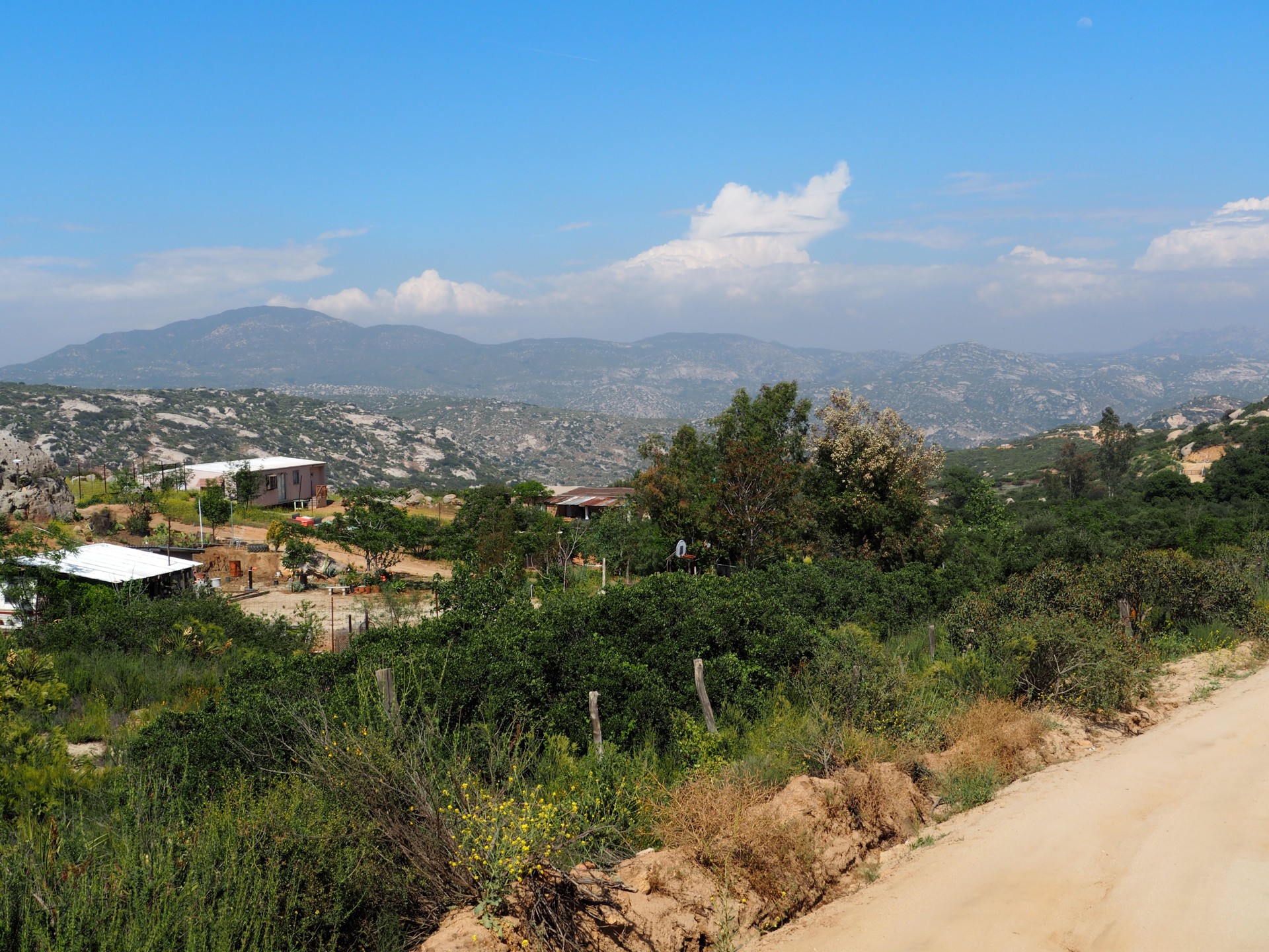
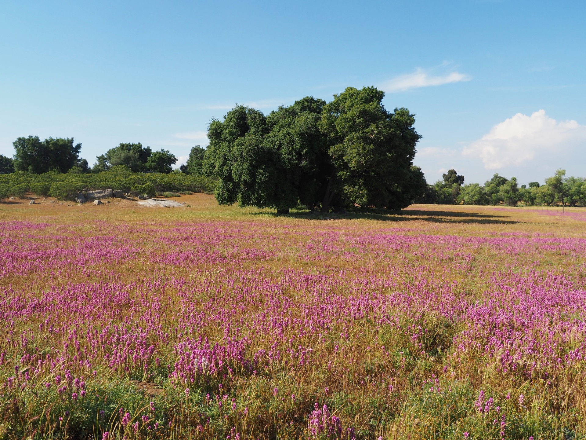
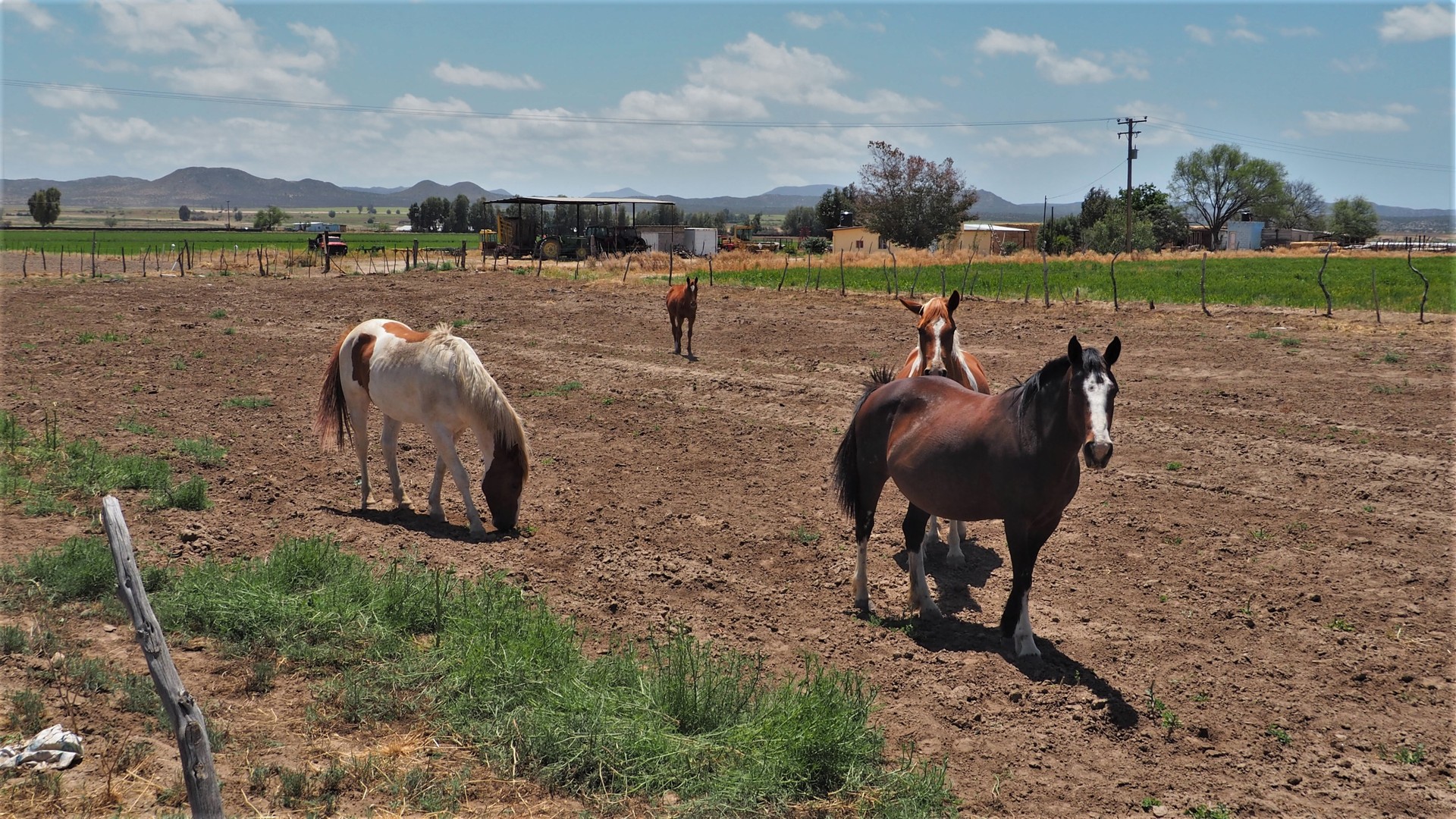
Chris's ability to drive and manipulate the GPS never ceases to amaze me. Now, however, we get no meaningful navigation help at all: both Garmin and Google Maps offer roads that seem to have never existed, or turns into ranches with padlocked gates. We explore a road after a road, all coming up to barbed-wire fence. The ranches make us envious - beautiful land in pine forest, meadows, little neat buildings, an occasional car in front, horses and cattle.
 |
 |
 |
Finally, we give up. We flag yet another black Ford four-door cab pickup with California license plate and a family inside and inquire about the road to Laguna Hanson. The owner - a stereotypical Mexican rancher in a large sombrero hat, red checkered shirt, and black leather sleveless jacket - speaks near-perfect English and confirms our fears: that we almost have to go down to Highway 3 to reconnect to the road to the Park.
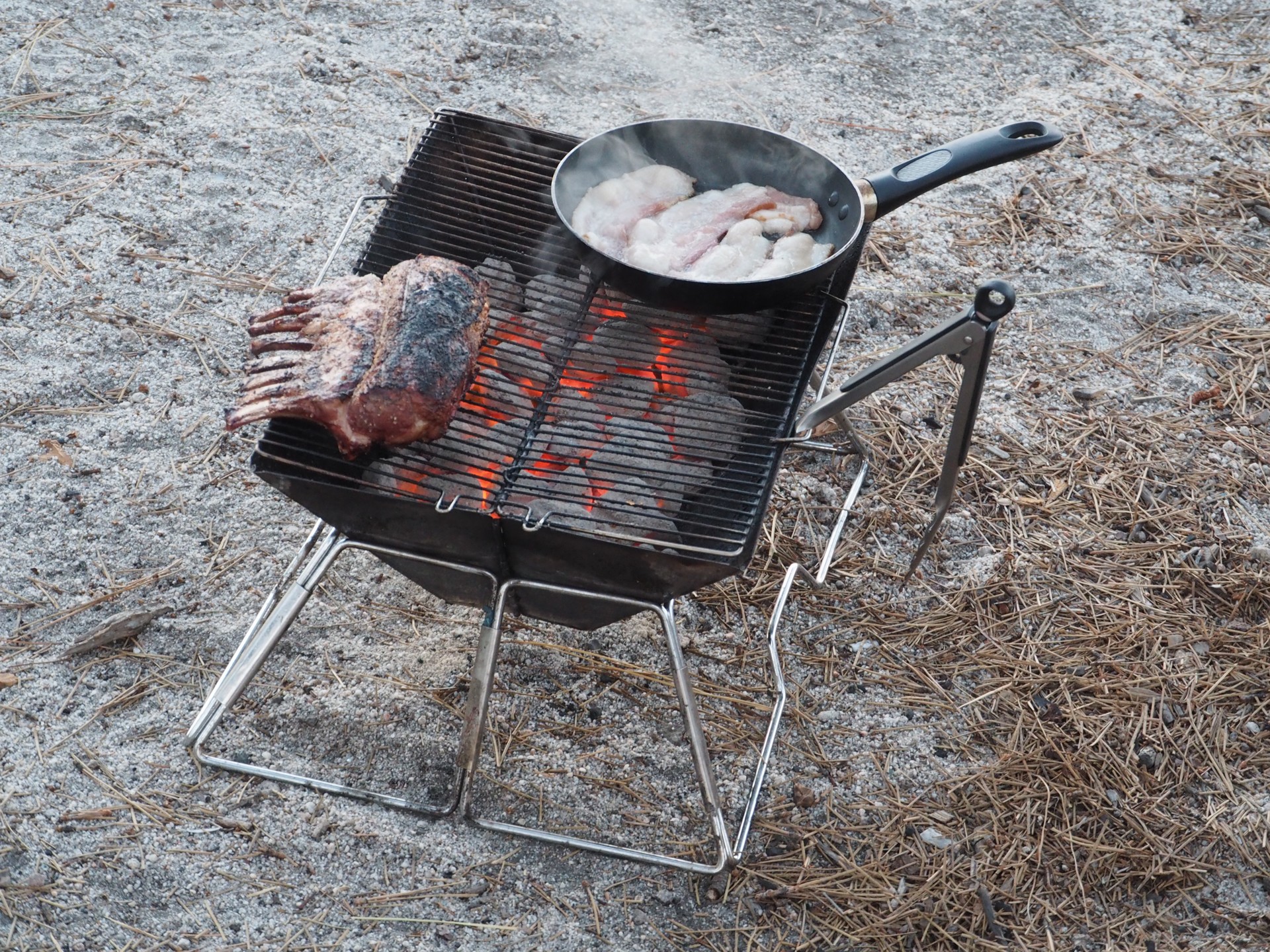
Time flies fast, and we finally roll to a flat campsite near Laguna Hanson close to sunset. Chris is setting up his tent, and I break out the grill and charcoal. It is time for our traditional grilled lamb ribs dinner - lacking any garnish, I use the space on the grill to cook some bacon as well. After a cold storm, under clear skies, and at 5300 ft, the night promises to be chilly. We finish the ribs, polish them off with Bourbon, and turn in.
 |
 |
At two in the morning, a group of Mexicans arrive in a Toyota pickup, a Tahoe, and a four-door Jeep. They spent about an hour repositioning the trucks every which way, trying to climb a boulder next to the Mexican government-provided toilets, and eventually calm down by three o'clock.
The coldest time of the night arrives by four - but nothing to complain about in the comfy cabin of the Range Rover.
This is our last morning of the trip - we wake up with a bit of sadness. Our "no definite plans" turn into no plans at all - so after a "breakfast of champions" of strong coffee and bacon strips, we depart South towards Highway 3.
 |
 |
It takes less time than I thought to reach the outskirts of Ensenada - rather ugly slums full of trash, junk yards, and dust. I take Chris on a dime tour of Ensenada's tourist facilities - without stopping at any of them - and we absorb the shock of taking a four-lane, divided, freeway (section of Highway 1 between Ensenada and Tijuana). It has been days since the speedometer registered more than 60 miles an hour - we are nearly the slowest vehicle on the road, police be damned.
 |
 |
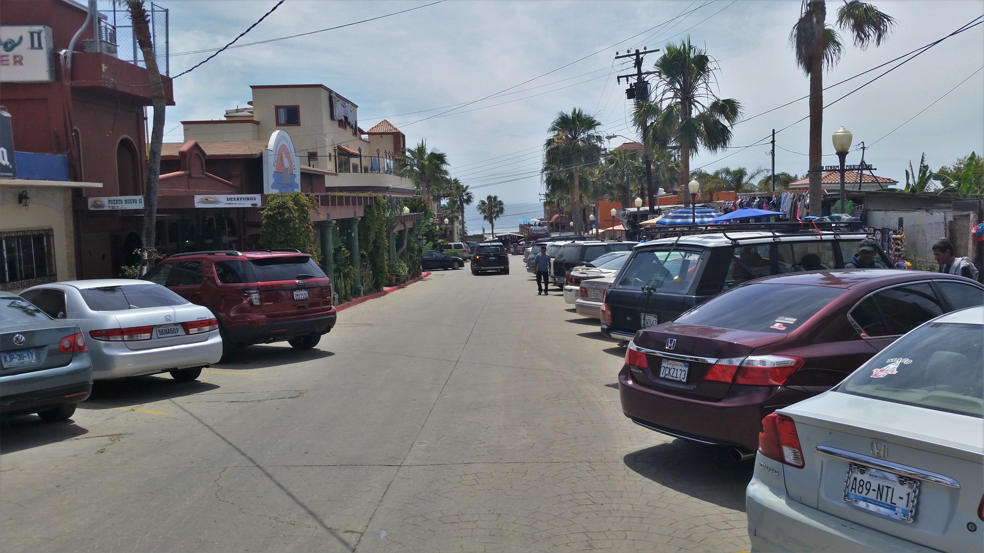
Halfway between Ensenada and Tijuana there is a former fishing village named Puerto Nuevo - now aptly nicknamed "Lobster Village" by both Mexicans and gringos. The least we can do is to have a seafood lunch before leaving Mexico, so we hang a left to Puerto Nuevo's reddish-ochre gates.
Yelp or Google communicate to Chris which restaurant (out of - what - a hundred?) is the best; it just might be, judging by the dining room completely full and a line outside. We join the line, and are seated in about 20 minutes. The restaurant is noisy with customers' chatter and mariachi music.
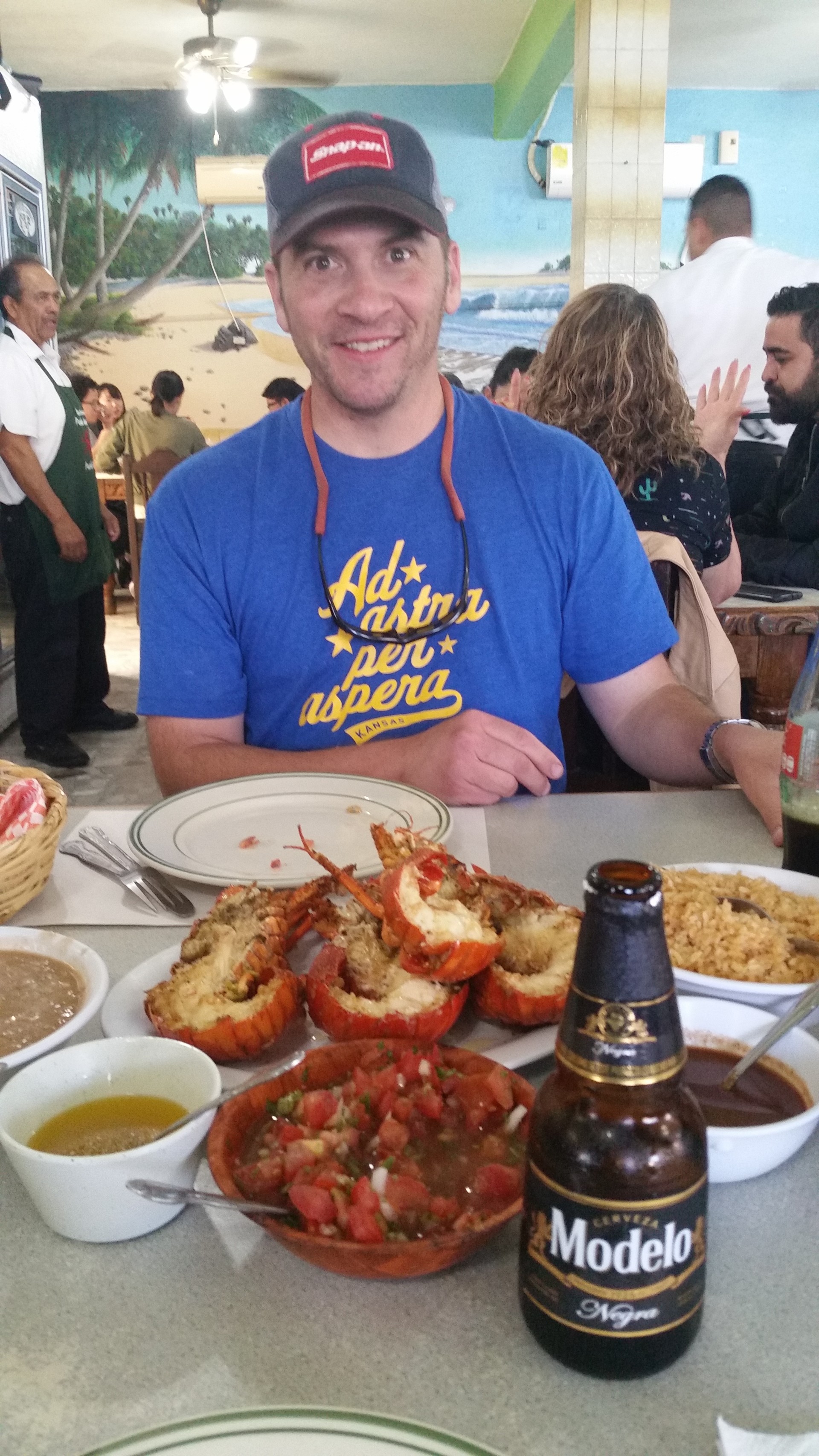
A waiter arrives, and I am instantly reminded of my last trip to Puerto Nuevo about 20 years ago - my friend's request for a "Menu" was met with the waiter's raised eyebrows and a question of "How Many?" This is exactly what happens. Menu be damned, there are only medium lobsters on the menu, and everything else is completely irrelevant. We order two - not cheap! - and the bugs of the sea arrive pronto. I wonder how the large, extra-large, and jumbo lobsters look - because the medium ones barely fit on the plate. These are not of delicious, flaky, melting-in-your-mount New England variety; but lobsters nonetheless. We are busy chomping them down for half an hour, and then kick back staring incredulously at the pile of shells we left behind.
 |
 |
 |
Then I buy two felt hats for my ladies and we leave.
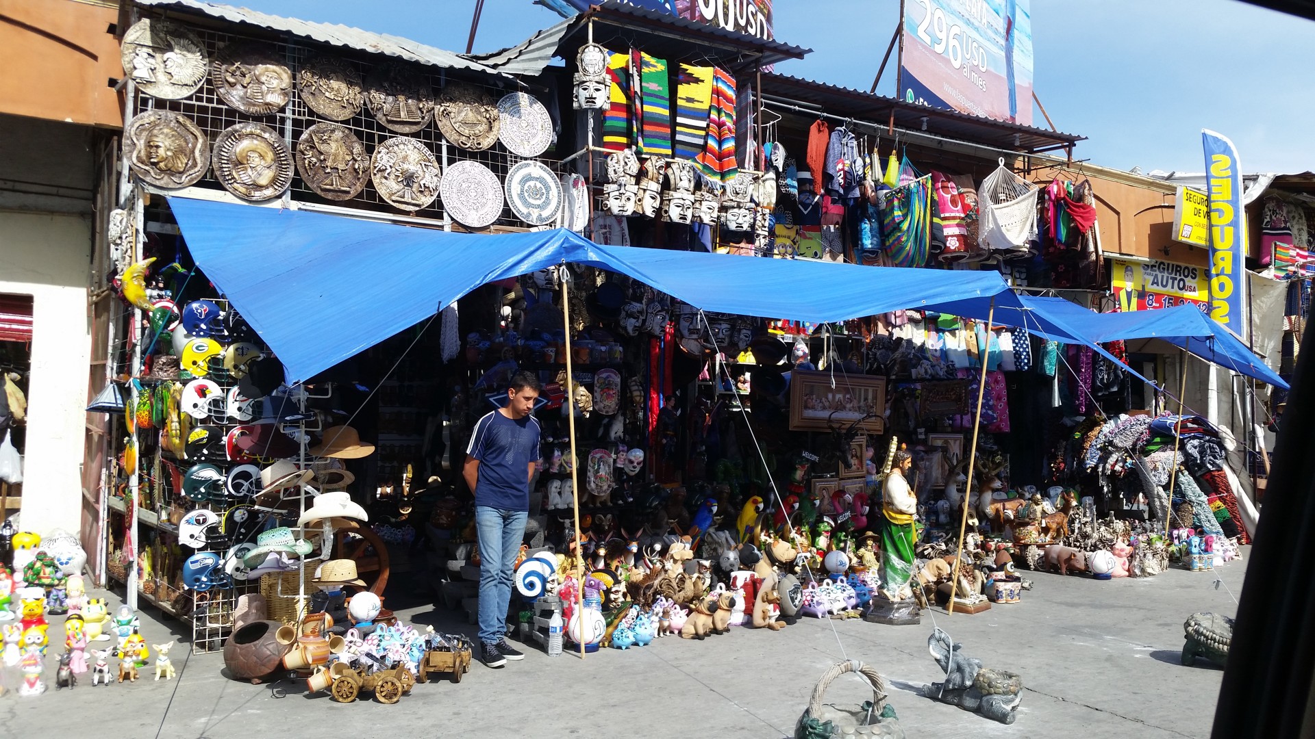
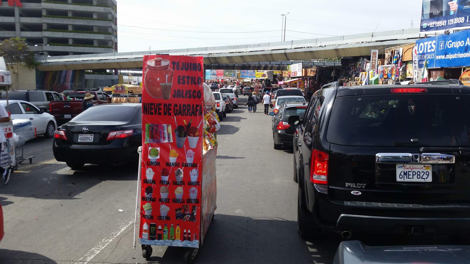
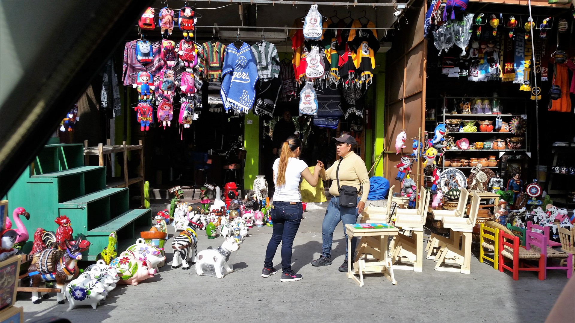
We miss our turn towards the border in Tijuana, which ends up better - instead of the drive along the border wall, we cross town through its center, Avenida Revolucion and all. The neat website provided by US Immigration and Customs tells us that it's only an hour and a half wait at San Ysidro border crossing - which takes the wind out of going to Tecate and even Otay Mesa, so we take our spots in lines stretching from the border checkpoints far into Tijuana. Two miserable hours are then spent fending off offers of churros, burritos, tamales, tacos, cell phone covers, ice cream, aguas frescas, Jesus Christ figurines on the cross with clearly bullet wounds, puppies, and God knows what else. The lady ICE officer barely looked into our passports, glanced inside the clear windows of the Range Rover, and waved us back to the U.S.
 |
 |
The shock of ten-lane divided Interstate has not yet worn off for me. We arrive at the entrance La Jolla Shores Hotel at half past five, accompanied by loud bark of my Airedale Jules that Lena just happened to walk close by.
Funny that the anti-climactic feeling of return, so beautifully captured by John Steinbeck in "Travels with Charlie," was a subject of our conversation at the border. Steinbeck was spot on.
Okay, time for a roadmap and some stats.
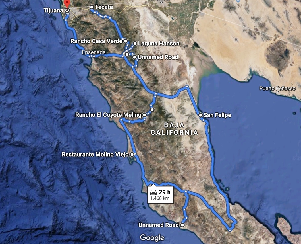 |
This map is pretty coarse - many "side excursions" are not shown here.
The total distance travelled in Mexico - about a thousand miles.
Out of this - off pavement about 350 miles.
Fuel stops in Mexico: Lazaro Cardenas (Hwy 3), Gonzaga Bay (Hwy 5), El Rosario (Hwy 1), Lazaro Cardenas (Hwy 3).
Fuel prices: $6 U.S. per gallon of premium, give or take some.
Cell phone coverage: good in most towns, almost inexistent between towns and away from highways.
Special off-road equipment needed - none; heavy-duty tires and spare parts are highly desirable.
Navigation: Google Maps cannot be trusted for either coverage or routing. Special-coverage maps for Garmin GPS are much more detailed and accurate. National Geographics' paper map of Baja California Norte was stellar.
Military checkpoints - 5 or 6. Searches - 0 (well, 0.5 maybe - a request to open tailgate and cursory peek inside doesn't count). Police stops - 0.